Hot days ahead as South Florida temps soar into the 90s through the weekend
South Florida could end the week with the longest stretch of steamy weather so far this year with temperatures reaching highs unusual even for August and the heat index climbing into the triple digits.
A combination of cloud-clearing high pressure in the upper atmosphere and gooey air at the surface is to blame for the pending sizzle, which follows a mild April marked by dry skies and near-normal average temperatures.
The official forecast from the National Weather Service in Miami calls for a high of 89 on Wednesday at Palm Beach International Airport in West Palm Beach. That is expected to climb into the mid-90s on Friday and settle back to near 90 for the weekend.
More: Climate change triggers new Florida heat warning chart that alerts when it could be deadly outside
Central Florida and areas of the Treasure Coast are also expected to bubble into the 90s on Wednesday and stay there through Sunday.
“The main concern right now is the heat, especially mid to late week,” said Cole Fehling, a meteorologist with the NWS in Melbourne. “The heat index values may be just below our warning criteria but it will be a stressful event for those working outside and in the direct sunlight.”
High pressure building through the week means an increase in sinking air. That sinking air warms by compression as it falls, working to evaporate clouds and increase temperature-spiking sunshine.
At the same time, cooling afternoon sea breezes will give way to tropics-warmed winds coming from the south and southwest. Dew point temperatures — a measure of water vapor in the air ― will be in the low 70s. The NWS considers dew point temperatures greater than 65 as “becoming oppressive.”
“We’ll see the triple digit heat indexes more in the interior sections of South Florida but they could be in the upper 90s along the coast,” said NWS Miami meteorologist Chuck Caracozza. “There’s going to be a lot of sunshine.”
The normal high temperature in West Palm Beach for this time of year is 85 degrees. That means Friday’s 94-degree forecast is nine degrees warmer than normal and would tie the standing record for May 10 set in 1998.
More: Man's death in South Florida heat prompts federal investigation into company that employed him
August’s normal daytime high in West Palm Beach is 90 degrees.
April ended with the average temperature hitting 75.3 degrees, which is about a half degree warmer than 30-year normal. Most of April’s 5.57 inches of rain fell on the last day of the month with 4.81 inches measured on April 30 at PBIA. That tied the day's rainfall record set in 1972.
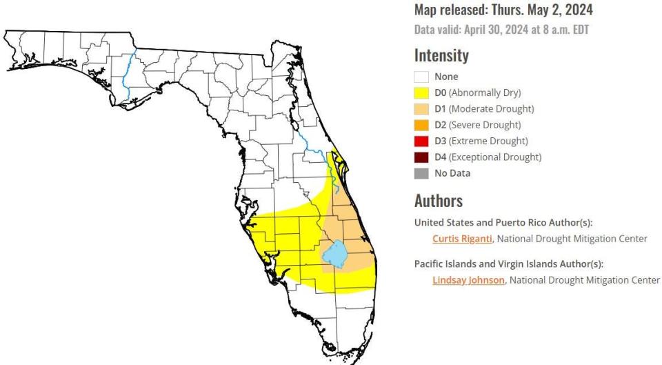
The U.S. Drought Monitor report issued May 2 showed northern Palm Beach County through the Treasure Coast in a moderate drought. But information for that report was gathered through 8 a.m. April 30. An updated report will be released this Thursday.
Rainfall in West Palm Beach for the year so far is 5.69 inches more than normal.
Kimberly Miller is a journalist for The Palm Beach Post, part of the USA Today Network of Florida. She covers real estate and how growth affects South Florida's environment. Subscribe to The Dirt for a weekly real estate roundup. If you have news tips, please send them to kmiller@pbpost.com. Help support our local journalism, subscribe today.
This article originally appeared on Palm Beach Post: South Florida to see triple-digit heat index, August-like temperatures

