May storm clobbers Utah, delivering snow, rain and wind
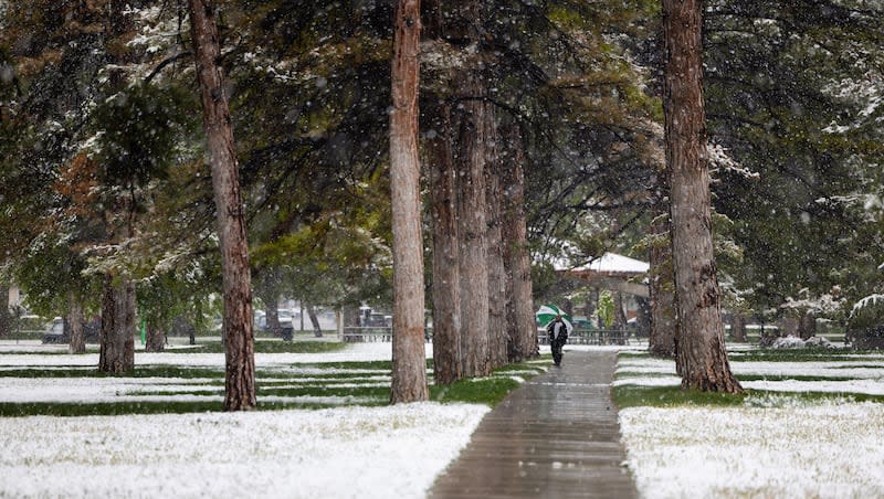
A storm is clobbering many areas of Utah, dumping copious amounts of snow in the mountains, even some on the benches and valley floors, driving wind advisories in western Millard and Juab counties and causing a dozen power outages affecting nearly 2,000 customers.
Snowbird Ski Resort up Little Cottonwood Canyon picked up 15 inches of snow in a 24-hour period as of early Monday morning and is expecting another 11 to 17 inches of snow to fall Monday with another 9 to 17 inches accumulating Tuesday. While most resorts are closed — Solitude is slated to close in seven days — Snowbird said it will remain open through Memorial Day.
Chains or snow tires were required for travel through Parleys Canyon because of weather conditions.
The National Weather Service in Salt Lake City has a winter storm warning in effect for a wide swath of Utah that includes the Wasatch Mountains, all along the Wasatch Front and north to Logan to as far south as Nephi. It also ropes in the western Uinta mountains and will remain in effect through noon Tuesday.
The storm brought a swift change in temperatures over the weekend, with areas experiencing a drop by as much as 30 degrees.
As an example, the federal agency said the normal maximum temperature for May 5 is 68 degrees, while this past Sunday it dropped to a high of 55 degrees.
Over the weekend, it warned residents to take precautions for outdoor gardens and agriculture. In some areas of the state, anticipated low temperatures could drop to near freezing or below freezing.
⬇ Low Temperatures for the next several mornings will be near the freezing mark for many locations, especially Wednesday morning. Take a look at the forecast lows for where you live below and take any necessary precautions for outdoor gardens and agriculture. #UTwx #WYwx pic.twitter.com/AM6ayeD3W7
— NWS Salt Lake City (@NWSSaltLakeCity) May 5, 2024
In another social media post, the service warned of high winds impacting the Cedar City area on Sunday.
Winds are gusting up to almost 60 mph in the Cedar City area. Use caution in this area this morning! #utwx
— NWS Salt Lake City (@NWSSaltLakeCity) May 5, 2024
On Monday, it issued a new wind advisory for the Duchesne area, with westward gusts of up to 55 mph.
So what gives with this weather?
The service said it is not unusual for Utah to get a spring storm that delivers some snow.
“With the mountains it is not unusual at all. We have days where we see snow down to the valley floor. Again, not all that unusual, especially for early May,” said Christine Kruse, meteorologist with the National Weather Service in Salt Lake City. “There might be a few years where we see no snow in May and then we get one like this. As it get towards Memorial Day it tends to be fairly unusual.”
The snow, wind, rain and sharp drop in temperatures are the result of a strong cold front that moved into Utah from the Pacific Northwest and the Gulf of Alaska.
In addition to delivering some impressive snowfall accumulations in the mountains, other areas that picked up some compelling amounts include North Salt Lake at 5 inches; 8 inches in Liberty, east of Ogden; Sandy, 3 inches; and Suncrest, with 8.5 inches as of Monday morning.
Kruse said while the storm will continue into at least Tuesday, it will begin to lose momentum and by the end of the workweek, northern Utah will see temperatures as high as around 68 degrees. By Sunday, it will creep up to the mid-70s.
Despite the warmup, no flooding alerts have been issued and at this time, she said no immediate flooding is in the forecast.
“We always have to watch to see if we have a really fast melt or if something that we weren’t expecting occurs — but right now, there’s no concern for any flooding.”

