Cal Fire’s new website, approach to data sends crews out faster, shares critical info in real time
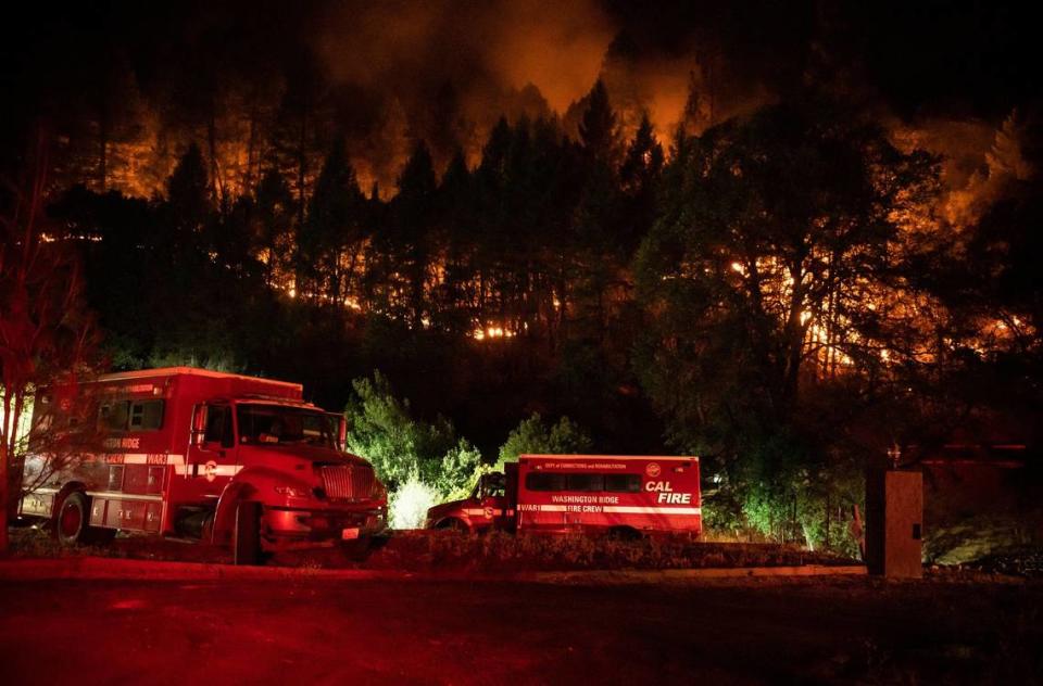
In the sweltering heat of July 2020, the calamity of California’s record-breaking wildfires stretched beyond the front lines. The website of the California Department of Forestry and Fire Protection — a crucial source of real-time information for millions — crashed under an avalanche of users seeking updates on rapidly spreading blazes.
Chief Nick Schuler, Cal Fire’s deputy director of communications, knew the site’s brief outage went beyond a simple capacity issue. It needed vast improvement.
Now, as fire season ramps up — and the state faces extreme heat, bone-dry conditions and the threat of winds over the Fourth of July week — Schuler and the firefighting agency said this week that the website is ready for its biggest challenge yet: Keeping vital data up to date and helping the state’s nearly 40 million residents know when a blaze is an imminent threat to lives, property and the people working to battle the flames.
As climate change amplifies the severity and danger of wildfires, Cal Fire officials like Schuler said the mission of the website was straightforward: Keep up and stay up.
To be able to handle loads of traffic at a moment’s notice and inform the public during seasons as bad as 2020’s, Schuler turned to Scott Gregory, the newly appointed deputy director of technology, with a mission of redesigning the website to withstand waves of demand while being responsive and accessible — especially in the heat of a firestorm.
State and federal regulations mandate that public websites in California be accessible to all users, including those with disabilities. Gregory and his team faced the dual challenge of adhering to these guidelines while also rebuilding the website’s infrastructure to handle unprecedented traffic volumes and provide clear, immediate access to essential information.
“It required us to re-imagine everything, from our information architecture, to how we disseminate the information and even how we manage information on the back end that the public never sees,” Gregory said.
Over 90% of traffic to the Cal Fire website goes to pages related to fire incidents, according to Gregory, so it was important for the agency to make a user-centered experience that quickly relayed the information users are most interested in.
After a comprehensive review and update, the homepage now has incident-related information immediately conveying robust information about the state’s fire season as a whole, as well as links to detailed information about individual active fires.
Since the new website developments launched in June, Cal Fire’s website has received four times the number of average monthly visitors, according to Gregory.

This made Gregory and Schuler eager to continue developing the site to meet even more of the public’s needs, making plans to include more information about Cal Fire’s operations.
“I think the sky is really the limit,” Schuler said. “(Gregory) and I are both extremely invested in seeing this succeed because we’re also the end users, right? We live in these communities, we have families.”
Cal Fire and the U.S. Forest Service responded to more than 2,800 wildfires in the state in the first half of the year, slightly more than last year’s roughly 2,500 fires to date.
However, this year’s blazes have been much larger — only 7,500 acres burned by July 1 last year while more than 131,000 acres burned in the same amount of time this year.
2024’s early-season fires have been some of the largest on average over the last five years. Wildfires this year burned roughly five times more acreage than the five-year average of 27,160 acres in the first half of the year. This could be a sign of a dangerous six months to come, as 19 out of the 20 largest fires in the state started after July 1.

What does the new Cal Fire website feature?
The site’s centerpiece, a comprehensive fire map, is dotted with icons representing active wildfires. Each icon varies in size based on the fire’s acreage, with smaller flames indicating less than 10 acres and larger, more prominent symbols marking significant blazes. These icons also highlight red flag warnings and smoke forecasts from the National Weather Service, painting a vivid picture of the state’s fire landscape.
While the site’s previous design had a link to a detailed incident map, it required navigation. Now, users only need to load up fire.ca.gov to instantly see conditions across the state or close to home.
Having a network of information providers allows the agency to constantly tweak the numbers listed on the site, which helps show the public an accurate view of the situation validated by official sources.
“We want to give (the public) the latest, greatest information,” Schuler said. “I would rather have the most up-to-date information that we know of at that time, and have to bring something back than wait hours to provide the information.”
Fires more than 10 acres are represented by a larger, red and orange fire icon and have an outline showing the latest perimeter as mapped by the fixed-wing Fire Integrated Real-time Intelligence System operated by the Governor’s Office of Emergency Services. Airplane icons show where Cal Fire’s air tankers and tactical aircraft are flying in near-real time, according to Schuler.
Those notable fires also have dedicated incident pages, which display the latest location, perimeter and containment information, as well as fresh imagery of the area and the incident, a list of evacuation orders with a corresponding map, a summary of recent firefighting activity and more.
Incident pages are updated frequently throughout the day by FIRIS survey planes, networks of sensors and firefighters and incident commanders on the ground. Previously, incident reports only went out twice a day — at 7 a.m. and at 7 p.m.

How does the site work?
The new site is centralizing information about the thousands of fires the decentralized agency responds to each year.
Cal Fire’s operations across the state are split into 21 administrative units and a total of 12,000 firefighters, as well as administration and other support staff overseeing 32 million acres of land in the state’s area of responsibility. Having an agency of this magnitude, Schuler said, can make consolidating accurate and complete information about active fires difficult.
The process begins at the fires themselves, where ground crews and FIRIS aircraft gather and upload data. This information is immediately reflected on the site. By putting the updates in the hands of the crews at the fires, Schuler said there is virtually no delay between the agency receiving information and the public being notified, Schuler said.
“You’re seeing it the same time as I get to see it,” he said.
Collaborating with UC San Diego’s AlertCalifornia program, which has a network of cameras monitoring environmental conditions across the state, has been another major tool for Cal Fire in both information dissemination and firefighting response.
According to Caitlin Scully, communications program manager for AlertCalifornia, the program’s cameras have aided different state agencies in monitoring earthquakes, mudslides, coastal conditions in the San Francisco Bay, and even watching for endangered species like California condors.
AlertCalifornia and Cal Fire operate many of the cameras themselves, with partners like PG&E, San Diego Gas and Electric, Los Angeles Department of Water and Power and California OES operating a large portion of the cameras as well.
The network’s 1,087 statewide cameras send images through an AI tool that is able to detect wildfire smoke early on and notify Cal Fire’s command center, which vets the validity of the notification and responds accordingly.

According to Gregory, the system can notify Cal Fire of an emerging incident, sometimes minutes before anyone can call 911 to report it. Having a filtered view of developing fires across the state helps Cal Fire make decisions on how to respond at a command center in unit offices in Fortuna, San Luis Obispo and Oroville, among others — rather than needing to send crews out to survey the area — significantly reducing response times.
The images from the cameras are mirrored on Cal Fire’s incident pages frequently to give the public a firsthand look at smoke plumes produced by a blaze.
Last year, Time magazine named the system one of the best inventions of the year.
The transformations made since 2020 have not only improved the site’s functionality but also redefined how the state communicates critical information to its residents, which could make the difference in saving lives.
Cal Fire officials say they are continually thinking to the future, considering what other website features may benefit communities. According to Schuler, the agency is planning to introduce a layer to the homepage map that shows where prescribed fires are occurring, demonstrating the state’s year-round fire prevention efforts.
To Schuler, every feature of the website needs to aid communities with useful information — showing evacuation orders, detailing the day’s plan for hand crews to fight a fire and accurately outlining a fire’s perimeter down to a road or property.
“Fire is not a backcountry problem, fires impact communities,” he said. “If we can get people to be in the mindset that you all need to be prepared ... we’re making a safer community.”

