Forecasters monitor Atlantic disturbance. It could impact Florida, at least with rain
The National Hurricane Center is watching a tropical disturbance in the mid-Atlantic that has the potential to develop into a tropical depression — or something stronger — and approach Florida over the weekend.
Whatever happens, it shapes up as a potentially rainy weekend for South Florida.
For days, the hurricane center has held the disturbance’s chance of strengthening within the week at 60%. And as of Wednesday morning, that remained the same. Forecasters gave the system a 0% chance of developing into a tropical depression in the next two days.
Conditions should get friendlier for the system in the next few days, the hurricane center said. By Friday or Saturday, it could develop into a tropical depression as it nears Cuba, Florida and the Bahamas.
On the hurricane center’s map, the orange blob marks areas where the hurricane center thinks a tropical depression could form, not where it could go or who could be affected.
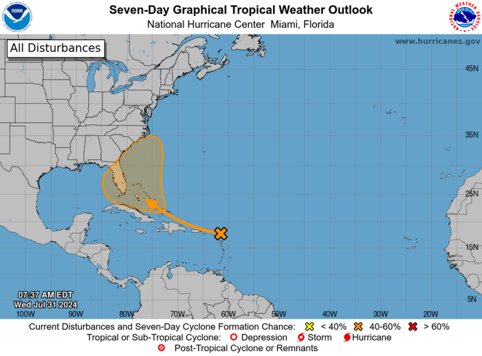
This far out, global computer models don’t do that well at predicting where a yet-unformed system could go, or how strong it could get. But early runs have continued to suggest the system could pass near Florida’s east coast over the weekend as a tropical depression or tropical storm.
The next name on the list is Debby.
“But,” meteorologist James Spann noted on X, “there is little skill in forecasting the position or intensity of a tropical cyclone seven days in advance. So, be sure and watch for any changes.”
Wherever the system ends up forming, it will likely bring rain to South Florida. The Miami office of the National Weather Service calls for a 70% chance of rain over the weekend.

