Park Fire weather improves but blaze now eighth-largest in California history at 300,000+ acres
Firefighters, aided by improving weather conditions, were beginning to get a handle Saturday on the Park Fire, now the eighth-largest wildfire in California history at 307,368 acres (480 square miles), as it continued to rage across an area half the size of Sacramento County.
Cal Fire spokesman Rick Carhart said containment remained at zero for the fire, which doubled in size in about 24 hours, but crews reported progress as the blaze raced north toward Shasta County and more-populated areas such as Shingletown. Dozens of mandatory and voluntary evacuation orders remain in effect across Butte and Tehama, as well as Shasta and Plumas, two more counties potentially in the fire’s path.
He said the Park Fire continued to burn aggressively as extreme fire behavior supercharged flames while winds and terrain triggered significant fire growth, even creating a fire whirl Thursday night in the area of Forest Ranch. But Saturday’s weather would give firefighters a chance to slow down a blaze that has burned through terrain at 8 square miles an hour or more in the past two days.
“It feels much different today — that lower temperature and a little increased humidity...” Carhart said. “We’ll take advantage of every opportunity as we can to make gains.”
On Friday night and into Saturday, the fire crossed Highway 36 before crews and dozers were able to contain the fire toward the east as personnel worked all night in the area of Paynes Creek, a community of several dozen homes 20 miles east of Red Bluff, where at least one home was destroyed.
Firefight in Tehama County
By daybreak, hills on both sides of the roadway were completely burned over and smoldering. Uphill from Highway 36, ash continued to float through Lanes Valley Road as crews toggled between ranches to battle hot spots as dark smoke blotted the morning sky.
Park Fire map
Sources: U.S. Department of the Interior, IRWIN, FIRIS, NIFC, NASA, NOAA and Esri
Residents of Paynes Creek were breathing a sigh of relief. Neighbors who stayed to protect their property checked in on one another.
Diane Staser said at one point in the night her home was surrounded by fire, but the fire breaks she and her husband dug days ago held firm.
“Thank the Lord,” she said. “At first we thought we were good but at one point there we were sure we’d lose it.”
A volunteer firefighter, she and her neighbors took pains to protect their homes and businesses: installing tin roofs, clearing brush, digging fire breaks and laying hoses.
“We’ve been through four fires now. We’re not leaving,” she said. “This is all we have and I’ll fight for it religiously. We’re not going to be homeless.”
Flames also reached Manton, a community of 300 people about five miles south of Shingletown on a flat expanse of Tehama County home to wineries and a wild horse sanctuary.
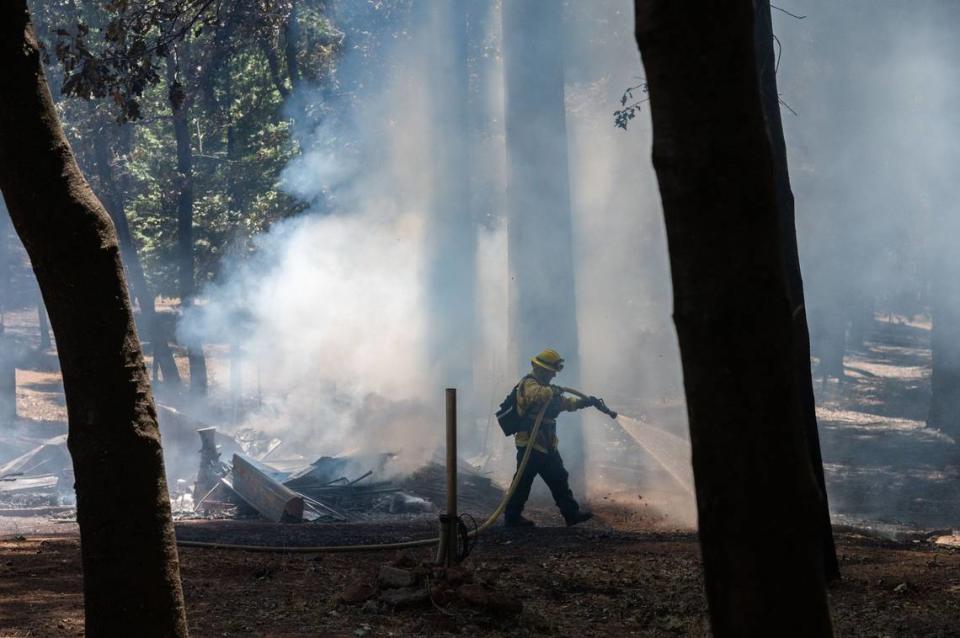
“We have structure defense going out there last night, with a lot of good work,” Assistant Chief Jed Gaines said during a morning operational briefing. He added that calmer, cooler conditions allowed strike teams, some of whom had worked a double shift, to “go direct” on dozer lines as the fire laid down around Highway 36.
East of Paynes Creek into Mineral, firefighting crews dispatched from around the state were deploying deeper into northern stretches of the fire.
“We’re keeping up to the best of our ability,” said Battalion Chief Mark Seastrom from Ventura County, whose crew was tasked with patrolling the highway. “But the truth is we haven’t seen fire like this in some of these areas for the last 25 years.”
Manpower on fire swells to 2,500
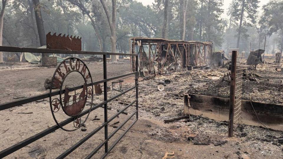
Meanwhile, fire lines stayed put along the Highway 32 corridor in Butte County, where crews have worked to keep flames from more homes in the Forest Ranch area, a hamlet of about 600 homes straddling a rise between Big and Little Chico Creeks and several miles from Paradise, that was ravaged on Friday. Officials said several spot fires that jumped the roadway were put out quickly, as the flames tried to cross control lines in the area.
Still, at least 135 homes have been leveled by the blaze, a figure expected to rise dramatically as teams work to assess the damage.
The priority for firefighters, officials said in a morning briefing, was to keep the blaze boxed in — north and west of the Skyway in Paradise and south of Highway 44 around Shingletown. Crews have been able to keep the fire “backed down” on the western flank, Gaines said, a fire line running parallel and several miles away from Highway 99 between Chico and Red Bluff.
Nearly 2,500 personnel including an additional incident management team are now on the fire, which prompted an emergency declaration from Gov. Gavin Newsom on Friday afternoon for Butte and Tehama counties, as well as the Gold Complex of fires in Plumas County.
Better weather expected amid dangerous plumes
Despite the better conditions, firefighters were cautious about the prospects to gain traction on containment, given the high fuel loads on the fire’s northern tier.
“There are areas out there that have no fire history, a lot of dead and down (fuel), and a lot of logging slash,” said Battalion Chief Scott Weese. That could keep the fire moving at an explosive pace, demonstrated on Thursday and Friday afternoons as the fire made significant charges through the Ishi Wilderness and other parts of the Lassen National Forest.
“The heat signature is huge,” Weese told firefighters during the morning briefing. “Yesterday, it burned 150,000 acres. We saw multiple plumes — four to five plumes — exaggerating this.”
The fire continues to burn north into lighter fuels out of the deeper forests where it raced for three days, but the mixture of dry grass and brush in Shasta County — similar to the conditions in Butte County where the fire began — could prove difficult for firefighters in the days ahead.
Still, firefighters have some help in the way of burn scars from the 2021 Dixie Fire — which ultimately torched almost a million acres to the east of Park’s fire line — as well as the best weather since the fire began Wednesday afternoon when authorities said a man pushed a vehicle on fire down an embankment in Chico.
“We had a fair amount of cool and moist air moving into the central North Valley this morning,” said fire meteorologist Jeff Tonkin at the morning briefing. He said that humidity improved by 10% to 15% from a day ago, bumping the forecast humidity to 25% through most of the fire’s perimeter.
“So a more moist day today,” he said, adding high temperatures were expected to top the lower 90s: “Temperature-wise, we’re going to see about a 10- to 15-degree drop in temperatures this afternoon.”
Winds will also moderate from days past, he said. Conditions on the northern half of the fire were expected to be 4 to 6 mph with some gusts to as high as 15 mph as winds shift from the south to the west.
After hearing the weather report, Weese told crews that Saturday would be “the best day as far as weather conditions that we’re going to experience this week” for battling the fire.
“A plume-dominated fire is very dangerous,” he said. “This one we have multiple plumes working together. Very dangerous situation out there.”

