The science you need to know before seeing 'Twisters'

- Oops!Something went wrong.Please try again later.
'Twisters' aims to be more scientifically accurate than its predecessor, 'Twister.'
Many of the film's characters are scientists or storm chasers who know a lot about tornadoes.
They drop meteorological terms like updraft and Fujiwhara effect, so a refresher might be helpful.
You don't need to know a lot about tornadoes to understand the massive storms you'll see on screen in the new film "Twisters," debuting in US theaters Friday.
However, the filmmakers worked to make "Twisters" more scientifically accurate than its predecessor, and the scientists and storm chasers in the movie spit out some jargon that could leave you scratching your head.
So, a weather refresher might help if you want to follow along more closely. Here are a couple dozen terms that show up in the film and may be worth reviewing before you head to the theater. We tell you what the terms mean but not how they appear in the film, so no spoilers.
22 science terms to know before seeing 'Twisters'
Cap: A layer of warm air thousands of feet high in the atmosphere that can slow or stop the formation of a thunderstorm. Sandwiched between warm, moist air and cold, dry air, the cap can also increase instability and cause a severe storm if it's removed.
Cloud microphysics: This branch of atmospheric science relates to the study of ice formation and similar processes in the air. Scientists use it to more accurately simulate clouds in their weather models.
Cloud seeding and silver iodide: Some regions hoping to increase precipitation release particles of silver iodide — a compound of silver and iodine that can encourage ice formation — to cause rain or snow to fall.
Death ridge: Storm chasers use this term to describe conditions that lead to milder weather. When an elongated area of hot, dry high atmospheric pressure settles over the Plains, it means severe storms are less likely to form, according to The Washington Post.
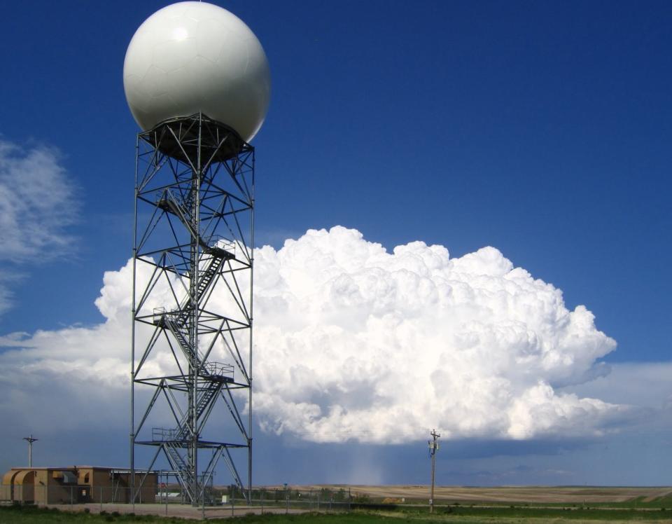
Doppler radar: The National Weather Service's Doppler radars look like they have giant golf balls sitting on top of them. These are the antennae, which spin around and scan the atmosphere at different heights. The radar's beam hits particles of precipitation and receives the information back, creating a picture of what's happening in the sky.
Enhanced Fujita Scale/EF Scale: Meteorologist Ted Fujita created the original scale, with ratings from 0 to 5, for tornado intensity in 1971. The newer version from 2007 includes more types of buildings and objects to better reflect the level of damage. When a meteorologist describes a tornado as EF1 or EF5, it's a reflection of how destructive the storm was. Tornadoes are only rated after the NWS performs an assessment.
FEMA, NASA, NOAA, and NWS: The Federal Emergency Management Agency (FEMA) helps coordinate disaster response. The National Aeronautics and Space Administration (NASA), National Oceanic and Atmospheric Administration (NOAA), and National Weather Service (NWS) all contribute to weather and climate data with satellites, radar, and other technology. The NWS is responsible for issuing tornado warnings.
Fujiwhara effect: Named for Sakuhei Fujiwhara, who wrote about the effect in 1921, this uncommon phenomenon occurs when two cyclones pass close enough to each other that their centers either lock into a dance, or in rarer cases, they can merge into a single, more powerful storm. The effect occasionally happens with hurricanes, and in 2023, atmospheric scientist Matthew Cappucci noted on X that the phenomenon occurred with tornadoes in Oklahoma.
Hook echo: When a hook shape shows up on a radar screen as part of a supercell storm, it can indicate the conditions are ripe for a tornado. The spinning storm can show up at a hook's tip, but it's not a guarantee that a tornado has formed, according to Weather.com.
Instability, lift, and moisture: These are three ingredients needed for a thunderstorm. The instability comes from air that keeps rising after something provides lift, like a cold front or mountain. The rising air brings heat and moisture to the cooler atmosphere above. As the water vapor cools, it condenses and becomes a cloud. It's these cumulonimbus clouds that you see in thunderstorms.
Goldilocks problem: Much like a certain fairy tale figure's porridge, the temperature of the air flowing into a supercell storm has to be just right for a tornado to form, according to researchers Paul Markowski and Yvette Richardson. Everything needs to be perfect for all the other ingredients, too.
Hail: When rain freezes in a thunderstorm's updraft, it can turn into ice chunks ranging from pea-sized (0.25 inches) to grapefruit-sized (4.5 inches).
Lagrangian mechanics: Joseph-Louis Lagrange published important work on celestial mechanics in the late 18th century. Researchers still use his principles in modeling work on tornadoes and thunderstorms.
Phased Array Radar (PAR): The National Severe Storms Laboratory has used PAR for weather data since the early 2000s, installing a newer version in 2018. It's a large, stationary flat panel antenna on top of a building in Norman, Oklahoma. Experts can control the radar beam electronically and point it at a storm to get the most relevant data.
Sodium polyacrylate: This super-absorbent polymer, which is often used in the gel layer of diapers, can irritate the eyes and nose. It plays an important role in the film's opening scene.
Supercell: Most storms aren't supercells, but these long-lived storms can be severe. Strong tornadoes are often the result of supercells.
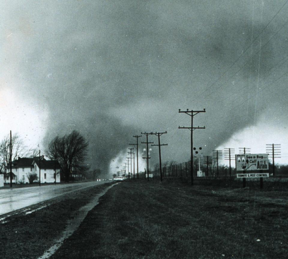
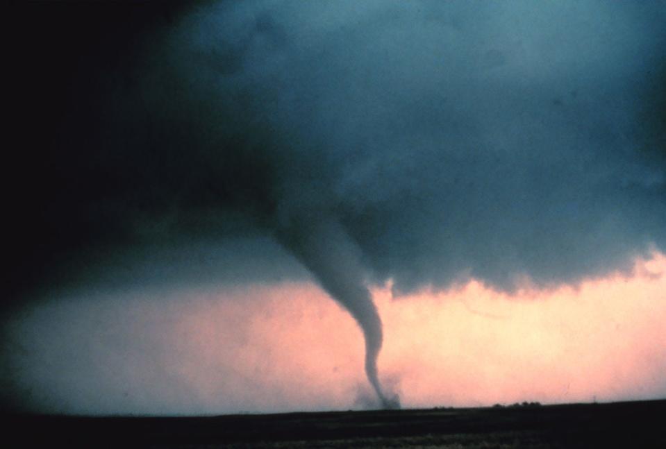
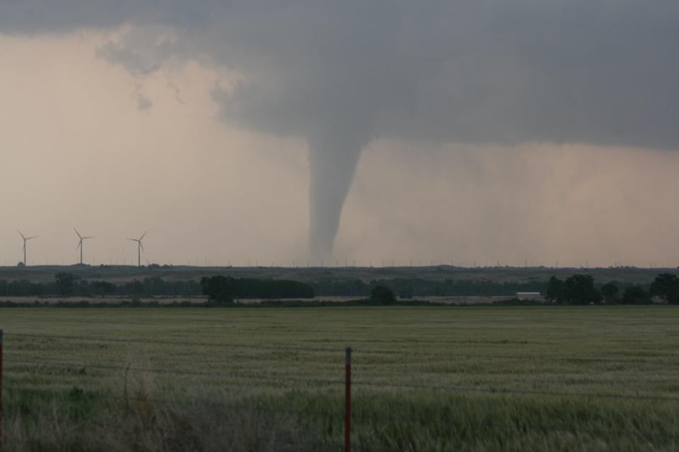
Tornado: When a thunderstorm causes a violent rotation of air to touch the ground, it creates a tornado. Sometimes the funnel is visible but not always. Tornadoes need the right amount of moisture, instability, lift, and wind shear to develop.
Tornado Alley: This is the area of the US where tornadoes have traditionally occurred most frequently. Tornado Alley encompasses parts of Kansas, Nebraska, Oklahoma, and Texas. Recent research suggests severe storm activity is shifting to states like Alabama, Arkansas, Kentucky, Louisiana, Mississippi, and Tennessee.
Tornadogenesis: The process of tornado formation.
Updraft: Warm air rising in a thunderstorm is called updraft. It sucks in more warm, moist air to help power the storm. If the updraft starts rotating vertically, it can produce a tornado.
Vortex: A vortex is a horizontal or vertical mass of air that's rotating in a column or spiral. Some tornadoes can have more than one.
Wind shear: Wind shear is when winds at different heights change speed or direction or both. If it contributes to rotation in a thunderstorm's updraft, a tornado can form.
Despite taking some artistic license on how to stay safe from tornadoes, the 1996 "Twister" movie inspired in many people a deep appreciation for and interest in meteorology — or, at the very least, in jaw-droppingly powerful storms. Now its sequel could do the same for a new generation.
Read the original article on Business Insider

