NYT mapped Sacramento sidewalk temperatures. How hot are they? Is tree canopy helping?
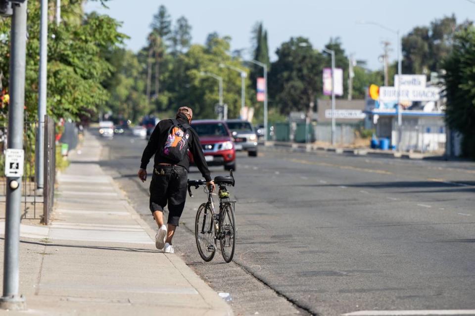
Hot weather is heating up Sacramento’s sidewalks.
The New York Times recently mapped surface temperatures in three different cities across the United States — including Sacramento.
“Sacramento is known, with pride, as the City of Trees,” New York Times reporters Raymond Zhong and Mira Rojanasakul wrote in an article published on Wednesday. “But tree cover isn’t distributed equally there, and neither is exposure to broiling heat.”
Residents of low-income neighborhoods in the northern and southern portions of the capital city “have long contended with a shortage of shade and green space on sweltering days,” they wrote.
Here’s how hot surfaces got in the Sacramento area on a recent summer day.

How hot are sidewalks in Sacramento?
The New York Times used data from the U.S. Geological Survey to assess surface temperatures in Sacramento.
It looked at temperatures in the Capital City on July 11 — smack in the middle of a California heat wave.
Jeffery Wood, a meteorologist with the National Weather Service, told The Sacramento Bee that overall air temperatures on July 11 for the Sacramento area reached a high of 110 degrees.
According to the Geological Survey data, a vast majority of the Sacramento area — spanning from Elk Grove to downtown Sacramento to Sacramento McClellan Airport — had surface temperatures of around 120 degrees.
In some areas, such as West Sacramento and North Sacramento, sidewalk temperatures reached the 130s and 140s.
That’s significantly hotter than Portland, Oregon, where some scattered areas had surface temperatures around 120 degrees on July 9, the New York Times reported.
In Phoenix, Arizona, pavements got hotter than 150 degrees on July 10, the publication said.
How do surface and air temperatures differ?
Surface temperatures may vary depending on the type of ground you’re on, Wood told The Bee.
Darker asphalt and sidewalks tend to absorb heat instead of reflecting it up into the atmosphere, he said.
“The air temperature might be 110 degrees, but the sidewalk temperature might be 115 or 120,” Wood said.
Lighter-colored sidewalks may feel warm since they reflect the heat, but darker-colored surfaces are hotter to the touch, he said.
“Hot surfaces can make the places people live and work more dangerous, and can increase the risk of contact burns,” Zhong and Rojanasakul wrote in the New York Times article.
Compared to constructed surfaces made of asphalt or concrete, moist and permeable areas such as grass or soil absorb less heat and aren’t as hot, according to Reuters.
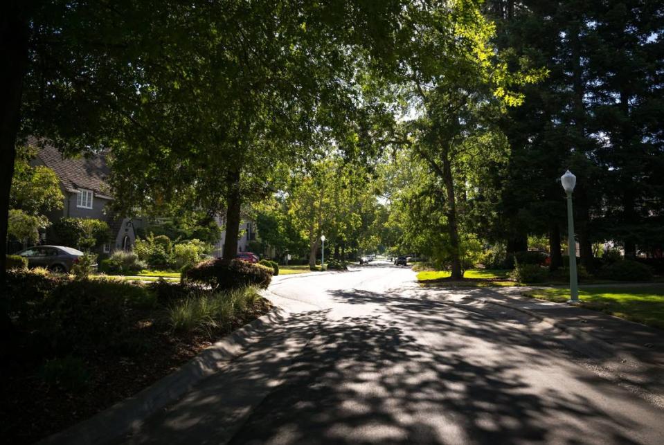
Is Sacramento’s tree canopy helping with heat?
Although Sacramento has a sizable urban tree canopy, the shade isn’t distributed equally across the capital city.
Land Park, East Sacramento and the Pocket have a higher-than-average number of trees — and the largest concentrations of high-income households, The Bee reported in 2019.
Meanwhile, neighborhoods with predominantly low- to moderate-income residents, such as Meadowview, Del Paso Heights and Parkway have fewer trees, and consequently, less shade.
More than half of Sacramento’s population lives in so-called “urban heat islands,” areas that feel roughly 9 degrees warmer than neighboring areas, The Bee reported July 3.
Those heat islands include parts of downtown Sacramento, West Sacramento, North Natomas and South Sacramento. The tree canopy is scarce in these areas, too.
Which city neighborhoods have the most trees?
According to the city’s Sacramento Urban Forest Plan, neighborhoods that have 35% or more of a tree canopy are:
Boulevard Park Campus Commons
Elmhurst
Land Park
Marshall School
Natomas Corporate Center
New Era Park
Richmond Grove
River Park
Southside Park
Communities with the lowest tree canopy include South Sacramento, North Sacramento and North Natomas, according to the plan.
In May, the city received nearly $2 million in federal funding to expand the city’s tree canopy from 19% to 35% by 2045, aligning with the city’s plan to enhance its urban forest.
What do you want to know about life in Sacramento? Ask our service journalism team your top-of-mind questions in the module below or email servicejournalists@sacbee.com.

