South Florida’s rain chances rise as messy tropical wave moves toward the state
South Florida could be in for rain and flooding over the weekend as a tropical wave near Haiti inches closer to the state.
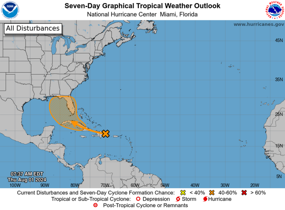
The National Hurricane Center has been tracking the disorganized cluster of storms for days, but on Thursday morning forecasters began to up its chances of strengthening into a tropical depression in the next two days.
As of Thursday morning, the hurricane center gave the wave a 20% shot of forming in the next two days and a 60% shot over the next week.
Overnight, early models suggesting where the disorganized system could go shifted from favoring a track along Florida’s east coast to a potential path into the Gulf of Mexico, although these tools aren’t very good at forecasting the movements of a system without a defined center. The hurricane center’s orange blob, which it uses to show where forecasters believe the tropical wave could form, also shifted west and into the Gulf overnight.
Those models also now suggest the potential for the system to “stall out” as the major weather forces steering it for the last week begin to weaken.
“Until the system gets a low level center, model will continue to struggle. If the system does get into the Gulf of Mexico, steering currents will be light, and the system could move slowly and erratically,” meteorologist James Spann posted on X.
The hurricane hunter planes are set to investigate the broad tropical wave later this week, which should help feed more information into the prediction models and help forecasters figure out where the system might go.
No matter what happens with the system, the Miami office of the National Weather Service is warning of the potential for flooding and rain in South Florida this weekend. On Wednesday evening, the agency noted a limited risk of excessive rainfall on Saturday and Sunday across the southern portion of the state — potentially one or two inches in South Florida.
“Again NHC has not made this an invest yet and once that changes and more data is put in models we will be able to get more details, but its certainly much more interesting with this guidance shift. Stay tuned, much to sort out still,” Weather Channel meteorologist Jim Cantore posted on X.

