
Is New Orleans Ready for Isaac?
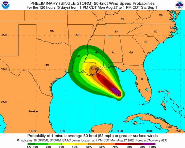

Dead center of the cone of possible paths that Tropical Storm Isaac could take as it wends its way northwest in the next 24 hours lies the city of New Orleans. Experts expect Isaac to pick up steam as it crosses the warm, energizing Gulf of Mexico to become a Category 1 or Category 2 hurricane by the time it bears down on the coast. Is New Orleans ready for the storm's arrival?
Since Hurricane Katrina devastated New Orleans almost exactly seven years ago on Aug. 29, 2005, the U.S. Army Corps of Engineers has spent $14.45 billion overhauling the city's hurricane preparedness infrastructure, which was in a sorry state of disrepair when the especially severe, Category-5 Katrina laid siege.
This time, the smaller, slower Isaac faces a much fiercer fight against New Orleans' Hurricane and Storm Damage Risk Reduction System (HSDRRS), a new system of levees, floodwalls and pump stations built to defend the city against a "100-year storm."
According to the Army Corps, that's a storm that has a 1 percent chance of happening in any given year. (Authorities have said there's no easy way to size up such a storm by other measures, such as the Saffir-Simpson hurricane categories, because a storm with an especially large diameter could cause a once-in-a-100-year storm surge, or rise in ocean water level, even with relatively low wind speeds.)
The National Hurricane Center (NHC) predicts that Tropical Storm Isaac could become a Category 2 hurricane, a storm with winds up to 100 mph (160 kph). The NHC also predicts a 6- to 12-foot (1.8- to 3.6-meter) storm surge. For comparison, Katrina had maximum sustained winds of 175 mph (280 kmh) and brought in tow a 28-foot (8.5-m) storm surge. [Isaac & Katrina: What Are the Odds?]
To protect the city from flooding during all but the rarest storms, Corps engineers have increased the height of the city's levees, or sloped embankments along the river and sea, which had sunk 2 feet (61 centimeters) below their original elevations by 2005 because of subsidence and unstable soils. The rain and storm surge from Katrina breached the levees at about 50 locations, flooding 80 percent of the city.
Engineers also replaced many of the concrete I-shaped floodwalls — vertical walls along the city's drainage canals — with T- and L-shaped walls, which have steel support beams that extend as far as 130 feet (40 m) into the ground, buttressing the walls should the canals fill to capacity during a future storm. [Future Hurricanes will Get Worse]
Pump stations, most of which failed in 2005, have been storm-proofed. A new, $500-million flood pump has been installed in a floodgate that closes across the Gulf Intracoastal Highway during storms, blocking off the heavily trafficked inland waterway from the surging Gulf. In the event that the floodgate is breached by a storm surge, the pump can suck 150,000 gallons of water per second back out of the gate.
Bearing in mind these massive infrastructure improvements, Colonel Edward Fleming, commander of the U.S. Army Corps of Engineers overseeing New Orleans flood protection, said the city is in a far better place than it was seven years ago, according to Reuters.
Federal Emergency Management Agency Administrator Craig Fugate concurred. "It's a much more robust system than what it was when Katrina came ashore," he told reporters.
Both officials noted that areas outside New Orleans' top-notch flood prevention system could fare much worse.
Follow Natalie Wolchover on Twitter @nattyover or Life's Little Mysteries @llmysteries. We're also on Facebook & Google+.
Copyright 2012 Lifes Little Mysteries, a TechMediaNetwork company. All rights reserved. This material may not be published, broadcast, rewritten or redistributed.