Showers & storms for Monday; much of next week is unsettled & warm
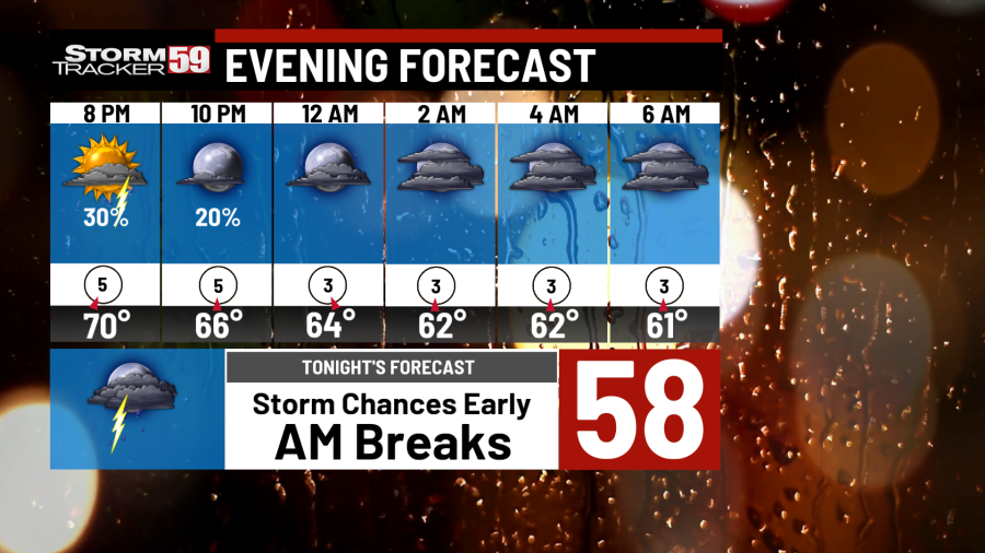
Sunday night starts with scattered showers and storms during the evening hours. These have the potential to produce some lightning strikes and some quick heavy downpours. As the sun sets, rain and storm chances will decrease to only an isolated chance closer to midnight. Clouds will linger afterward as temps drop into the 60s, though the more breaks in the clouds we see, the better the chance to see some patchy fog tonight.
Monday starts with a brief break in the morning before another round of showers and storms approaches the area by the late morning hours. With a stalled front draped over northern West Virginia on Monday, overcast skies and occasional showers in the afternoon will be possible. A warm day is expected, however, with temps in the 70s.


Tuesday will still be a good day to pack the rain jackets with scattered showers expected as our stalled front lifts off to the north. Occasional rain showers, and even some strong thunderstorms can’t be ruled out, with the biggest threat being damaging winds. Yet another toasty day with temps climbing into the 70s.


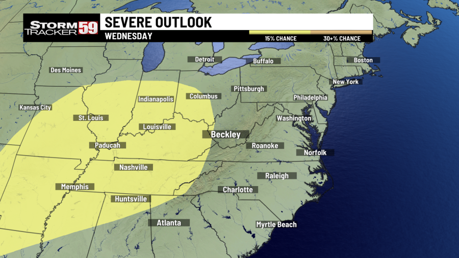
Wednesday is looking unsettled as well as we now turn our attention to an arriving cold front. This front will bring back even more chances for scattered showers. We are also watching for the potential of some strong thunderstorms, though much of the severe risk looks the greatest just west of our region. Temps on Wednesday reach the 80s.
Thursday carries a similar theme where keeping something around to keep you dry will be a benefit. A low pressure system will be parked near the Great Lakes on Thursday, igniting more chances for scattered showers. With a few breaks possible in between showers, temps will look to build into the 70s.
Friday keeps the chances for more showers around with another front scooting through. As a cold front moves through on Friday, we look to finally be rounding the corner to ‘nicer’ weather conditions once this front passes through the weekend. Friday also looks to be the ‘coolest’ day of this week with temps reaching the upper 60s/low 70s.
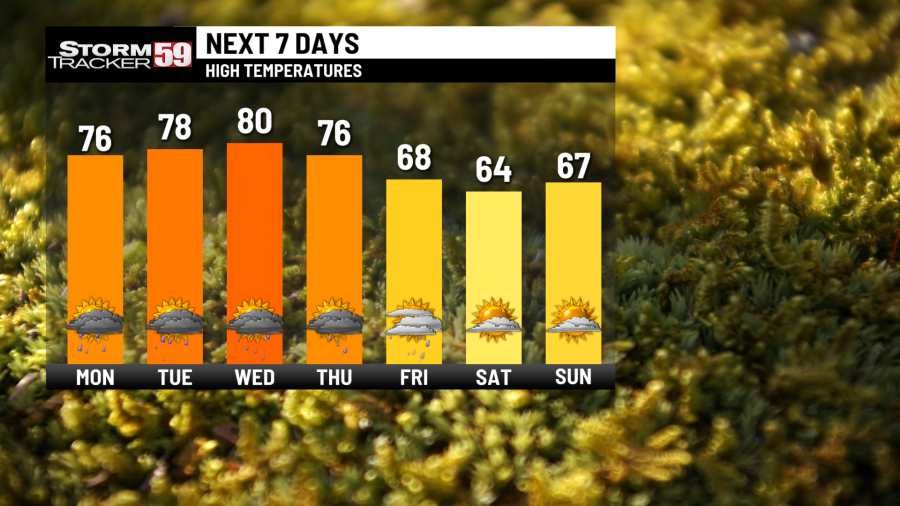
Saturday looks to finally give us a break from the shower/storm activity. Some lingering moisture along the mountains might spring forth an isolated shower or two, but the lowlands are trending on the dry side for now. Cooler air will start to settle in for our Saturday, keeping our temps down in the 60s.
In your extended forecast, next Sunday brings in the chance for some isolated showers, with only a stray chance lingering into our Monday. After which point, we’ll enjoy a dry spell on Tuesday before another round of showers looks possible heading into next Wednesday. After a brisk weekend, temps will recover back into the 70s by next week.

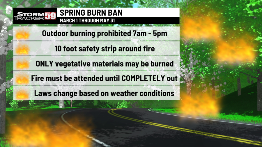
We are in spring forest fire season in West Virginia – this means don’t burn between 7 AM and 5 PM through May 31st. Low humidity values during the daytime, along with breezier and warmer conditions will at times increase the fire threat, hence the burn ban during most of the daytime. Follow all regulations or be faced with potential consequences, such as fines!
TONIGHT
Scattered showers/storms early. Overnight break with patchy fog possible. Lows in the 60s.
MONDAY
Brief break in the morning. Showers/storms PM. Highs in the 70s.
TUESDAY
Showers and thunderstorms possible. Cloudy and warm. Highs in the upper 70s.
WEDNESDAY
Scattered showers again. Few thunderstorms also possible. Highs in the 80s.
THURSDAY
Rain/storm chances continue. Overcast and warm. Highs in the 70s.
FRIDAY
Scattered showers/storms. Keep umbrella around. Highs in the 60s.
SATURDAY
Lingering MTN shower. Plenty of breaks. Highs in the middle 60s.
SUNDAY
Slight chance for a shower. Lots of dry time. Highs in the upper 60s.
MONDAY
Stray shower chance early. PM sunshine. Highs in the low 70s.
TUESDAY
Partly cloudy start. Clouds build overnight. Highs in the 70s.
WEDNESDAY
Chance for showers. Getting warmer. Highs in the 70s.
For the latest news, weather, sports, and streaming video, head to WVNS.

