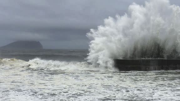
Typhoon Nepartak slams Taiwan, threatens China with more flooding

Super Typhoon Nepartak blasted Taiwan with 150 mile per hour winds on Thursday night and Friday, local time. The storm, in a weakened state, is now spreading heavy rains and strong winds into mainland China.
According to the Associated Press, at least two people have died and 72 were injured in the typhoon.
At the time of the storm's landfall just south of Taitung City at 6:30 a.m. on Friday, local time, the storm was classified as a Category 4 Super Typhoon, though it was weaker than its peak as a Category 5 storm earlier in the week.
SEE ALSO: Super Typhoon Nepartak is an example of terrifying meteorological perfection
With 175 mile-per-hour sustained winds on Thursday, Super Typhoon Nepartak had been the first Category 5 storm of the year in the Northern Hemisphere.
Videos and photos of the storm damage showed cars tossed around, street signs missing, homes missing roofs, and downed trees and power lines, among other damage.
Storm chasers who were present near the area where the storm initially came ashore described a harrowing evening in a series of social media posts.
Storm chaser James Reynolds took this video of the storm during its height as well as the immediate aftermath.
Reynolds broadcast as a security guard was nearly sucked out of a building while trying to hold the doors shut against the storm's onslaught.
Nearby, Josh Morgerman of the iCyclone chasing team broadcast the eerie sounds of howling winds attempting to break into a hotel lobby.
The scope and severity of the storm's damage will not be known for several days, as heavy rain continues to fall in the high terrain of central and eastern Taiwan. Rainfall amounts of around three feet are likely in this area, which could cause extensive flooding and mudslides.
The storm is forecast to hit China's Fujian Province as a Category 1 or 2 typhoon. In China, the greatest hazard from this storm will be its heavy rainfall.
Some of the same areas that saw deadly flooding in recent weeks could be in for more rounds of heavy rainfall as the storm slowly turns north-northeastward toward Shanghai.

