Using Planes to Fix Air-Pollution Satellites


Anyone who's ever driven down Interstate 5 in central California's Kern County knows about the smell. The one that penetrates cars despite closed vents and windows. Wafting from an adjacent cattle ranch, the largest on the West Coast, the well-known odor comes from the ammonia all those cows produce.
California's Central Valley, which spans I-5, regularly has some of the worst air pollution in the United States because of its unfortunate combination of geography and agriculture. It is ringed by mountains that trap bad air like water in a bathtub, and it is lined with fertile soils that produce much of the country's vegetables, fruits, nuts and meat, along with pollutants.
The region's unique pollution profile drew the attention of NASA scientists, who recently sent two research planes on swooping arcs from Bakersfield to Fresno on a mission to improve air-quality monitoring in the United States.
Tight lid traps pollution
The Central Valley bathtub has a shallow lid, the flights revealed, and this contributes to the region's poor air quality. "All of the pollution is confined to a very shallow boundary layer, about 1,500 feet [450 meters] and as shallow as 500 feet [150 m]," said Luke Ziemba, an atmospheric scientist at NASA's Langley Research Center. "We would spiral down into this muck and get very clean air above the boundary and very polluted air below."
The region's shallow, thin boundary layer, the lowest layer of the atmosphere, confounds both satellites monitoring the pollutants and the atmospheric models that predict the occurrence of these pollutants, Ziemba said. "Models in the San Joaquin Valley get the composition wrong, and when satellites try to retrieve the properties of the aerosols, it can be difficult," he told OurAmazingPlanet.
Ammonia from dairy farms is part of the problem, Ziemba said. The ammonia creates chemical droplets called aerosols that accumulate in the valley's stagnant air. Aerosols and other tiny particles confuse satellites. From space, the instruments can't distinguish between pollution located high in the atmosphere and that found at the surface, where people live.
"Near-surface pollution is one of the most challenging problems for earth observations from space," said Jim Crawford, the mission's principal investigator. "To look at ground level, you still have to look through the whole atmosphere."
Nor can satellites readily detect the difference between liquid and frozen droplets. "Basically, we have to make an educated guess as to the type of aerosol we're looking at," said David Starr, a NASA project scientist at Goddard Space Flight Center.
Better tracking
To better monitor aerosols and other pollutants, such as ozone and small particulates, NASA has launched a five-year, $30-million mission called DISCOVER-AQ, for Deriving Information on Surface conditions from Column and Vertically Resolved Observations Relevant to Air Quality. "The most tortured title in all of our Earth Ventures," said NASA program manager Hal Maring.
DISCOVER-AQ will use the airplane missions to help improve air-quality monitoring on the ground and from space, Crawford said. Researchers will use the information for a planned 2017 pollution-monitoring satellite, called TEMPO. The data will also give scientists the opportunity to compare the view of satellites from space with that from stations on the ground, as well as from aircraft. [Top 10 Craziest Environmental Ideas]
"Even in urban areas, there's a fairly sparse [monitoring] network," Crawford said. "What's really happening there is a difficult question to answer. If you could learn to use satellites to diagnose what's happing, we could begin to broaden our understanding of what's driving air quality," he said.
The Central Valley is the second of four stops for the researchers. The first was Baltimore, in 2011, and the next two are Houston and Colorado.
Improving satellites
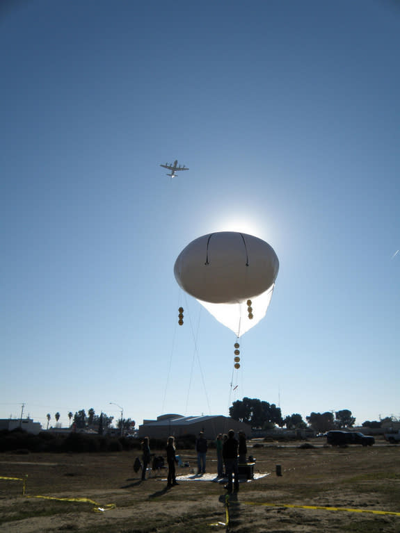
In the Central Valley, one plane, a P-3B, spiraled in the atmosphere below 15,000 feet (4,500 m), skimming as low as 100 feet (30 m) over local airports to capture pollution levels near the surface. Because the boundary layer was so low, the researchers also launched a tethered balloon to record surface pollutants.
At the same time, a B200 King Air plane flew as high as 26,000 feet (8,000 m). The plane's instruments looked down at the surface like a satellite, measuring particulates and gaseous air pollution along agricultural and traffic corridors.
The flight paths of the two planes passed over air-quality ground stations, as well as underneath afleet of eight Earth-observing satellites, called the Afternoon Constellation or "A-train," that soar over California every afternoon within 15 minutes of each other. [Satellites Gallery: Science from Above]
"They come over at 1:30 p.m., which is the worst time of day as far as emissions are concerned. Emission are concentrated in the morning, but these satellites were not launched with air quality in mind," Crawford said. "That's what this observing strategy is looking forward to in the future. We hope these experiments make them better."
Reach Becky Oskin at boskin@techmedianetwork.com. Follow her on Twitter @beckyoskin. Follow OurAmazingPlanet on Twitter @OAPlanet. We're also on Facebook and Google+.
Copyright 2013 LiveScience, a TechMediaNetwork company. All rights reserved. This material may not be published, broadcast, rewritten or redistributed.
