
Want to Make a Topographical Map? This Artist Will Show You How
By Lisa Martin
Make:
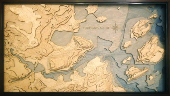
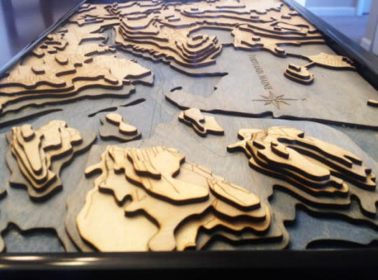
Most topographical maps show 3D geographical information in a 2 dimensional way. This layered, laser cut map, however, is an object that directly reflects the elevation of Portland, Maine. Scott Shambaugh created this map of his hometown as a gift for his parents. Hills and ocean depths that would be lost on a simpler map are highlighted here, and make for an interesting geographical piece of artwork.
If there’s a place you’d like to immortalize as a wooden topography map, Shambaugh has posted a detailed guide on recreating his process. In part one of his guide, he goes over how to use open source geographic information to format a map fit for a laser cutter. In part two, he shows how to assemble the layers of wood for a display-worthy finish.
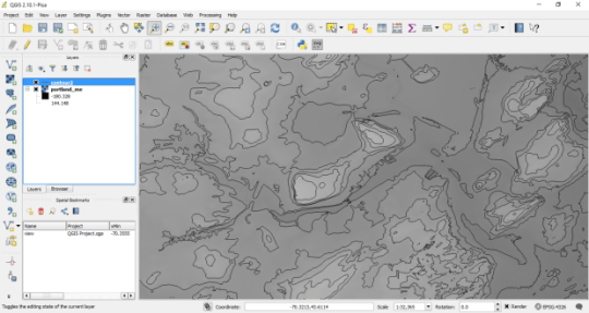
According to Shambaugh, the hardest part of the process was creating the map itself. He used QGIS, an open source geographic information system that allows users to create and edit maps, and GIS data from Maine’s Office of Information Technology to map out the elevation and road information. In Adobe Illustrator the map information is formatted into separate layers to prepare them for laser cutting. “Both those programs [QGIS and Illustrator] are deep professional tools with a lot of capability, and that means the learning curve is more of a learning cliff. I wrote the how-to guide mostly as a way to demystify the whole process for others and myself,” Shambaugh explained.
Since this was a one-off project, he had his design files laser cut by a third party. He stained the lower ocean levels different shades of blue, but kept the wood natural for the landmasses. He affixed the layers of the map together with glue and then framed the whole thing.
Shambaugh had this to say about the mystique of maps and mapmaking:
Maps tell all sorts of stories. For example in the map I made, you can see where the glaciers carved paths tens of thousands of years ago, and where rivers have eroded their own course since. You can see how the naturally deep harbor has made Portland ideal for large tankers and ships, and where the seafloor has been dredged to facilitate this. And of course there’s the human story hidden in the maze of roads, which — as someone who grew up there — holds a lot of personal meaning.
Because of the positive reception he’s gotten for this project, he’s decided to do commissions part time as a more hands-on creative break from his full-time job programming the autopilot on Atlas V rockets. He’ll be taking requests as soon as he can get a laser cutter of his own to make such projects scaleable.
[via Reddit]
More from Make:
3D Printing Topographic Maps Using Lidar
Hold a Moment of History in Your Hand with 3D Printed Maps
