WEATHER NOW: Calm conditions today, but 2 rounds of severe weather are possible tomorrow
NEXT 24 HOURS:


CURRENT WEATHER ALERTS:


LOCAL FORECAST AHEAD:
After a rainy, stormy Friday, conditions look to be much better today. Sunny skies will take over later in the morning and should pave the way for a classic Spring day with temperatures in the upper 70s and low 80s.

With it being a holiday weekend, there are likely lots of travel plans and outdoor plans in store for many of us. It would be wise to have those plans be either for today or Memorial Day itself, as tomorrow brings us a risk of impactful severe weather.
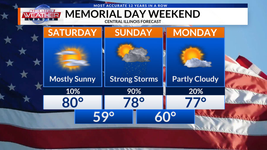
At the moment, most of the area sits under a Level 3 out of 5 Enhanced Risk for severe weather tomorrow. There will be 2 rounds of potential severe storms, with the 2nd round being highly dependent on how the 1st round plays out.

The 1st round will take place from roughly 6:00 in the morning and should be out of the area by about noon. This round is expected to be the lesser of the 2 potential rounds, but will still bring the risk for some widespread strong wind gusts of 60+ mph with it. If this 1st round can clear out early on in the day and allow our atmosphere to recover, then we could be in for a rough afternoon with round 2, which could start as early as 2:00 PM.
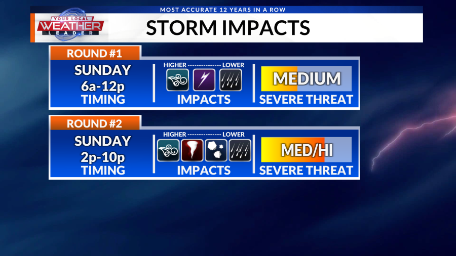
Below is a look at what Round 2 will be capable of if that morning round clears out in time. The primary risk will be widespread damaging winds of 70 to maybe even 75 mph, mainly south of I-72. The tornado risk will also be present throughout this 2nd round as well.

Strong gusts could bring the most impact to the area tomorrow as these storms form into a bowing line segment. As we saw yesterday, all it takes is 60 mph gusts to take down large tree limbs and even damage some property.
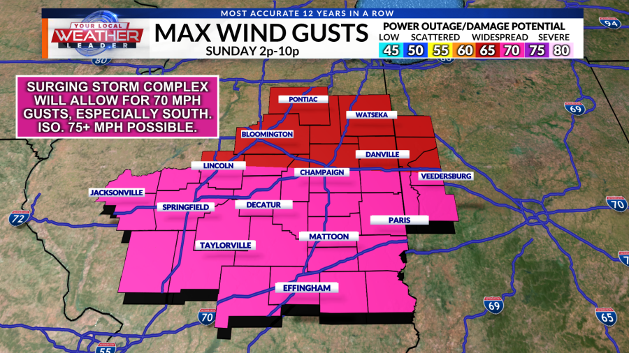
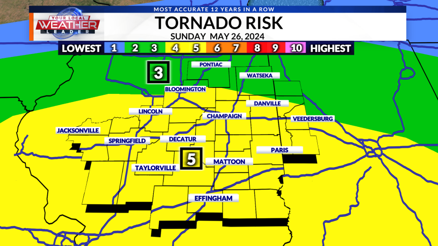
As things sit right now, we are sitting at a 5 on our Tornado Risk index. The greatest environment for tornadic activity will be along the I-70 corridor, but anyone that manages to see storms in this afternoon round will have an opportunity of seeing tornadoes.

Below is a look at Futuretrack, which details both rounds of storms tomorrow. Keep in mind:
– Round 1 is likely to still bring some impacts to the area, even if it is not the main event. This line of storms could span across the area, and 60+ mph gusts will be possible all along this line as will 1+” hail. The tornado risk isn’t high, but will still need to be monitored. Again, this round will be from about 6 AM – 12 PM
– How Round 1 plays out and how soon it concludes will be a major factor in when / where we see storms in the afternoon and how strong they could potentially become.
– Round 2 will have a high ceiling, with 70+ mph gusts and tornadoes as the primary hazards. This looks to mainly stay south of I-72 and will occur from roughly 2 PM – 10 PM.
Now is a great time to learn more about WeatherCall. It’s a phone call service that for just $12 a year, we will call you for weather alerts at your home location.

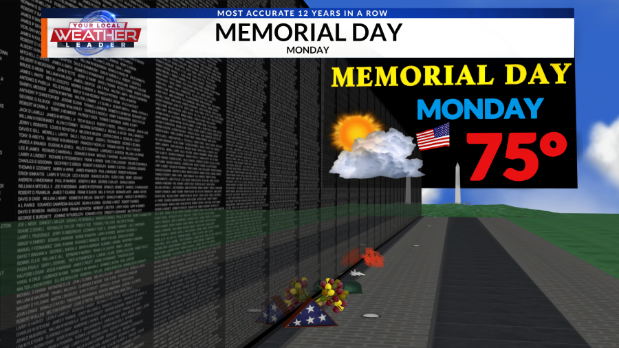
Thankfully, we won’t have to worry about much in the way of showers or storms for the rest of the upcoming week, including Memorial Day. Expect temps in the middle 70s with some clearing skies on Monday.
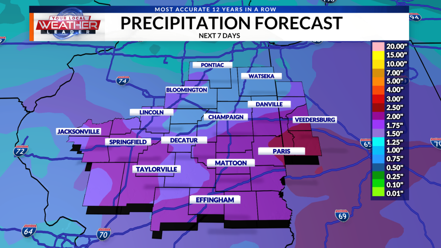
This 1-2 punch of storms will bring another high dosage of rain to the area on Sunday, but hopefully drier conditions prevail for the rest of the week.
Temperatures tend to return to more normal this time of year as we get to next week.

Don’t forget to download the WCIA 3 Weather App to stay up-to-date with the latest forecast anytime, anywhere.

7 DAY FORECAST:
Here is your 7 day forecast updated several times a day. You also can see the 7 day forecast and more on the WCIA 3 Weather App and on the WCIA 3 Weather Map Room.

DROUGHT MONITOR:
See the latest drought monitor showing drought conditions in Central Illinois below. The drought monitor is released every Thursday morning and includes rainfall amounts from the Tuesday to Tuesday 7 day window immediately before the drought monitor is released.

LONG-TERM FORECAST:
Here are the latest extended outlooks for the 8-14 day temperature and precipitation outlooks. These outlooks are issued daily and provide insight into the confidence in seeing temperatures and precipitation above or below normal beyond our 7 day forecast.


Download the WCIA 3 Weather App for iOS
Download the WCIA 3 Weather App for Android
Copyright 2024 Nexstar Media, Inc. All rights reserved. This material may not be published, broadcast, rewritten, or redistributed.
For the latest news, weather, sports, and streaming video, head to WCIA.com.

