The heat is on
AUSTIN (KXAN) — The day dawned with decreasing clouds along with some dense fog in a few areas, especially in Fayette Co. where the visibility was under a mile for several hours. It finally went above normal in the 9 a.m. hour.
Lows temperatures were near the averages with many minimums in the mid to upper 60s. Camp Mabry’s low was 68°, a degree above the normal. The low at the airport was normal at 66°.
Today is an Ozone Action Day for Williamson, Travis, Hays, Caldwell, and Bastrop counties. A sunny sky, the forecast of hot temperatures and light winds out of the south will lead to ozone levels on the lower end of the “Unhealthy for Sensitive Groups” range on the south side of Austin.
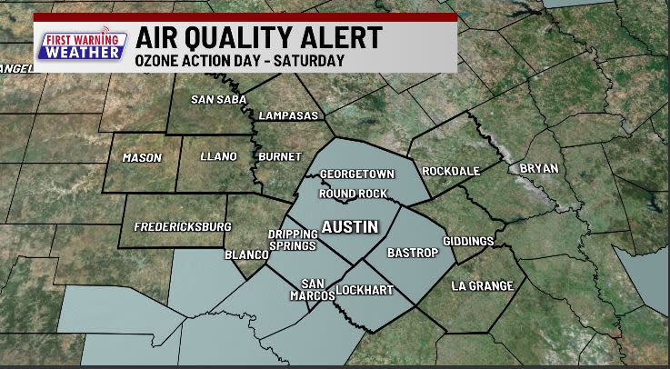
Those with respiratory issues should limit their outdoor activities. When driving, try to avoid idling. Wait until after dusk to refuel your car.
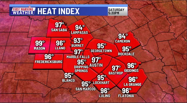
Southerly winds have returned to the area that, when combined with a mostly sunny sky, will lead to afternoon highs in the lower 90s at many locations. The highs forecast this afternoon will feel more like readings that occur in early to mid June.
Dew points will hover in the low to mid 60s today. This will lead to afternoon heat index readings in the mid to upper 90s.
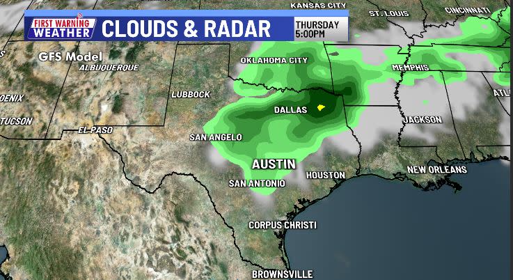
Similar conditions will prevail tomorrow. The morning will be cloudy in many areas along with areas of fog. Rapid clearing will find the sky becoming mostly sunny.
Monday and Tuesday will be dry. A weather disturbance in the upper atmosphere gives us rain and thunderstorm chances beginning late Wednesday afternoon. Thursday has the potential for being the wettest day with a 30% chance of showers and thunderstorms.
It’s a week of 90+° heat for most of the area. Plan accordingly.°
NEW BLOG: May forecast: Will our rainiest month live up to it?
BLOG: Here’s when El Niño ends and La Niña begins
BLOG: La Niña Watch Issued: Here’s the impact on Central Texas
FIRST WARNING WEATHER: Stay up to date with your Central Texas forecast, sign up for our weather newsletter at kxan.com/newsletters
Stay up-to-date with the First Warning Weather team
Follow the KXAN First Warning Weather team on Facebook, Twitter and Instagram.
You can also follow our meteorologists’ individual accounts for livestreams and a little bit of what goes on behind the scenes:
Copyright 2024 Nexstar Media, Inc. All rights reserved. This material may not be published, broadcast, rewritten, or redistributed.
For the latest news, weather, sports, and streaming video, head to KXAN Austin.

