Storm day 1: State of Emergency declared in Fresno County as flooding grows
This is a developing story. Check back to fresnobee.com for updates. To get breaking news alerts, click here.
8:00 p.m.
Fresno County Emergency Services Director Paul Nerland proclaimed a State of Emergency on Monday night, saying the storm impacted county roads, and caused flooding and hazards threatening public safety and property. He said all county departments were “collaborating around the clock to provide updates, assist residents and facilitate repairs.” He encouraged the public to check the Fresno County website for updates.
Highway 180-Piedra on evacuation alert
7:30 p.m.
Rising waters prompted an evacuation warning from the Fresno County Sheriff to residents in the general area of Highway 180 and Piedra Road in Sanger. That included homes within Riverbend RV Park, N. Wilderness Drive, N. Trout Lake Drive, Wood Duck Ave., Little Beaver Road and beyond. The impacts were due to heavy water flows into Mill Creek and Hughes Creek, which feed into the Kings River. A map of the evacuation status can be found here. A real-time map of road closures is also available.
Madera Sheriff reduces evacuation
6:30 p.m.: The Madera County Sheriff’s Office reduced an evacuation order at Sierra Springs Village mobile home park near Bass Lake to a warning, meaning residents may return but should be prepared to leave again if flood waters rise.
Shaver Lake drenched
5:30 p.m.: While rainfall totals from Monday’s storm continued to climb in Fresno, approaching 1.5 inches between midnight and 5:15 p.m. at Fresno Yosemite International Airport, that figure was dwarfed by what was happening throughout the day in the unincorporated mountain community of Shaver Lake, a mere 40 miles or so from central Fresno.
By 5 p.m. Monday evening, the National Weather Service reported that about 6.6 inches of rain fell in Shaver Lake since midnight. The heaviest pummeling took place between 6 a.m. and noon, a six-hour period in which more than four inches of precipitation drenched the town.
More rain coming Tuesday
4:30 p.m.: Monday’s storm dropped more than 1.3 inches of rain at Fresno Yosemite International Airport since midnight Monday morning, according to data from the National Weather Service. Forecasters with the NWS office in Hanford said they expected the storm to taper off Monday evening before another rainmaker – not as strong as Monday’s drencher – flows through the region on Tuesday.
School canceled, park closed
4:15 p.m.: The Sierra Unified School District, which serves foothill communities in eastern Fresno County, announced that it has canceled classes on Tuesday because of severe weather and road conditions. Students will make up the lost day of school on March 6.
Fresno County also closed the popular Lost Lake Park day-use area and campgrounds to the public starting Monday afternoon until further notice because of heavy flooding. The park is tucked along the south bank of the San Joaquin River near the town of Friant, below Friant Dam and Millerton Lake.
Madera County emergency declaration
4 p.m.: Madera County Sheriff Tyson Pogue declared a local emergency for Madera County as rain continues to fall both in the Sierra Nevada foothills and on the San Joaquin Valley floor.
The declaration, issued shortly after 3:30 p.m., was in response to “the significant impacts of the ongoing extreme weather conditions.” Just since midnight Monday morning, the National Weather Service reported that more than an inch of rain had fallen at Fresno Yosemite International Airport, with even heavier rainfall totals in other areas of the central San Joaquin Valley.
On its Facebook page, the Madera County Sheriff’s Office stated that the steady rain had resulted in some mandatory evacuations due to dangers from flooding, as well as mudslides, downed trees and flooded roadways across the county.
Amid the havoc, “the extreme weather has strained our local resources,” requiring the emergency declaration “to maintain our standard level of public protection to the county,” the Facebook post stated.
Also on Monday afternoon, the Shaver Lake Visitors Bureau posted on its Facebook page that all roads from the Valley floor to Shaver had been closed because of road problems, including Auberry Road, Old Tollhouse Road and Highway 168.
Underpass closed: A Fresno roadway underpass prone to chronic flooding was closed in the Fig Garden area of the city on Monday after pumps failed to keep up with the rainfall. The Van Ness Avenue underpass beneath the BNSF Railway tracks was shut down Monday afternoon as city public works crews checked on pumps that are intended to keep the roadway open.
Storm creates problems for drivers
2:10 p.m.: The continuing storm is creating problems for drivers throughout the region, particularly in the foothills.
While California Highway Patrol officers were stationed on the “four-lane” section of Highway 168 southwest of Shaver Lake Monday afternoon because of mud and water on the roadway, a major rockslide tumbled down the hillside and onto the highway, CHP spokesperson Mike Salas told The Fresno Bee.
Salas said no one was hurt by the rockslide, which happened about one mile east of another rockslide from a previous storm.
The Fresno County Sheriff’s Office is urging drivers to avoid the area of Tollhouse Road and Pittman Hill Road, near the community of Humphrey’s Station in the foothills northeast of Fresno, because of flooding across a nearby bridge making the road impassible for vehicles.
Fresno County reported numerous road closures because of flooding in addition to the Highway 168 four-lane. They include:
Belmont Avenue between San Diego and Fairfax avenues, west of Mendota.
Washoe Avenue between California and Belmont Avenues, west of Mendota.
Lyon Avenue between California and Belmont Avenues, southwest of Mendota.
Shaw Avenue between Washoe and Douglas avenues, between Mendota and Firebaugh.
Douglas Avenue between Shaw and Bullard Avenues, southwest of Firebaugh.
Evacuation shelters in Madera, Mariposa counties
The American Red Cross has opened two evacuation shelters for mountain residents in Madera and Mariposa Counties who have been forced to leave their homes because of danger of flooding.
The shelters are at:
The Oakhurst Community Center at 39800 Fresno Flats Road in Oakhurst.
The New Life Christian Fellowship at 5089 Cole Road in Mariposa.
Red Cross volunteers are providing water, meals, and other resources to residents who have evacuated. The agency urges evacuated residents wo bring prescription medications they may need, extra clothing, pillows, blankets, personal hygiene supplies. Diapers, formula and toys are also recommended for children and infants.
Storm relief centers in Fresno
1:30 p.m.: The city of Fresno has opened four storm relief centers for homeless residents to escape the current series of storms battering the region.
The centers opened Monday and will remain open 24 hours a day through Sunday, Jan. 15. The centers are:
The Pinedale Community Center at 7170 N. San Pablo Ave. in the Pinedale neighborhood of northwest Fresno.
The Ted C. Wills Community Center at 770 N. San Pablo Ave., in central Fresno south of the Tower District.
The Maxie L. Parks Community Center at 1802 E. California Ave., in southwest Fresno.
The Sal Mosqueda Community Center at 4670 E. Butler Ave., in southeast Fresno.
City officials said the centers will provide three meals each day as well as cots and blankets for those seeking refuge from the storms that will flow through the region this week. While the centers are in use as storm relief centers, normal programming is suspended.
People who need a ride to one of the centers can use the city’s FAX buses free of charge, or call 311 to arrange for transportation through the Poverello House, a local homeless shelter and ministry.
Evacuation ordered at Bass Lake
12:15 p.m.: An RV park in the Madera County mountains is under an evacuation order because of the threat of flooding from heavy rains riding an atmospheric river soaked the central San Joaquin Valley on Monday.
The Madera County Sheriff’s Office issued the orders for the Bass Lake RV Resort at 39744 Road 274 because “there is an immediate threat to life” from flooding and urging every one to leave “now.”
“The area is being closed to public access,” stated the advisory sent out by text message to residents in the area and posted to the department’s website at about 11:30 a.m.
Deputies are asking people in need of evacuation assistance to call 911 for help. As of noon Monday, the location for an evacuation shelter was not yet determined.
TV stations off air
12 p.m.: Gary Cocola, president and CEO of Cocola Broadcasting Companies in northwest Fresno, said all of the stations operated by his company – a collection of independent and low-power stations – had been knocked off the air at about 7:30 a.m. Monday by power outages at two foothill transmitter locations east of Fresno: Bear Mountain near the town of Squaw Valley and at Meadow Lakes near Auberry.
Jim Zahn, a consultant for Cocola, said several major network affiliates in Fresno also remained off the air, including NBC affiliate KSEE Channel 24, Fox affiliate KMPH Channel 26, CBS affiliate KGPE Channel 47, and others.
Cocola said viewers who receive those stations through a cable television subscription or streaming services were not affected because stations typically have a direct fiber-optic connection to the cable company and streaming services, but over-the-air viewers who get the signals through an antenna are affected.
Power outages
Thousands of PG&E customers were without power Monday morning as a strong atmospheric river moved into the Fresno area.
Close to 2,000 customers were reported without power just after 8 a.m. in a large area north of Fresno around Friant and Millerton Lake. Power had been restored there around 10:15 a.m.
Another outage in Auberry was impacting 412 customers. There was no estimate as to when power might be restored there.
PG&E also reported more than 800 customers experienced an outage east of Clovis near Shaw and Academy avenues. Power had been restored there by around 9:20 a.m.
The outages were just some of the affects of the storm, which was expected to bring two to three inches of rain to Fresno by Tuesday.
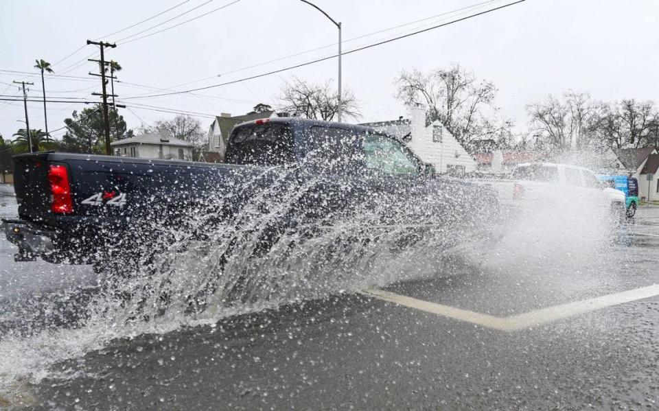
Fresno-area flooding
Throughout various parts of Fresno and the greater Fresno area, drivers encountered flooded intersections as storm drains struggled to keep up with the downpours which began Sunday night and continued into Monday afternoon. The threat of drivers losing control of their cars due to hydroplaning – or standing water interfering with the grip of tires on the road – was also a concern.
The National Weather Service has issued a Flood Watch through Wednesday.