This new 1,000-acre nature park brings mountain hiking closer to the Triangle
There’s a new mountain to climb in central North Carolina, and what it lacks in height and grandeur it makes up for with convenience for hikers in the Triangle.
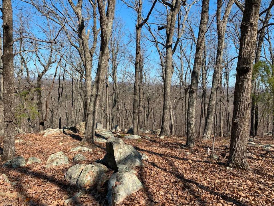
The mountain is not new, of course, but access to it is. The Cane Creek Mountains Natural Area in southern Alamance County opened last spring with 3.5 miles of trails, including one that ascends to what the county parks department says is “the highest peak east of Greensboro at 987 feet.”
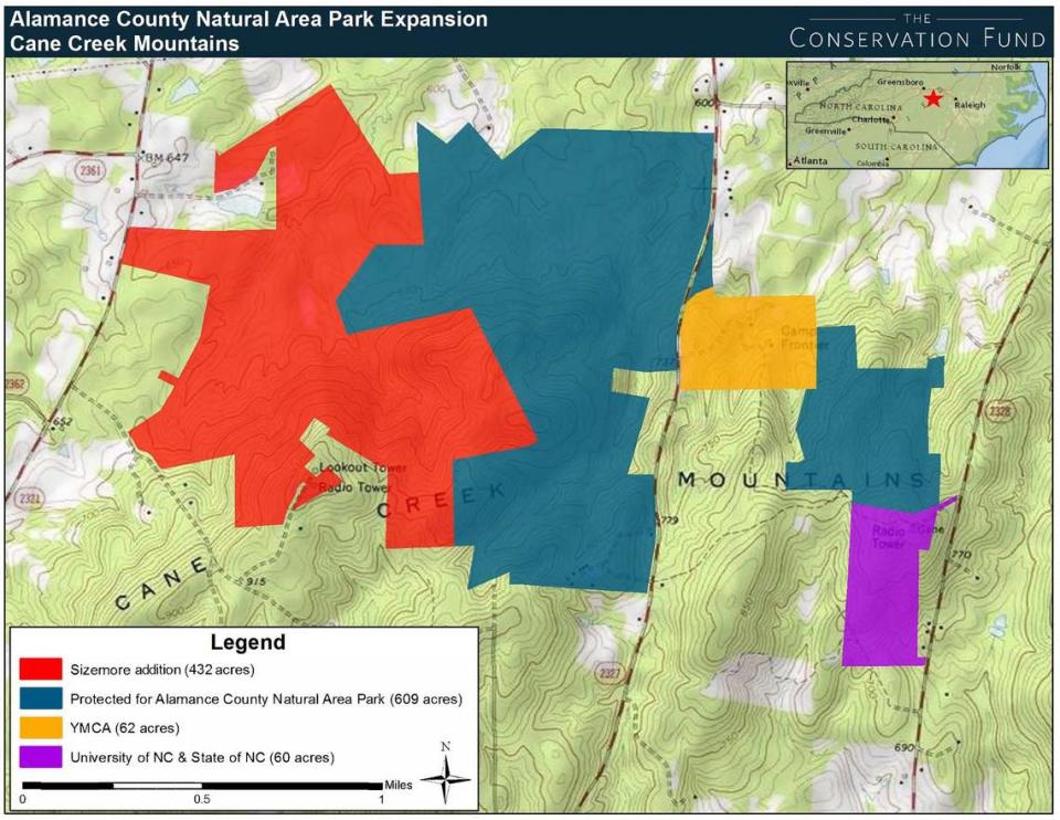
Now the nature park is getting bigger, with the addition of 423 adjacent acres. The Conservation Fund, a national environmental group, bought the land a couple of years ago and has now transferred it to the county, creating a mostly tree-covered park of more than 1,000 acres just north of Snow Camp, 60 miles west of Raleigh.
The park stands out on a satellite image as a dark forest surrounded by a patchwork of woods, fields and houses. Saving it was a rare opportunity, says Brian Baker, director of Alamance Parks.
“When you work in a developed area of the Piedmont, you just don’t get the chance to put together 1,000 acres of high-quality land very often,” Baker said. “If you tried to do this in Orange or Durham or Wake, it’s just not possible.”
The Cane Creek Mountains are what’s known as a Piedmont monadnock, the worn, isolated remnants of ancient mountains that rise above the surrounding countryside. Others in the region include Occoneechee Mountain in Orange County and Pilot Mountain, north of Winston-Salem.
Topography kept the Cane Creek Mountains from being turned into farmland like the area around it, said Bill Holman, The Conservation Fund’s North Carolina director.
“It’s steeper, rocky land,” Holman said. “It’s good for growing trees, but not great for agriculture.”
‘It’s close to home’
Wendy Panko of Durham learned about the new park when she looked for hiking trails online. She and her husband, Scott, first visited last fall when the woods were full of flowers and mushrooms after a rain.
They returned Thursday under a brilliant late-winter blue sky to hike the 2.5-mile loop trail to the top. Surrounded by the raspy call of chorus frogs, they navigated muddy patches on the trail before it began to climb, zigzagging over and around boulders.
The Pankos are avid hikers but say their favorite trails at Eno River State Park and Jordan Lake can get a little too familiar.
“You’re always looking for a trail you haven’t been on 10 times,” Scott Panko said as they rested near the top. “This reminds us of going to the mountains. And it’s close to home.”
Doug Northup was making his second visit to the park as well. Northup, who moved to the area from North Raleigh after retiring from IBM, said he enjoys hiking the Blue Ridge Mountains around Asheville and Boone but also likes having some elevation close to home.
“It’s the best we’ve got. I’ll take it,” he said, catching his breath near the summit. “I don’t have to drive more than five miles. It beats four hours to Asheville.”
There is no Cane Creek Mountain
As Alamance County began creating the park, it had to deal with the vagaries of North Carolina place names. The entrance to the park is off Bass Mountain Road, which Baker said is how many locals would refer to the park’s high point. But the U.S. Geological Survey puts Bass Mountain two miles east.
So the county parks department studied a map of the county created in 1893 by William L. Spoon, who carefully drew and labeled the geographical features along with every homestead, mill, church and school. Spoon called what is now the high point of the park Pine Hill, so the county named the parking area the Pine Hill Trailhead.
There is no Cane Creek Mountain, by the way; the name, plural, refers to the collection of peaks and hills that make up the isolated range.
There are about 15 Cane Creeks in North Carolina, according to the N.C. Gazetteer, including two that flow into the Haw River near the park. The one that joins from the north passes through its namesake reservoir that provides drinking water to Carrboro and Chapel Hill, while the other comes up from the south and west through Snow Camp.
The creek that the loop trail follows down the mountain in the park is neither of those. It was an unnamed tributary of Varnals Creek, and the county decided to give the stream a name as a reference point, Baker said. It chose Buggy Shop Branch, because Spoon’s map showed a buggy and wagon shop at the point where it joined Varnals Creek.
The county began planning the park about a dozen years ago when the Great Recession halted a housing development off Bass Mountain Road and 100 acres suddenly became available, Baker said. But it wasn’t until The Conservation Fund and the Piedmont Land Conservancy got involved that the county had money to begin acquiring property.
The latest acquisition, known as the Sizemore tract after the family who owned and grew timber on the land, is the largest. The Conservation Fund bought the land for $1.7 million, Holman said, and held it until the county could get a $1.2 million grant from the N.C. Land and Water Fund, which was created by the General Assembly. The other $500,000 came from private donors.
Holman said new subdivisions in the area show what might have become of the property.
“Development was coming,” he said. “We were fortunate that some local families preferred to sell their land for conservation.”
Holman said he thinks the highest point in the Cane Creek Mountains is just outside the park, on a peak that includes a state fire tower and communications towers.
Baker said he grew up in the Blue Ridge Mountains, hiking Grandfather Mountain and Linville Gorge as a boy. He acknowledges this isn’t that.
“I was a little self-conscious about calling it a mountain, because, you know, it’s a big hill,” he said. “But when you get half way up, you accept the title that it’s a mountain. It’s enough to get your heart beating.”