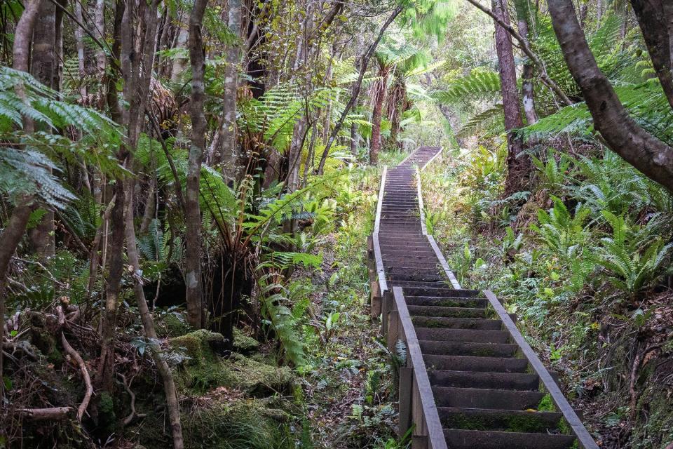
10 Stunning Hiking Trails and Great Walks in New Zealand
PatrikStedrak/Getty Images
New Zealand's natural beauty is unparalleled. From its majestic mountains, lush rainforests, pristine lakes, and beaches, it's a place where Mother Nature truly shows off her best assets. Want to experience it all? Then it's time to head out on one of the country's Great Walks.
In New Zealand, whether you're discovering your inner athlete, or you want to immerse yourself in some of the world's most remarkable nature, you can explore in peace at your own pace. Here are a few of New Zealand's most stunning walks to bookmark for when you're ready to set out for adventure on foot.
The Milford Track
anothersteph/Getty Images
"The Lord of the Rings" often comes up when I mention that I'm from New Zealand. People are entranced by the scenery. "Does it really look like that?" they ask. The answer is yes, on the Milford Track (where filming took place), it does.
It's arguably the country's most famous walk and has been a hikers' favorite for over 150 years, counting Sir Edmund Hillary among its fans. The Milford Track sits within a UNESCO World Heritage Site and has been referred to as the "Eighth Wonder of the World" for good reason.
The 33-mile walking track begins at Lake Te Anau, through Fiordland National Park, arriving at the spectacular Milford Sound (four days later, that is). The scene looks like it was painted by Monet. There are majestic snow-capped mountains, ancient rainforests, the country's highest waterfall, and sapphire blue waters, completely unobstructed by man-made roads. Both novices and seasoned hikers can enjoy the track, although it is not recommended for children under 10.
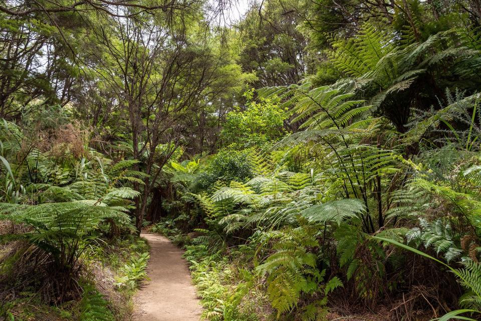
Abel Tasman Coast Track
imagoDens/Getty Images
With its golden beaches, lush native bush, and azure-blue lagoons, the Abel Tasman is considered New Zealand's finest coastal walk.
It's located on the South Island's northern shores, where the climate is mild and the landscapes are idyllic. Unlike many other hiking trails, it's highly accessible, and many tour operators offer options to experience it depending on the desired duration and ability. Visitors can choose a multi-day, lodge-based walk, a full day trip, a half-day trip, or even opt for a tour as short as 30 minutes, taking a water taxi between locations.
Some visitors combine walking with guided kayaking or a cruise. If you opt to do the entire walk on foot, it takes an estimated five days and is 32-miles long. The track has little elevation, so it's appropriate for families with young children and people with a limited fitness level.
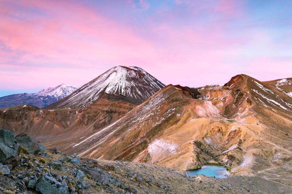
Tongariro Alpine Crossing
Matteo Colombo/Getty Images
You could be convinced that you've landed on another planet on the Tongariro Alpine Crossing, surrounded by moon-like red craters, emerald-colored lakes, and thermal vents. The otherworldly volcanic landscape makes the walk so unique, drawing over 125,000 visitors each year (in non-pandemic times).
The track sits within the Tongariro National Park, a dual UNESCO World Heritage Site. A moderate level of mobility is required as it's an arduous hike, taking a full day to complete (around eight hours). Visitors can walk it in either direction, but most people set out at the Mangatepopo Valley, beginning at 1,120-meters and ascending to the peak at 1,868-meters. The views are spectacular once you reach the top, extending across Ngauruhoe, Tongariro, Ruapehu, and Mount Taranaki in the distance. It is an active crater, so it's essential to visit GeoNet before embarking on the crossing to check on any volcanic activity.
Rangitoto Summit Track
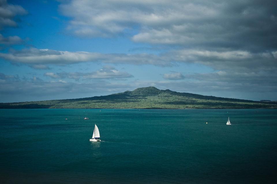
Stas Kulesh/Getty Images
Rangitoto is one of Auckland's most iconic landmarks, often the subject of paintings and local landscape photography. It's the largest of the city's 48 dormant volcanoes, sitting right in the middle of the Hauraki Gulf and providing panoramic 360-degree views from the Waitakere Ranges in the west to the Hunua Ranges in the east. It's also home to the world's largest pōhutukawa forest (the magnificent trees with crimson flowers) and is a haven for endangered native birds.
Visitors can take a ferry from downtown Auckland or Devonport (which takes just over 20 minutes) to get there, or if anyone is feeling particularly adventurous, kayak over from Takapuna Beach. Once at Rangitoto Wharf, travelers can set out on a well-formed path with a gradual incline and is 4.3-miles long, taking two hours tops. Note: There are no bathrooms on the island or any running water, so prepare before you disembark the ferry.
Roy's Peak
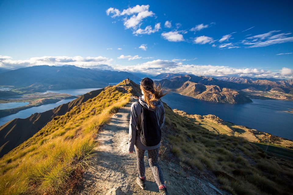
Matthew Micah Wright/Getty Images
Before the pandemic, Roy's Peak attracted so many visitors that there was often a queue to get the classic top-of-the-mountain money shot. In fact, there are now 73,000 posts with the hashtag #royspeak on Instagram.
Couples have been known to helicopter in for wedding photos, but if you're planning on hiking to the summit, a high level of fitness is required, and in the winter, hikers must be equipped with an ice axe and crampons.
The walk begins from the Roy's Peak Track parking lot on Mount Aspiring Road. However, parking is limited, so taking public transport or biking to the starting point is recommended (biking beforehand sounds like an Olympic event, but it's an unchallenging 25-minute bike ride from the Wanaka town center). The track leads through 10 miles of untamed alpine meadows, ascending to 1578-meters high, where there are surreal views of Lake Wanaka and Mount Aspiring. It's closed for 'lambing' from October through November 10 each year, and even in the summer, it can get chilly, so remember to pack a proper jacket.
Mount Maunganui Summit Walk
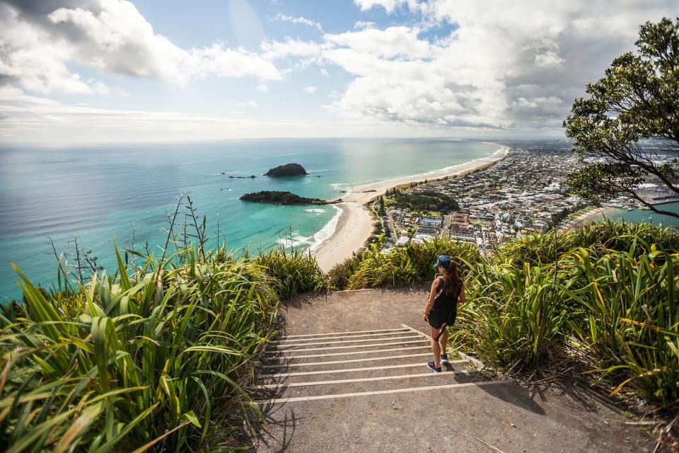
Christopher Kimmel/Getty Images
Climbing to the top of "The Mount," as locals call it, is a bit like reaching the top of Runyon Canyon in Los Angeles, often documented with an Instagram post to show off the glossy view. That's likely because it only takes around 40 minutes, and there are two scenic tracks with well-formed staircases leading to the 232-meter summit.
There are picnic tables at the top, so you can take a break and enjoy the views of the Pacific Ocean, the white sand coastline, and the bay on the other side. Once done, take a swim at the beach below and enjoy the leisurely pace of life in the classic Kiwi summer playground.
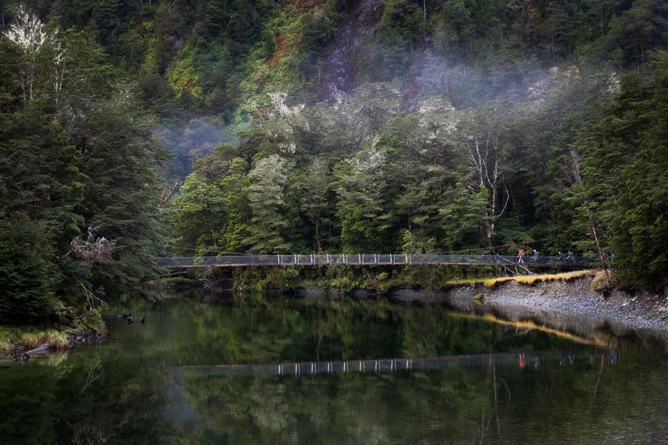
Routeburn Track
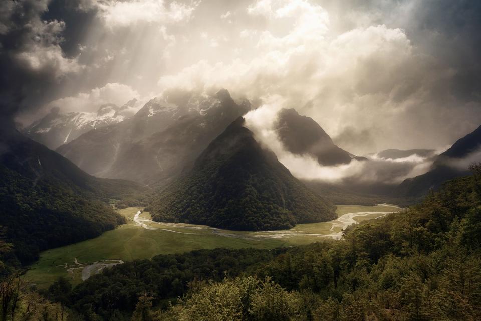
Daniel Garrido/Getty Images
Deep in the Southern Alps is the Routeburn Track, which links Mount Aspiring National Park and Fiordland National Park.
The track is known for its incredible natural scenery, featuring waterfalls, moss-draped forests, soaring mountain peaks, and crystal-clear lakes. The hike takes two to four days and can be walked in either direction; there is one track end at the Routeburn Shelter (near Glenorchy, where the revered Blanket Bay resort is located), and the other is at The Divide, close to Te Anau. It requires a decent level of fitness as it is steep and undulating, reaching 1,255-meters above sea level at its highest point. There is a high risk of avalanches between May to September, so it's best to visit during New Zealand's summer months (ideally between November through March).
Hooker Valley Track
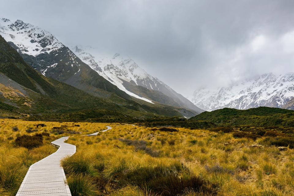
Ernest Kung/Getty Images
The Hooker Valley track is an excellent day-walk for people of all ages and abilities. The alpine terrain is mainly flat, and the path well-groomed, with boardwalks to protect the delicate eco-system.
The track is located within Mount Cook National Park in Canterbury, home to New Zealand's highest peak, Aoraki-Mount Cook, which stands at 3724-meters high. The walk takes three hours and is 6.2-miles, leading across three sets of swing bridges, where you can see incredible glaciers, lakes, and towering mountain ranges. Visitors will find wildflowers sprinkled across the valley floor in the summer, making for a stunning photo opportunity. The track was designed for avalanche safety, so avoid venturing off the designated path.
Rakiura Track
Peter Kolejak/Getty Images
Located at New Zealand's southernmost point, the Rakiura Track is a leisurely hike in a peaceful natural environment full of beaches, bushes, and birds. On the hike, visitors might even catch a glimpse of a Kiwi (New Zealand's national symbol).
The 20-mile loop track takes three days and can be accessed via a one-hour ferry from Bluff or a 30-minute flight from Invercargill. Like the Abel Tasman, sections of the walk can be done with a water taxi. A popular option is to take a Rakiura Charters water taxi to Port William Wharf and walk to Lee Bay, which takes four hours and passes the former Maori Beach sawmill settlement. From there, you can continue along the road, or take a taxi back to Halfmoon Bay.
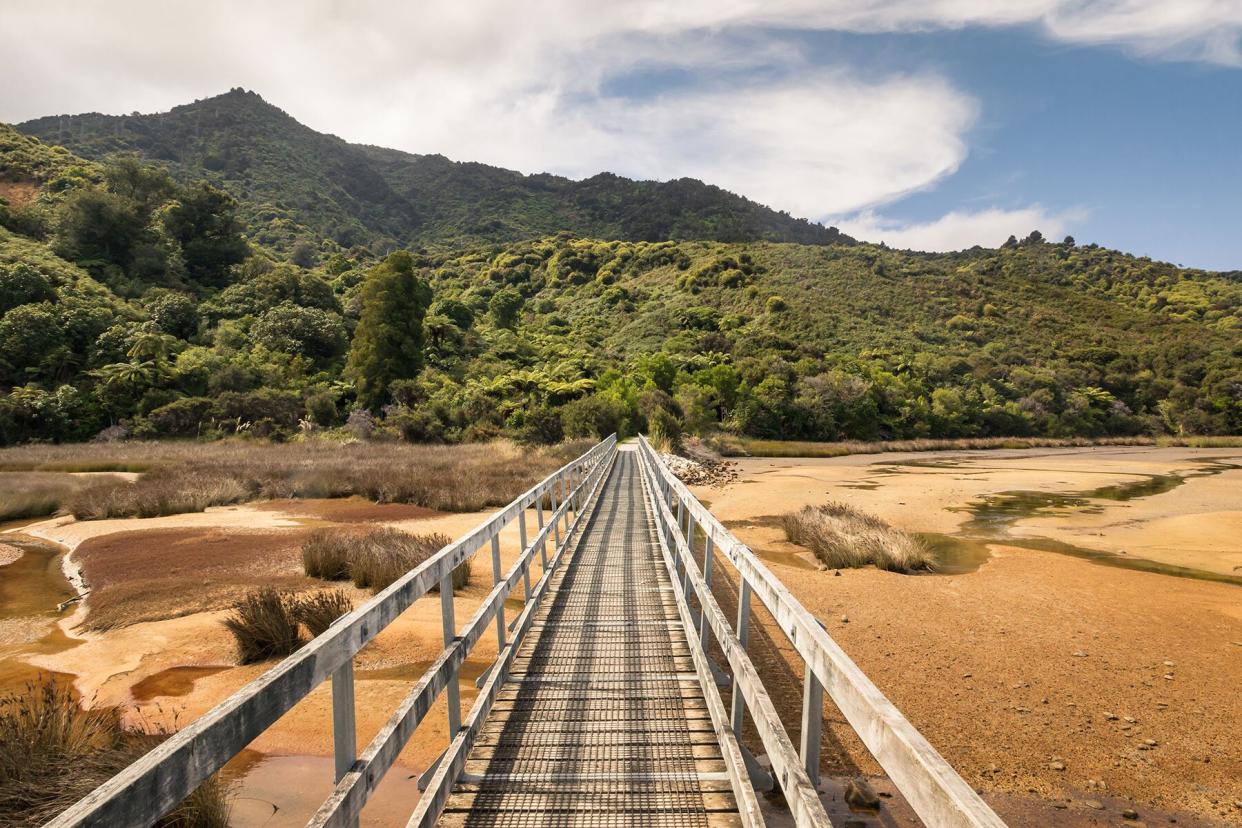
Lake Waikaremoana Track
DesmondD/Getty Images
Lush rainforests, rivers, waterfalls, and ghostly valleys of mist are some of the things that guests can expect to see on the Lake Waikaremoana Track. It has the largest area of native forest on the North Island and is home to nearly every species of native bird, providing a glimpse into the avian culture that once thrived in New Zealand.
The hike mainly follows the shores of the lake and is 28.5-miles long, taking 3 to 4 days to complete. There are also shorter walks and the option to break it up and explore the lake by kayak or canoe.
Getting to New Zealand
New Zealand is opening to travelers from visa waiver countries on May 1. Check airnewzealand.co.nz for flight information.

