100 years of urban sprawl — Is this your city’s future or can planners turn the tide?
Editor’s note: This is one of two stories today about city planning’s victories and mistakes, with enormous impact on the wellbeing of individuals, communities and the natural world.
It was mid-January 1997, the coldest day of the year, when city planners descended on Salt Lake City. They worked in a strange profession, a mixture of architecture, engineering and philosophy.
Forward-thinking Utahns worried about the 1 million new residents projected to live along the Wasatch corridor by 2020, and responded by organizing a group with the hefty task of “preserving Utah’s high quality of life for future generations.”
From Berkeley, Calthorpe Associates. Out of Portland, Fregonese-Calthorpe Associates. The man in common was renowned urban designer Peter Calthorpe. The two teams led a movement called “transit-oriented development.” Some were founding partners of the Congress for the New Urbanism — urban designers, architects and city planners who wholly rejected the “sprawling, anti-urban practices” of the 1900s.
They sought to undo the legacy of “urban renewal” as it was known in San Francisco, Portland and beyond — the often discriminatory war on perceived blight in the urban environment, regularly leading to relocation of lower-income families and dissolution of entire communities.
Related
The planners kicked off “The Utah Quality Growth Public/Private Partnership,” to address the challenge of a rapidly growing population. They joined with local press, government representatives, business leaders and an actor dressed as Brigham Young. His image served as a reminder of Utah’s unique planning heritage.
The collaboration would later go by the catchier “Envision Utah.” Recently, reclining in his San Francisco office, Calthorpe told the Deseret News, “It was truly radical and forward-thinking at the time.” He considers it one of his greatest successes. One result, the $610 million UTA FrontRunner, just turned 15 years old.
“I love working in Salt Lake,” Calthorpe said, “because even when people disagree with each other, they’re really civil about it. And then we’re able to come to really rational conclusions and do the right thing.”

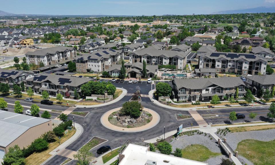
The collaboration was among the country’s first regional vision planning efforts. Calthorpe and his peers have since developed regional plans globally. Daybreak in South Jordan is designed by Calthorpe. So are communities in California, Texas, Louisiana and cities as far away as Beijing.
But new stresses continue to threaten the quality of life in cities everywhere. Skyrocketing housing prices, resource scarcity and failing public transportation are forcing this generation of planners to return to the drawing board, hoping to design a livable future for us all.
How sprawl infected California
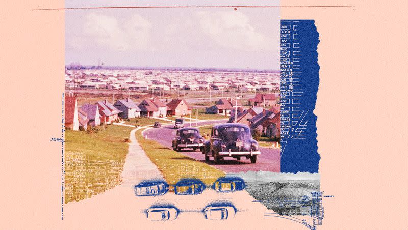
A strange shift happened in California in the later half of the 20th century. In 1950, the census recorded 10.5 million residents, which by 1990 was 29.8 million. The land-rich state supported growth and prosperity, as California workers found themselves with more money than their parents in a postwar economy. GI benefits, Federal Housing Administration loans, and massive interstate building programs from the Eisenhower administration let urbanites buy up single-family houses with big yards.
The promise of affordable single-family homes and steady work prompted the boom, but ironically later starved the region of ability to support future growth.
Many, Calthorpe explained, followed the old real estate saying, “Drive ’til you qualify.” If you can’t afford the house, you drive 10 miles farther to get a cheaper one. “At a certain point, those miles add up to the point where easily 20% of household income is spent on the cars, and then 35% on the mortgage.”
It represented the American dream: a family and a yard and space to play close to nature. Peaceful and pastoral. But it came at the expense of significant dependence on cars and increased environmental impact.
This is sprawl — a complex phenomenon, completely reversing the often-seen rural migrations to more urban areas. Ted Knowlton, former Envision Utah planning director, said sprawl misses four key elements of a healthy community. There’s a lack of town centers. Everything is separate — shopping, jobs, recreation and homes. The streets are not well connected, so it’s hard to walk and bike from place to place. Finally, population density is very low.
Sprawl became a major issue for cities. Suburbs relied on a healthy urban center for jobs, but commuters were not necessarily supporting it with taxes.
The city planner profession was relatively new, as were mounting problems facing population centers like Los Angeles and San Francisco. Automobiles and postwar migration clogged the roads across California. The daily commute into San Francisco was unbearable, the bridges across the bay to Oakland gridlocked. Workers increasingly lived in sprawling suburbs.
A commission report found that a “solution can be reached only through evolving a satisfactory system of mass rapid transit developed on the premise of moving people — not moving cars.”
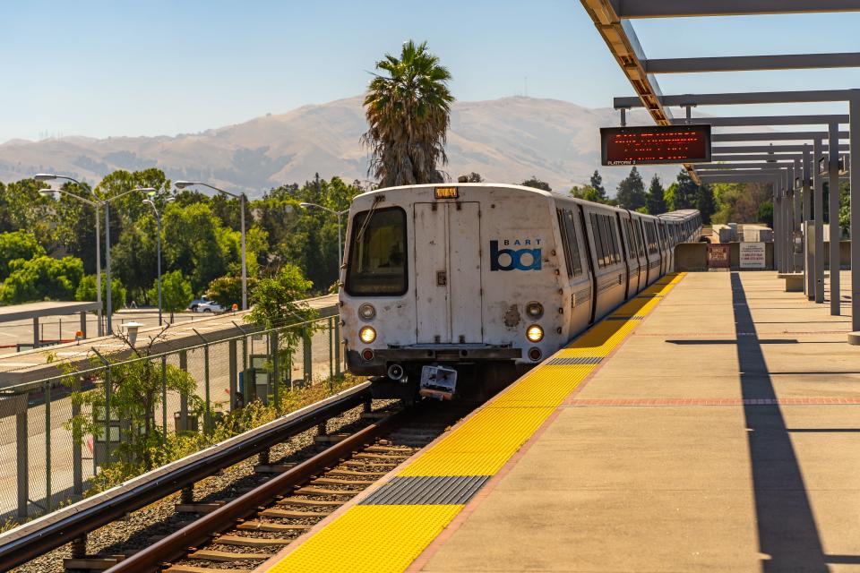
In 1953, Larry Livingston Jr., then a young city planner, became involved with the Bay Area Rapid Transit project, or BART. The proposal, the first modern U.S. rapid transit system, spanned three counties and was projected to cost $996 million.
Initially plagued with funding, legal and construction delays, 15 years after the plan was approved, the first sections were opened to paying passengers.
In 1980, looking back, Livingston found seemingly small planning missteps had big impacts when played out over a decade. His team purposely hadn’t provided service to outlying commercial and industrial areas, and spaced stations far apart to maintain higher speeds.
The result: “Downtown Oakland and Berkeley have gained relatively little strength from rapid transit service” and suburban centers unserved by BART became “focal points of traffic congestion with impacts far beyond their immediate vicinity,” according to an essay Livingston wrote in Planning Magazine. Ten years after BART began service, he concluded the “heavily subsidized transit” allowed affluent white-collar suburbanites to travel to the city for work, while blue-collar workers carried the tax burden with few of the benefits.
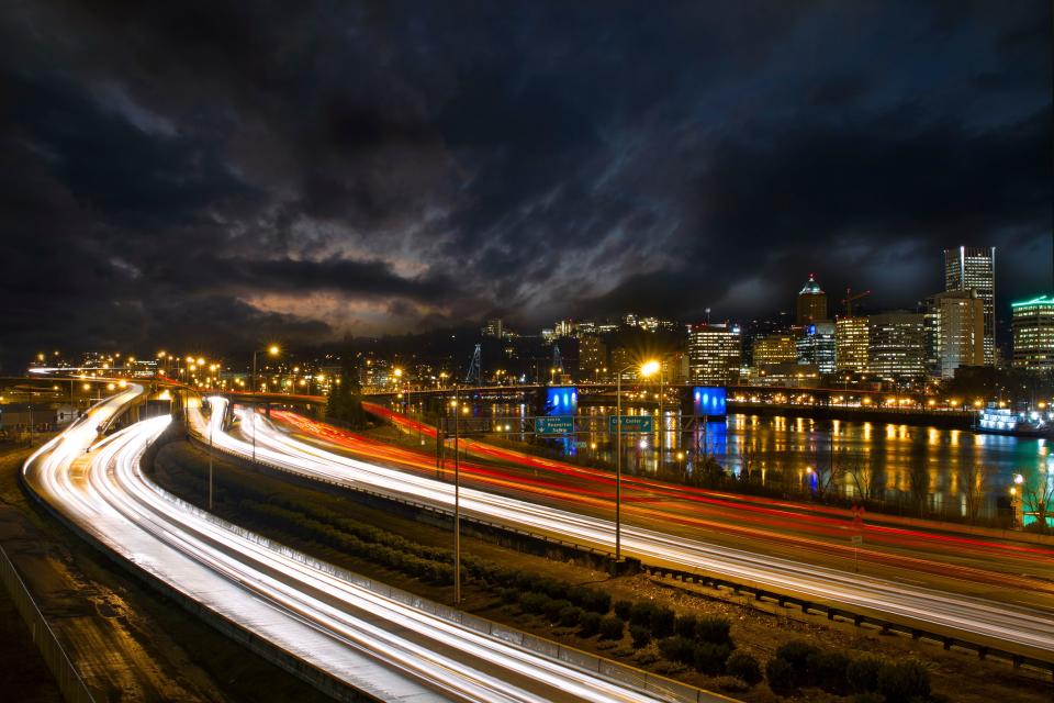
Portland’s fight against urban growth
Portland sits at the crossroads of the Willamette and Columbia rivers. Founded as an agrarian community, the city is hemmed in by the Cascade Range, most notably volcanic Mount Hood. The area grew as industries like logging and shipbuilding supplied the world wars.
Portland’s growth was shaped by a 1943 infrastructure plan designed by controversial New York urban designer Robert Moses. His team inspired construction of numerous bridges and freeways over the next 30 years. The projects were controversial, requiring the demolition of houses and businesses while geographically segregating communities. But something had to ease the city’s traffic, improve air quality and rescue a dying downtown.
By 1970, the region’s population had nearly doubled, but only 38% lived in Portland. Meanwhile, new funding allowed the state to acquire homes in the path of the proposed eight-lane Mount Hood Freeway.
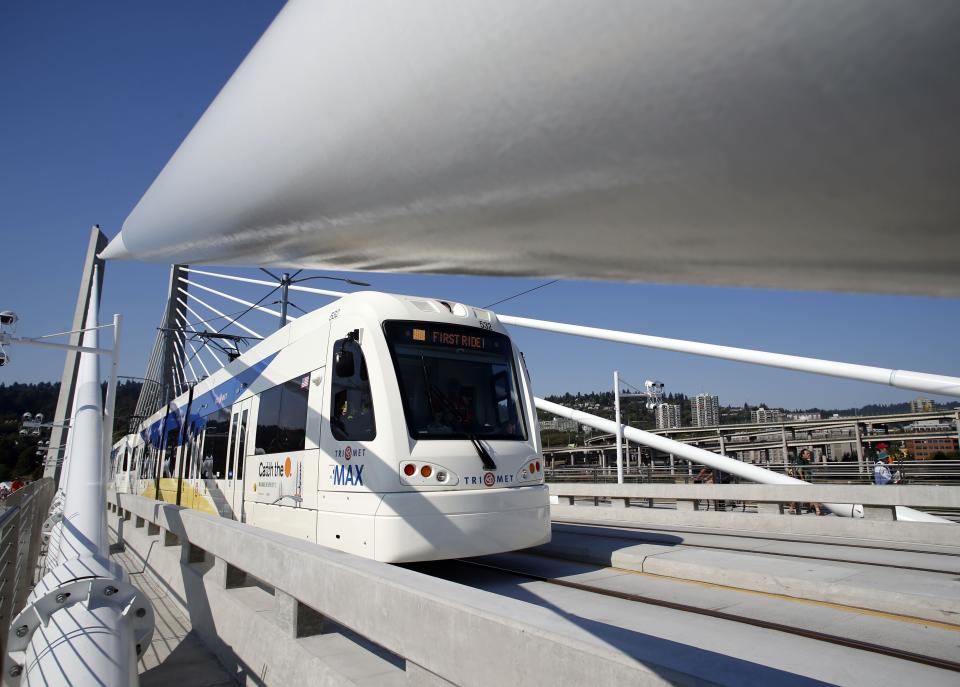
A new class of leaders gained political clout opposing the highway. By 1974 the freeway had been killed. Federal funding, already awarded, was diverted toward smaller projects, including a rapid rail transit system called MAX. Light rail became Portland’s answer to the transportation crisis.
Bob Young, for Willamette Week, wrote that quashing the Mount Hood Freeway “showed that a city could save its neighborhoods, even inner-city neighborhoods, from the ravages of the automobile … it signaled that citizens could stand up to seemingly inevitable social forces if they simply decided to do something about them.”
But sprawl was worsening. And the only viable alternative was to encourage what planners call “infill.” Instead of growing out, the idea is to make an urban area more compact, encouraging walkability, while reducing vehicle miles per resident.
Infill was encouraged through an urban growth boundary “to protect farms and forests from urban sprawl and promote the efficient use of land, public facilities and services inside the boundary.”
The boundary, part of Republican Gov. Tom McCall’s legislation, was historically significant. It created America’s first statewide land-use planning system. And the nation’s first elected regional planning body, Metro, formed in 1978, inherited management of the boundary, which could be expanded when desired.
Still, in the ’80s, Ethan Seltzer, director of the Institute of Portland Metropolitan Studies, wrote that despite the city’s pioneering efforts to mitigate sprawl, “we found ourselves with many of the same dilemmas: increasing traffic congestion, sprawl within the urban growth boundary and an uncertain sense of the future.”
Problems worsened with an influx of tech workers during the dot-com boom. In 1994, Metro convened urban designers and city planners to create one of the nation’s first regional plans, Metro 2040.
Metro planning director John Fregonese and longtime collaborator Calthorpe used untested methods and philosophies of walkable, human-scaled cities. They pioneered new ways of gaining vast community input. They leaned heavily on light rail transit and identified areas where growth should be encouraged.
Per the plan, “The light rail is intended not so much as a replacement for the automobile, but as a device that allows people to inhabit the region as pedestrians.” It was a purposeful shift, planning at the scale of a person.
Residents, however, worried that “planning to accommodate growth would only encourage it to happen.” Many feared the urban growth boundary created affordable housing shortages. But growth was inevitable, as Calthorpe explained. “If you build freeways, you get subdivisions. If you build transit, you get infill.”
After the regional plan was ratified, voters agreed to a $425 million bond to expand light rail. In 1995, a $138 million dollar levy was approved to purchase thousands of acres while improving existing areas.
But Portland, like every city, was fighting a century of sprawling development, lack of funding and an ever-changing political will.
Man plans, God laughs
City planning has seen vast improvements in a relatively short time. In 1980, Livingston was dismayed by the legacy of his generation, claiming partial responsibility for the “sprawl-inducing freeway system … and downtown redevelopment projects that have destroyed the homes of thousands of low-income residents.”
More modern analysis by Access Magazine classifies the continuing legacy of San Francisco’s BART as “one very big achievement, several smaller successes, and many missed opportunities.” Its study found housing along the stations declined significantly, and proximity to transit alone was not enough to encourage redevelopment and higher density.
The conclusion: “The land use benefits from investments in rail transit are not automatic. Rail transit can contribute to positive change, but rarely creates change by itself.”
The urban growth boundary experiment has survived and been expanded about three dozen times, but the planning body has controlled the expansions. They are increasingly popular, mandated or encouraged in a number of other states including Washington, Tennessee, Florida, Maryland and California.
Ted Reid, a current Portland Metro planner, believes it has been effective in supporting infill instead of sprawl. But as housing prices climb, the boundary remains controversial.
Some blame that policy for sprawl. A study by Wendell Cox suggests that it might be accelerating unchecked growth in commuter cities.
Can Utah hold off sprawl?
Utah has faced its own population boom, as the fastest-growing state of the past decade. Envision Utah guided that growth, drawing on the histories of Portland, Denver, Los Angeles and others while focusing on the Greater Wasatch Area, a “10-county area stretching from Brigham City to Nephi, and from Tooele to Park City.”
They engaged more than 18,000 residents in surveys to determine the community’s values and desires for the future, far different than Robert Moses’ Portland team “holed up for two months in a downtown hotel.”
Scott Fregonese worked with his father, John, and Calthorpe to tackle those issues in Portland and Utah, introducing a new generation of planning technology: geographic information systems, improved quantitative analysis and community input data.
The area is working with natural urban growth boundaries. The foothills, the Wasatch and Uinta ranges, the Great Salt Lake, Utah Lake and the international airport act as barriers to sprawl. But they put the region in a bind, limiting transportation options and natural resources.
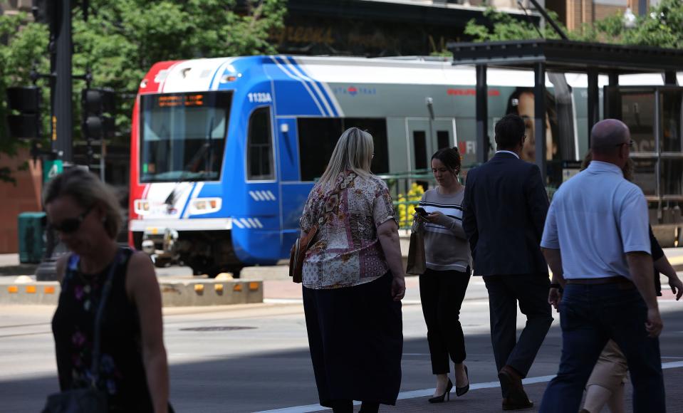
Through that process, the community made it clear there was a real need for public transportation: 88% of residents polled supported expanding the newly installed light rail system.
Fregonese stressed the connection between transportation and land use as a key element in fighting back sprawl. “If you want an area to grow, you become more flexible,” he said. Planners expanded their tool kit: Public-private partnerships, tax abatements, low-income tax credits, regulatory deals and streamlined permitting processes can encourage targeted growth. That is the driving force behind the concept of smart growth. Preventing growth in one place forces it on another.
The history of San Francisco, Portland and Salt Lake City are still being written, with Utah rapid transit as the youngest sprawl-fighting experiment in the group. It may also be the most necessary, as rapid growth has pushed the Greater Wasatch Area and beyond to the brink.
The future of western cities
Ted Knowlton, who worked on Portland’s Metro 2040 and Envision Utah, believes regional planning must encourage “valuable residents to pour their tax dollars back into the city,” and “recognize the unmet needs of communities that were forgotten in the flight to the suburbs.”
“Housing affordability is significantly worse than it has ever been,” Knowlton said, “and we’re trying to figure out how we deal with it as a community.”
Nick Norris, Salt Lake City planning director, told the Deseret News, “Suburban sprawl is probably contributing to a lot of the issues we’re facing as a region.”
Zoning to encourage smart growth is complex. “You can have a super dense place, but it almost doesn’t matter if the people who live there don’t have access to open spaces, clean air and clean water,” Norris said.
Through experimentation, Calthorpe and other New Urbanists believe they have found what makes a great city: Walkable streets, porches instead of garage doors, the shade of tree canopies and multiple convenient transportation options supporting a diversity in housing types and income levels.
But the walkable city of the future will only be for the affluent, at least at first. There are not enough walkable communities, and the developments tend to be newer.
Knowlton believes walkable places don’t have to cost a lot more. Planners say having a transit choice matters.
The cost to purchase, maintain, insure, fuel and park a car start adding up, Norris said. “If they could be cut in half or eliminated, it completely changes a lot of people’s economic situation.”
That means focusing on bike lanes and rail transit in Utah. But across the country, planners are working out new solutions to the housing and resource shortages. Calthorpe has found uses for dying strip malls across California, and helped write policy to make housing development on that land economically viable. His big idea: the Grand Boulevard, introducing transit and walkability to the large arterials cutting through city centers.
Locally, Scott Fregonese is working on general plans in Payson and Lehi and redesigning Thanksgiving Point. Calthorpe led the design of Daybreak’s mixed-use development.
“We do need infill. We do need density that’s affordable, but we also need to marry it to connectivity and transit in bikeways,” Calthorpe said.
City planners are hard at work attempting to predict the future. The unknowns are greater than ever before. The pandemic decimated transit ridership in most cities, but new technology is coming of age to reinvent transportation and construction.
Will workers return to offices or continue working remotely? Will ridesharing and autonomous vehicles play a large part in mobility’s future — and will they make life better or worse?
Regional and local plans must change and adapt to those new realities. If not, our cities will become unsustainable. Congestion will become unbearable, the air unbreathable and the water scarce.
What we know: “Business as usual” is a suboptimal scenario. We have a constant need for visionary engineers, designers and planners to develop creative solutions for the future. “You wouldn’t believe how much work is going into figuring out the housing crisis,” Scott Fregonese said. “I wouldn’t be surprised if there’s another Envision Utah in the next 10 years.”
Though Calthorpe has worked at this for nearly 50 years, his work is not done. “I’m getting old, but I still want to go out and change things for the better,” he said. “I’d be happy to come back to Salt Lake and start a new revolution.”