After 17 days of rain, Western Oregon to enter sunnier, cooler weather pattern
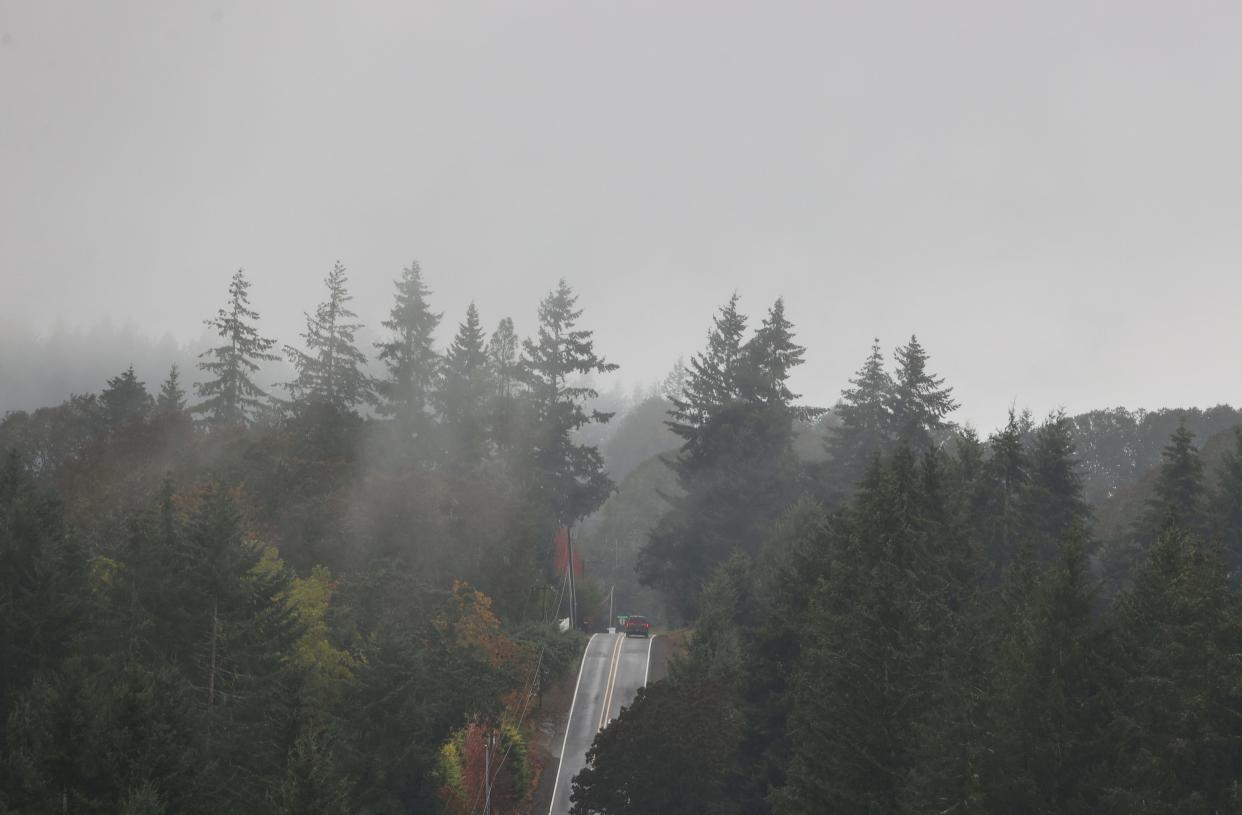
A long stretch of rainy and drizzly weather in Western Oregon will give way to a pattern likely to have more clear skies, cooler temperatures and likely some fog.
Salem and Eugene both saw 17 consecutive days with some level of precipitation but that will begin to change, as a high-pressure ridge will likely turn away most of the Pacific storms over the coming week or so.
“We might see light showers on Saturday, but for the most part we are expecting that high-pressure ridge to build and that’s going to mean drier conditions and clearer skies,” National Weather Service meteorologist Rebecca Muessle said. “It’s a pretty common feature this time of year, especially after the run of rainy days we’ve had.”
The stretch of rainy days doesn’t mean Oregon has been wetter than normal. Statewide, Oregon has seen 91% of normal precipitation.
Since the start of the water year — Oct. 1 — Salem has recorded 18.29 inches of rain, which is below a normal of 20.03. Eugene has been even drier, recording 14.7 inches of rain against a normal of 20.04. Portland is slightly above average with 19.22 inches, compared to 17.66 in a normal year.
“A lot of the weather fronts have been moving across the northern part of Oregon and kind of skirting just above Eugene,” Muessle said.
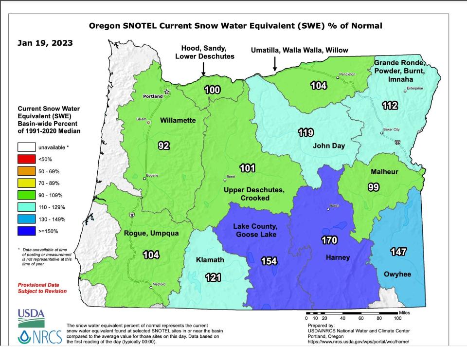
Oregon’s snowpack is slightly above average at 109% of normal, but that’s mostly in eastern and southern Oregon. Snowpack has been declining slightly and east of Salem and Eugene, in the Central Cascades, snowpack is 92% of normal while Mount Hood sits at exactly normal.
“The rate of snowpack accumulation has declined for most sites in the central and northern Oregon Cascades,” said Matt Warbritton, lead hydrologist for the Oregon Data Collection Office.
Medium range forecasts favor cool and dry conditions across most of Oregon, while February has better odds of being cooler and wetter than normal.
Zach Urness has been an outdoors reporter in Oregon for 15 years and is host of the Explore Oregon Podcast. To support his work, subscribe to the Statesman Journal. Urness is the author of “Best Hikes with Kids: Oregon” and “Hiking Southern Oregon.” He can be reached at zurness@StatesmanJournal.com or 503-399-6801. Find him on Twitter at @ZachsORoutdoors.
This article originally appeared on Salem Statesman Journal: Western Oregon still drier than normal after weeks of rain

