25 cm and counting: Southern B.C. wakes up to a blanket of snowfall
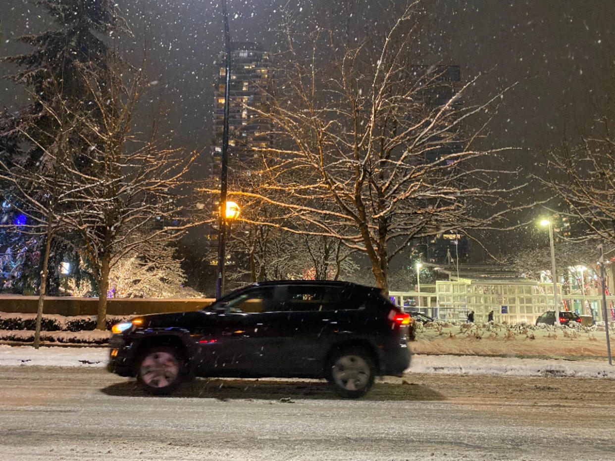
Widespread snowfall on B.C.’s South Coast continues to accumulate Tuesday morning as wintry weather is forecast through the morning hours.
This event comes only a day after Sunday’s blast of snow stranded motorists and caused power outages. As residents recuperate, they’ll now have to contend with a bout of snowfall which will be considerably worse in nature, with widespread alerts in place.
The lower-pressure system responsible for the active weather hit overnight Monday.
“As of 4 am PT, 21 cm of snow was reported at Victoria International Airport and 20 cm of snow at Vancouver International Airport,” says Kelly Sonnenburg, The Weather Network meteorologist. “Snowfall rates of 3-4 cm an hour were falling through the pre-dawn hours of Tuesday across the South Coast.”
SEE ALSO: 90% of Canadians will see a white Christmas, are you included?
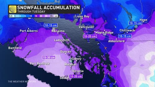
Environment and Climate Change Canada (ECCC) has issued a number of snowfall and winter storm warnings across the Lower Mainland and Vancouver Island.
Content shared of social media show how much snow has fallen during the early morning hours.
⛷️ Skiing down Como Lake Avenue in Coquitlam. I’ve seen it all! #BCStorm #BCwx @CityNewsTraffic @CityNewsVAN #Vancouver pic.twitter.com/tLu3fOEvRT
— Chad Harris (@ChadHarrisTV) December 20, 2022
“Consider postponing non-essential travel until conditions improve,” states ECCC. “Surfaces such as highways, roads, walkways and parking lots may become difficult to navigate due to accumulating snow."
Here's a glimpse of the #snowfall accumulation in #Burnaby.
1st pic 3:15 AM
2nd pic: 1:40 AM
3rd pic: 11:20 PM last night#ShareYourWeather#snow #Vancouver #Snowmageddon https://t.co/CzQE2w3fuc pic.twitter.com/O47qiGX97G— Shannon McKenney (@ShannonMcKenney) December 20, 2022
“High snowfall rates will continue into the early morning hours before snowfall eases through the late morning and into the early afternoon,” adds Sonnenburg.
For most parts, snowfall should ease by the afternoon hours with only isolated to scattered flurries lingering for parts of Vancouver Island through the remainder of the day.
WATCH: Snowiest December day since 2008 for Vancouver Island
A SHORT BREAK BEFORE PRECIPITATION PICKS UP FOR HOLIDAYS
Wednesday will provide a welcomed break from the snow, before rounds of precipitation move in for the end of the week and into the holiday weekend. A source of moisture originating in the south Pacific will lead to rising freezing levels across the South Coast and a messy mix of precipitation.
Forecasters are expecting snowfall to start late Thursday into Friday before transitioning into rain for the Lower Mainland. There is also a risk for freezing rain heading into the weekend.
WATCH: Be prepared for a messy commute Vancouver as snow continues to accumulate
Check back for the latest on these multiple wintry threats across B.C.

