3.5 earthquake registered near Desert Hot Springs
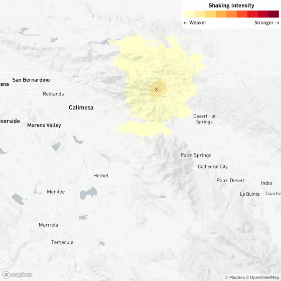
A magnitude 3.5 earthquake was reported at 11:19 p.m. Monday seven miles from Desert Hot Springs, according to the U.S. Geological Survey.
The earthquake occurred nine miles from Big Bear City, nine miles from Banning, 10 miles from Palm Springs and 13 miles from Yucca Valley.
In the past 10 days, there has been one earthquake of magnitude 3.0 or greater centered nearby.
An average of 234 earthquakes with magnitudes between 3.0 and 4.0 occur per year in California and Nevada, according to a recent three-year data sample.
The earthquake occurred at a depth of 3.9 miles. Did you feel this earthquake? Consider reporting what you felt to the USGS.
Even if you didn't feel this small earthquake, you never know when the Big One is going to strike. Ready yourself by following our five-step earthquake preparedness guide and building your own emergency kit.
This story was automatically generated by Quakebot, a computer application that monitors the latest earthquakes detected by the USGS. A Times editor reviewed the post before it was published. If you're interested in learning more about the system, visit our list of frequently asked questions.
This story originally appeared in Los Angeles Times.
