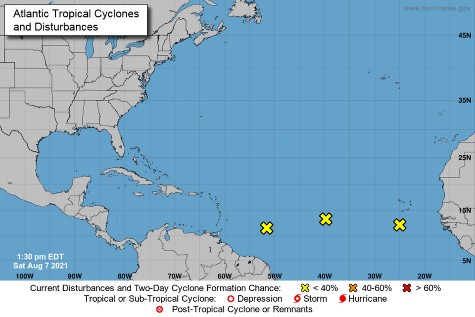
Three disturbances are in the Atlantic, and one could be a tropical depression mid-week
Three systems in the Atlantic have the attention of forecasters at the National Hurricane Center. One of them has the potential to develop into a tropical depression by mid-week.
Here’s what we know from forecaster Daniel Brown’s 2 p.m. Saturday advisory.
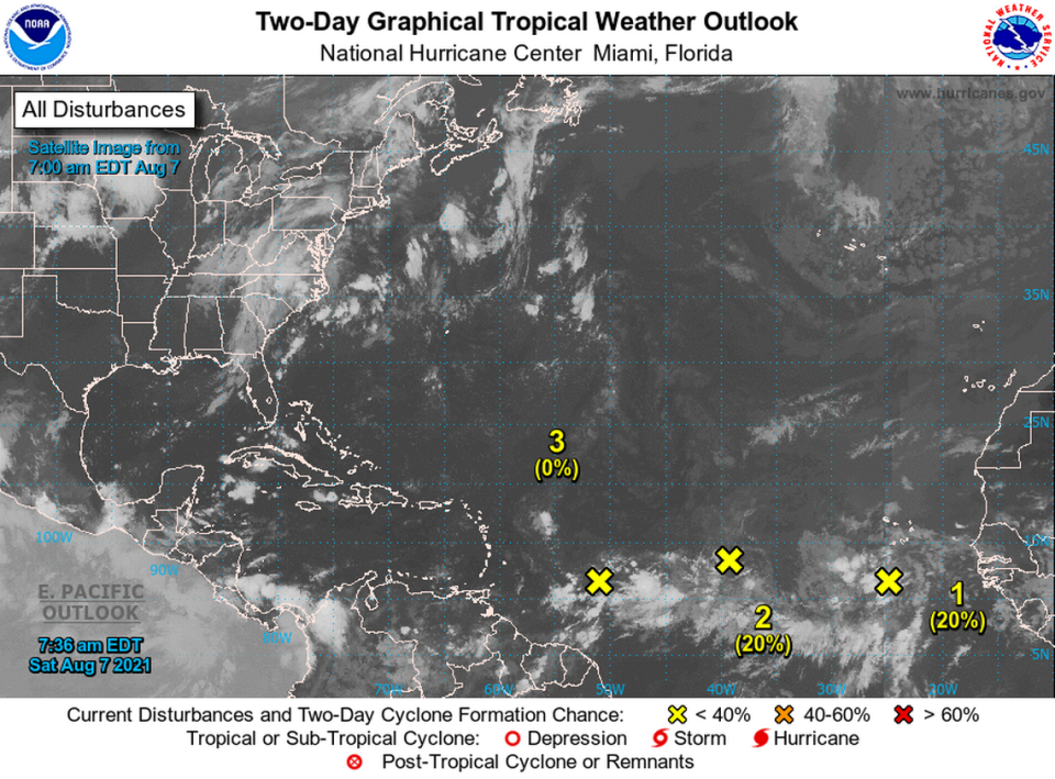
Disturbance 1
This broad area of low pressure was about 100 miles or so south of the southwesternmost Cabo Verde Islands and the disorganized showers and thunderstorms of the morning had grown more solid. On Friday afternoon, its chances of development over a five-day period were 60%. That’s fallen off by half. But these things can evolve.
“Although environmental conditions are only marginally conducive, some slow development of this system is possible during the next few days while the system moves west-northwestward to westward across the eastern and central tropical Atlantic at 10 to 15 mph,” Brown’s advisory said.
“Regardless of development, locally heavy rainfall and gusty winds are possible over portions of the southernmost Cabo Verde Islands tonight and Sunday,* the center added.
As of Saturday afternoon, put this one at a 30% chance of formation over the next 48 hours and 30% over five days.
Disturbance 2
“Small but well-defined,” Brown still calls No. 2. This area of low pressure in the eastern Atlantic was about 1,000 miles west of the Cabo Verde Islands and had some showers over the waters. As it drifts toward the west-southwest or west over the weekend it could pick up a little tempo when it moves west-northwest over the central Atlantic by mid-week.
But that’s when environmental conditions are expected to become a little more favorable for gradual development over the next several days. This second disturbance could become a tropical depression by the middle of the week, the center said in its 2 p.m. advisory. The system is forecast to drift toward the west-southwest or west.
The hurricane center calls it at 20% formation chance over two days, but the formation chance has risen from 30% at the 8 a.m. advisory to 40% at the 2 p.m. update over the next five days.
Disturbance 3
A tropical wave with the least odds for formation. But, you know. We’re in the heat of the season so let’s pay heed.
This wave was over the west-central tropical Atlantic and, as of Saturday afternoon was producing limited shower activity. “Significant development of this system is not anticipated as it moves west-northwestward across the Lesser Antilles and eastern Caribbean Sea during the early to middle part of next week,” Brown’s forecast said.
No change since the morning advisory. Formation chance through 48 hours: Near zero. Formation chance through five days: 10%.
The tropical Atlantic is getting a little bit more active during this first week of August. However, none of the systems we are watching are showing any signs of imminent development. Continue to monitor https://t.co/tW4KeFW0gB for the latest on these weather systems. pic.twitter.com/AOFPbM62bC
— National Hurricane Center (@NHC_Atlantic) August 7, 2021