3 Kentucky counties could see ‘1-in-a-100-year storms’ every decade, new research shows
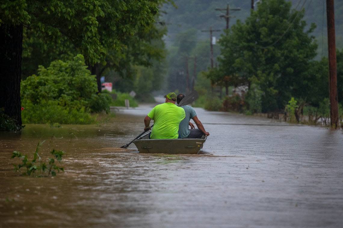
Storms capable of the torrential rainfall that swept away homes, businesses and lives in Eastern Kentucky last year are expected to occur much more frequently given the effects of climate change, new research suggests.
A recent study from the nonprofit First Street Foundation used a peer-reviewed model of precipitation estimates, finding the U.S. government is significantly underestimating the intensity and frequency of extreme precipitation in the changing climate. Indeed, roughly a fifth of the country can now expect a “1-in-100-year storm” every 25 years, the analysis found, as reported by The Washington Post.
Even more troubling, in about 20 counties home to more than 1 million people, these intense rain events could happen on average once a decade, if not more often, according to the Post. The counties include parts of Pennsylvania, North Carolina, Indiana and Kentucky.
In Kentucky, there are three such counties in the northern part of the state. Here’s a look at what this research means and how climate change influences flood risk more broadly, with analysis from Kentucky’s leading climatologist.
Which parts of Kentucky are most at risk?
Eastern Kentucky has a history of devastating floods, compounded not just by its hilly and mountainous topography, but by the rise of surface mining in the region. That activity has stripped from mountainsides trees and vegetation that previously stabilized soils and eased gradual drainage.
In its analysis and summary of the historic floods in the region last July, the National Weather Service noted waves of thunderstorms moving over Eastern Kentucky at times dumped more than 4 inches of rain in a single hour.
Images of devastated, eastern rural communities might be the first to come to your mind when you think of flood disasters in the state, but according to Kentucky State Climatologist Dr. Jerald Brotzge, many of us may be underestimating the risk outside of Eastern Kentucky.
The recent research from the First Street Foundation seems to bear that out, Brotzge said in an interview with the Herald-Leader.
As noted by the Post, the federal government’s official precipitation estimates in the form of the National Oceanic and Atmospheric Administration’s Atlas 14 do not yet account for the influence of climate change. Furthermore, they aren’t likely to for several more years, when Atlas 15 is completed.
When comparing the findings of the First Street Foundation to the National Oceanic and Atmospheric Administration’s official precipitation estimates for Eastern Kentucky, Brotzge finds Atlas 14 pretty closely mirrors the estimates shared by the more recent First Street study. However, NOAA’s precipitation estimates outside of Appalachia seem less accurate when compared.
“It’s really more Central Kentucky that’s underestimated the most,” Brotzge said.
The three Kentucky counties reported by the Post to be the most at risk of once-in-a-century storms on average every 10 years include:
Carroll County (estimated once every nine years)
Trimble County (every 10 years)
Oldham County (every nine years)
More than 86,000 people live in those three counties alone, U.S. Census Bureau figures show.
Additionally, in Floyd County, Ind., just across the river from Louisville, the First Street study estimates a once-in-a-century rain event could occur every seven years.
Which other Kentucky counties are at increased risk?
According to the Post, other Kentucky counties with an expected increase in extreme weather include:
Jefferson County, with a climate-adjusted 4.4 inches of rain an hour at an average 12-year interval
Boone County, which could see a storm bringing a climate-adjusted 4 inches of rain per hour once every 17 years
Fayette County, with a climate-adjusted 4 inches of rain per hour once about every 19 years
Jessamine County, with a storm bringing 4 inches of rain per hour about once every 18 years
Bourbon County, with a storm bringing 3.9 inches if rain per hour once every 24 years
What does all this mean for Kentucky?
Brotzge stressed precipitation estimates from NOAA’s Atlas 14 aren’t used for real-time forecasting from meteorologists, but rather as a guide for engineers.
While this new research from the First Street Foundation will not affect the accuracy of weather reports, Brotzge said it should hold significance for engineers, especially those who design flood-mitigation infrastructure. When the government develops and issues more accurate and up-to-date precipitation estimates, engineers will likely follow along and update their own design practices, Brotzge said.
Kentucky hasn’t had fresh Atlas 14 estimates since 2004, the climatologist added.
Homeowners and those shopping for a new home should check into whether the property is flood prone, and Brotzge recommends diversifying and drawing information from as many sources as possible. Flood zone maps made available online by Kentucky’s Energy and Environment Cabinet are one such resource.
You should also check into your eligibility to purchase insurance through the National Flood Insurance Program.
Do you have a question about weather or climate change in Kentucky for our service journalism team? We’d like to hear from you. Fill out our Know Your Kentucky form or email ask@herald-leader.com.

