For 40 years Prudence Island has quietly served as the center of coastal research in RI
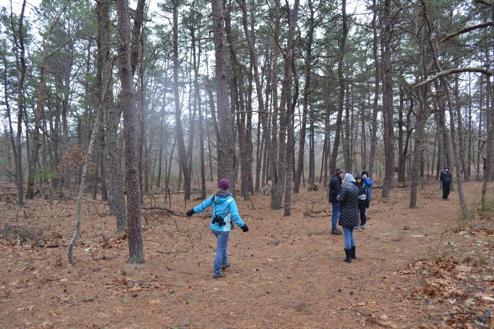
PORTSMOUTH – A light drizzle pattered into the sandy pine barrens of Prudence Island, one of the only places in the state where prickly pear cactus grows indigenously. Prudence is one of those places where a short mile of trail can cross three or four distinct types of habitat, seemingly shifting within a few strides down a walking trail from oak forest densely carpeted with greenbrier to sandy pine barrens interspersed with blueberry shrubs and reindeer lichen to coastal marshes filled with eelgrass and seabirds. In other words, it is the perfect place for scientists to set up shop.
Perhaps that is why Prudence Island since 1980 has quietly hosted the Narragansett Bay National Estuarine Research Reserve, one of a network of 30 coastal sites designated to protect and study estuarine systems across the country. Established through the Coastal Zone Management Act of 1972, the reserves represent a partnership program between NOAA and coastal states, with NOAA providing funding and each site being managed on a daily basis by a lead state agency or university.
In the case of the reserve on Prudence, NOAA provides about 70% of the funding and RIDEM is the state partner. The site is managed by the Audubon Society of Rhode Island in partnership with RIDEM. The reserve covers 4,332 acres spread across Prudence, Patience, Hope and Dyer islands. Patience, Hope and Dyer are uninhabited, and approximately 60% of Prudence Island is included in the reserve's boundaries.
What does the Narragansett Bay National Estuarine Research Reserve do?
Designated to protect coastal and estuarine habitats, the reserve, which is the only one of its kind in Rhode Island, serves as a living laboratory to promote long-term research & monitoring, place-based education, stewardship, and training on the challenges facing vital coastal habitats.
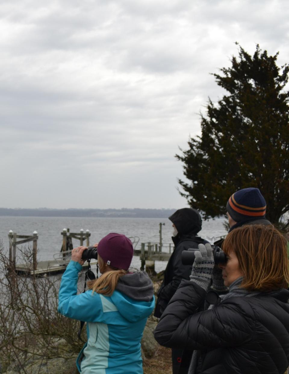
One key area of study is the System Wide Monitoring Program (SWMP, pronounced “swamp”), which the NBNERR has been participating in for over 15 years to collect and document data on the short-term variability, long-term changes and effects of human activities including climate change on estuarine waters and habitats. The data can be accessed at www.nerrsdata.org and www.nbnerr.org. Notably, Education Coordinator Maureen Dewire mentioned on a recent educational tour attended by The Daily News that data shows the northern end of Prudence will become its own separate island “sooner rather than later” due to sea level rise.
Habitats within the reserve include salt marsh, eelgrass beds, rocky intertidal zone, pine barren, deciduous forest and coastal meadow. Hope Island is also a rookery for colonial nesting wading birds. Data monitoring stations located at Nag’s Creek and Potter’s Cove provide updates on a variety of water and air quality metrics every 10 minutes.
The Narragansett Bay National Estuarine Research Reserve on Prudence Island provides educational programming for a variety of Rhode Islanders
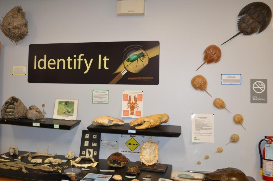
Education is one of the core components of the Reserve. Dewire, who has worked for the NBNERR since 2011, leads unique hands-on experiences for all ages including K-12 students, educators, scout groups and the general public. Activities include salt marsh and shoreline exploration, invasive species monitoring, water quality testing, birding and seal watching, with a good bit of historical information and expert tips about local birds, animals and plants thrown in the mix.
The reserve partners with many local organizations to offer education programs on Prudence Island, including Big Brothers Big Sisters of Rhode Island (one of Maureen’s favorites, especially as many of the kids who come with this program are experiencing boating, hiking, and even seeing Narragansett Bay for the first time), Girl Scouts of Southeastern New England, and ENRICHri.
Educators can also benefit from the reserve’s annual Teachers on the Estuary professional development opportunity, a free multi-day summer workshop focused on estuaries and the impacts of climate change. Anybody interested in bringing a group for a beautiful and educational day on Prudence Island can contact Maureen Dewire Maureen.dewire@dem.ri.gov.
What is an estuary?
According to the NERR website, an estuary is an ecosystem, comprising both the biological and physical environment, that has developed in a region where rivers meet the sea and fresh-flowing river water mingles with tidal salt water to become brackish, or partly salty. The website adds however that several types of wholly freshwater ecosystems have similar characteristics to traditional brackish estuaries, and the NERR system includes at least one freshwater site on Lake Superior in Wisconsin.
This article originally appeared on Newport Daily News: Prudence Island home of Narragansett Bay National Estuarine Research Reserve

