5 Oregon counties in state of emergency after Dec. flooding, mudslides

- Oops!Something went wrong.Please try again later.
PORTLAND, Ore. (KOIN) – Oregon Gov. Tina Kotek declared a state of emergency in five counties to repair roads that were hammered with flooding and mudslides during an atmospheric river in December.
The state of emergency, declared Jan. 5, covers Coos, Curry, Douglas, Jackson, and Tillamook counties to speed up road recovery efforts after heavy rain from Dec. 1-12 led to landslides, erosion, and “critical transportation failures,” the governor’s office said.
The state of emergency — under Executive Order 24-01, directs the Oregon Department of Transportation to provide assistance and look for federal resources to repair and reconstruct damage to federal highways.
NTSB: Warning lights came on 3 times on Alaska Air
“This emergency declaration will give ODOT the ability to seek federal resources to aid in the long-term recovery effort,” Kotek said. “I am grateful to the local leaders, service providers, and state agency personnel who partnered in quickly assessing the damage and providing immediate aid for community members left vulnerable by these storms.”
The emergency declaration comes after a damage assessment found the counties were eligible for federal aid, Kotek’s office explained.
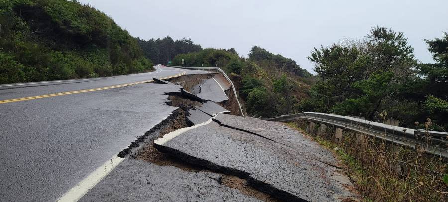
Because of the storm, parts of Highway 101 and Highway 26 were temporarily shut down and two Tillamook County roads — Miami Foley and Sandlake — collapsed. The governor’s office says the counties also saw mudslides and debris flows.
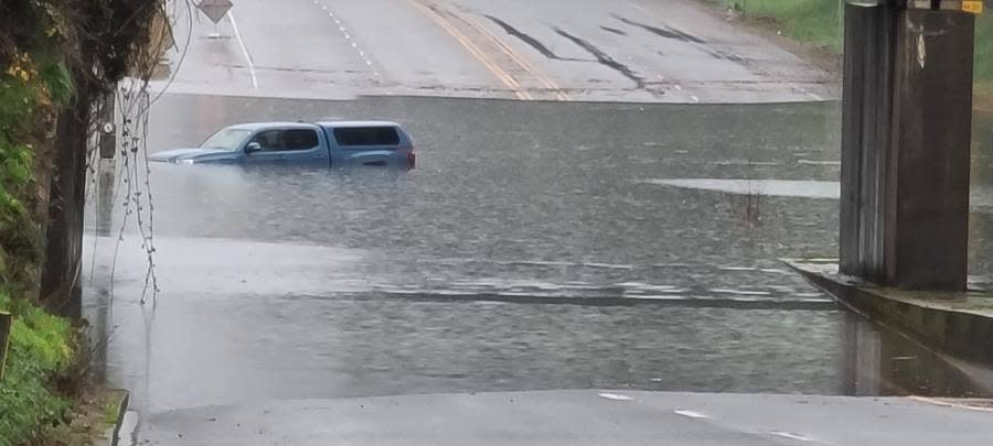
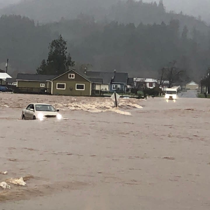
The scene of the slide. (Photo courtesy of Tillamook County resident Jon Laucks) The location of the new bridge on Miami Foley Road before and after the project was completed in 10 days. (Tillamook County) The “High Water Mama” mannequin has become a local landmark in Pacific City, where residents use the piece to gauge the height of the Nestucca River. Photos show that the Nestucca River swelled to nearly 6 feet during the storm. (Photos by Tillamook County resident Aimee O’Will) Photos of flooding seen around Tillamook County from the atmospheric river. (Photo provided by Laucks) A driver in Tillamook was rescued from the same flooded-out car twice on the same day after they attempted to save their car from rising floodwaters hours after their initial rescue. (Tillamook County Sheriff’s Office)
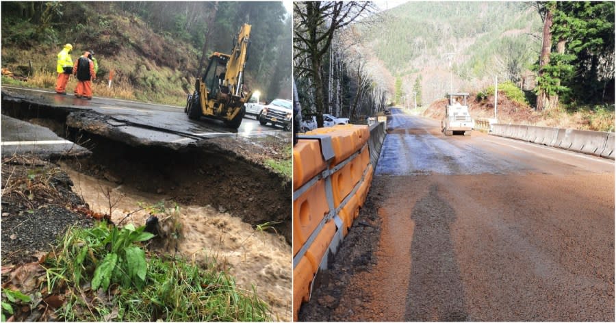

Tillamook County built a bridge in 10 days in order to reopen Miami Foley Road after the atmospheric river washed away a driveway-sized chunk on Dec. 5.
The storm brought Tillamook County its highest flood levels since 2017 and caused at least $2.5 million in damages to local roads.
Door plug, cell phones from Alaska Air 1282 found
Because Miami Foley Road serves as the only direct detour between Garibaldi and Mohler when Highway 101 is closed, the county made the project a major priority, officials told KOIN 6 News. The cost of the construction, completed by HP Civil Inc. and Mcgee Engineering Inc., cost the county a total of $690,203.
The bridge is open to vehicles. However, a few finishing touches, like the installation of permanent guardrails, are scheduled to be completed in the summer of 2024.
For the latest news, weather, sports, and streaming video, head to KOIN.com.

