5 summer hikes: Beat the Asheville heat in the cool WNC mountains
ASHEVILLE – How lucky are we in Western North Carolina? When temps are in the upper 80s, and it’s a long July 4 weekend and we’ve got kids and teens and grownups sitting around complaining about the heat, we can cure that real quick.
In about 30 minutes or less from the city center, the mountains rise sharply out of the valley, some to the highest heights in the Eastern United States, providing a summer hiking wonderland of cooler temperatures, refreshing streams and waterfalls and soul-cleansing views.
The Blue Ridge Parkway, the Great Smoky Mountains National Park and the Pisgah National Forest all have high-altitude options, from easy to strenuous, for just about every hiking ability.
RELATED: Beautiful and dangerous: Can waterfall deaths be stopped?
RELATED: Find your perfect hiking trail in Western North Carolina
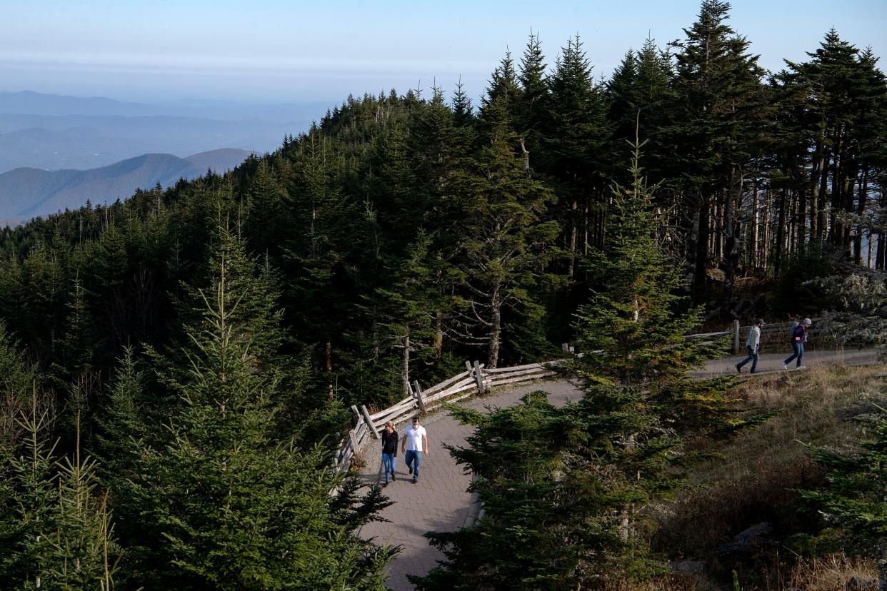
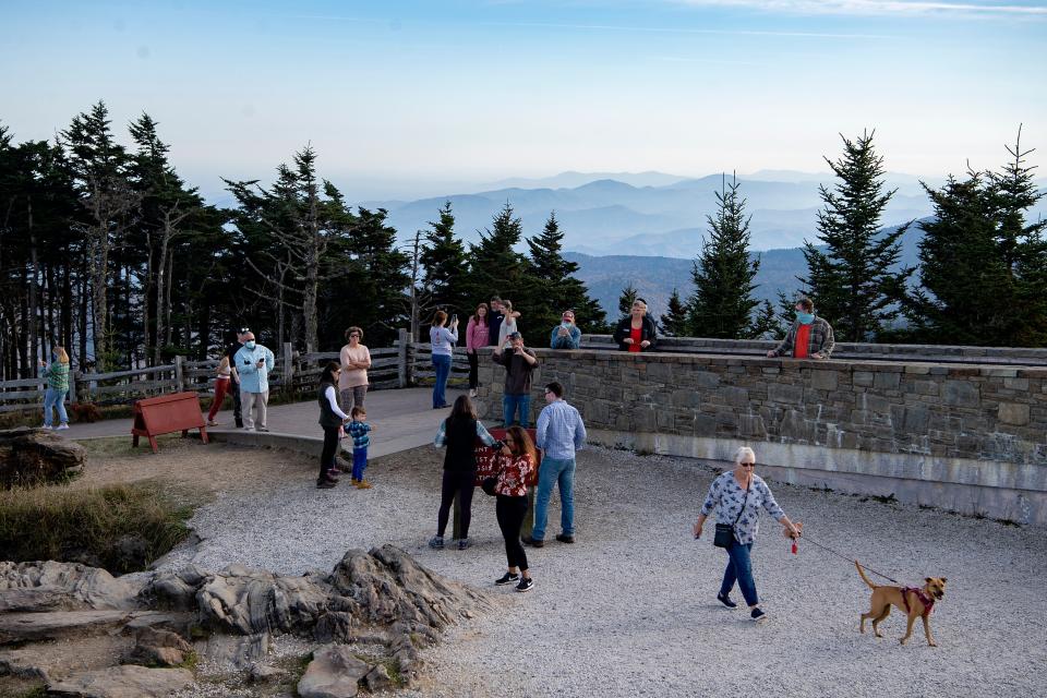
For instance, Mount Mitchell, the granddaddy at 6,684 feet in elevation – three times higher than sea level as Asheville – has great trails. The climate in the park, which sits off the parkway, about an hour’s drive north of Asheville, is more like Canada than the Southern Appalachians, with temperatures usually 10-15 degrees cooler than in Asheville, and much windier.
While the summit can be overrun by tourists on many clear summer days, another section on the parkway is always less crowded, though no less magnificent.
The Richland Balsam Trail toward the parkway’s southern end is a lush forest trail that climbs to 6,410 feet in elevation.
But the loop trail is only 1.5 miles round trip, gaining less than 400 feet in elevation, so doable for most hikers, even if at a slow pace, said Greg Mitchell, parkway education ranger.
“A lot of people don’t know about this trail. They pass it by on their way to Richland Balsam Overlook because that’s the highest point on the parkway, but it’s just an overlook,” Mitchell said.
“Once you get to the top of the trail you’re in a beautiful spruce fir forest. It’s nice, cool and so clean smelling. There are sections that can be strenuous, but there are little clearings along the way with benches to stop and rest.”
RELATED: Great Smokies trail to Mount LeConte closed due to hazardous conditions
Even if you are heading up high, it is summer, so Mitchell reminds hikers to always bring plenty of water and food, sturdy hiking shoes (no flip-flops or sandals), insect repellent, and extra layers of clothing, including a rain jacket for the ever-temperamental mountain weather.
“Be careful on trails because there has been so much rain, in some spots it might be muddy and slick spots,” he said. “And always tell someone where you’re going and when you plan to return.”
6 recommended summer hikes
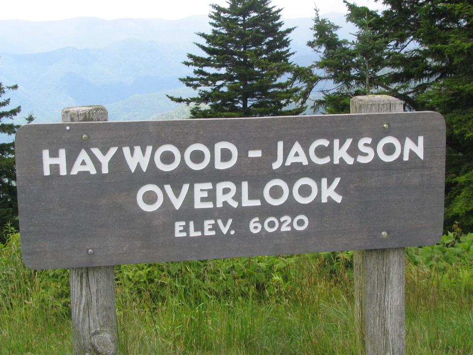
Richland Balsam Trail
Where: Milepost 431 on the Blue Ridge Parkway, 431 at the Haywood-Jackson Overlook, a quarter mile north of the Richland Balsam Overlook, and about 50 miles southwest of Asheville.
Distance/difficulty: 1.5 miles round trip/moderate.
Highlights: Parkway rangers will lead a hike on this trail starting at 10 a.m. July 5, called “A Frolic through the Frasers." Observe the forest’s cycle of life while exploring an area hit by the woolly adelgid and see how the local tree life has been affected by this invasive pest.
Or go any time on your own for the cool breezes and views. There is a picnic table in the parking area. Waterrock Knob, another high-elevation hiking area with scenic picnic area and visitor center, is 20 miles farther south, at MP 451.
Information: Call the parkway Visitor Center at 828-298-5330, Ext. 304.
Mount Mitchell
Where: Mount Mitchell State Park, N.C. 128 at Milepost 355 on the Blue Ridge Parkway about 30 miles northeast of Asheville.
Distance/Difficulty: There are several trails, ranging from easy to strenuous. The Balsam Nature Trail near the summit is a .75-mile loop suitable for children. The 4-mile round trip Old Mitchell Trail starts at the park office and leads to the summit before the return to the office.
Highlight: The 6,684-foot summit is the highest peak east of the Mississippi and on a clear days has 360-degree views. The summit also has an accessible ramp.
Information: Call the state park at 828-675-4611 or visit the NCparks.gov website.
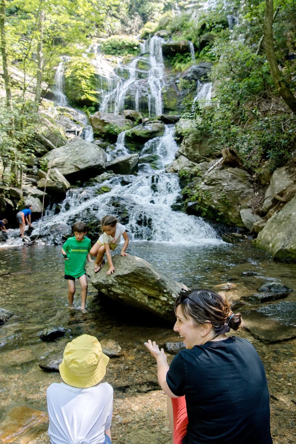
Crabtree Falls Hike
Where: Park at Milepost 339.5 near Spruce Pine on the Blue Ridge Parkway, about 40 miles northeast of Asheville.
Distance/difficulty: About 3 miles round trip, considered strenuous with 500 feet of elevation gain.
Highlights: Crabtree Falls is 60 feet high and is considered to be one of the prettiest waterfalls on the parkway. Since the only way to see it is by a heart-pumping hike, the waterfall views can feel even more satisfying. Crabtree Falls Campground is nearby, with tent and RV sites.
Information: Call the Crabtree Falls Campground at 675-5444. For automated road and weather conditions on the parkway, call 828-298-0398 or visit www.nps.gov/blri.
Mount Cammerer Lookout Tower
Where: Great Smoky Mountains National Park. Just over the border into Tennessee on I-40, from the U.S. 321 and Tennessee Highway 32 junction in Cosby, start at the Cosby Campground.
Distance/difficulty: The shortest hike to the lookout tower is 11 miles round trip, with 3,000 feet of elevation gain. Strenuous.
Highlights: Get some history along with your views. Take the Low Gap Trail to the Appalachian Trail to the Mount Cammerer Trail and lookout, a restored 1930s fire tower with dazzling panoramic views.
Information: Call the Great Smokies at 865-436-1200 or visit www.nps.gov/grsm.
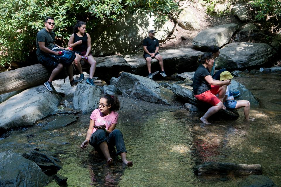
Laurel River
Where: Hot Springs area of Pisgah National Forest at intersection of U.S. 25/70 and N.C. 208.
Distance/difficulty: 7 miles out-and-back along Big Laurel Creek to confluence with French Broad River.
Highlights: Go as far as you like and turn around at any time. Plenty of places along the whitewater river for dipping in and cooling off, as well as large rocks to spread out a picnic. Easy.
Information: Call the Appalachian Ranger District Office at 828-689-9694.

Help the Asheville Citizen Times continue to provide in-depth reporting like this. Find our latest subscription options and special offers here.
This article originally appeared on Asheville Citizen Times: Blue Ridge Parkway, Pisgah National Forest, Great Smokies offer cool hikes

