50 MPH winds tracked through Michigan, gusts expected to pick back up Friday afternoon
NORTHERN MICHIGAN — Throughout Wednesday, high-speed winds took over the state of Michigan.
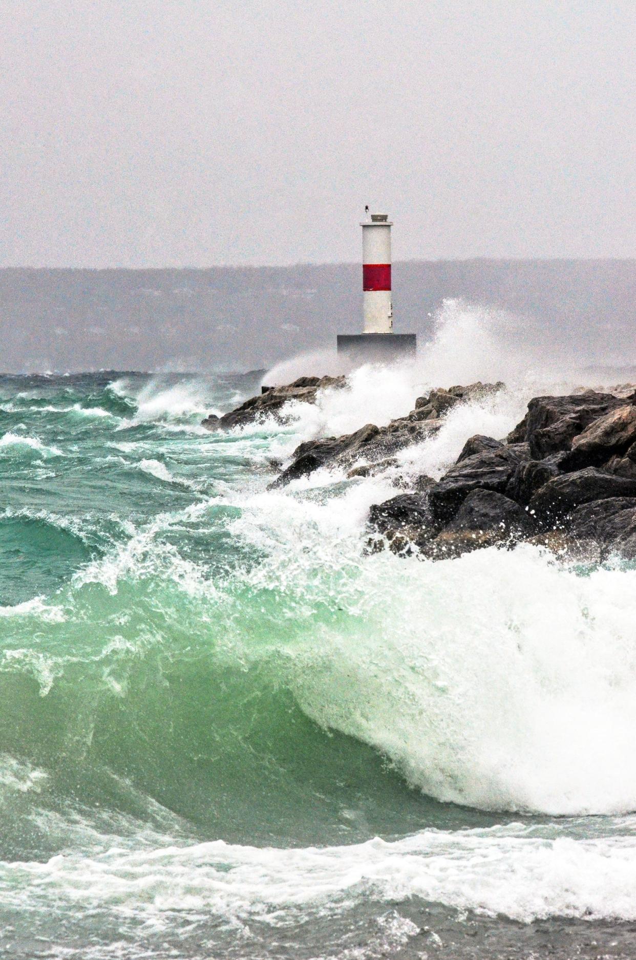
Gaylord National Weather Service meteorologist Sabrina Jauernic said Leelanau County and Sault Ste. Marie received the worst of Wednesday’s wind gusts, which reached speeds between 50-53 miles per hour.
“It looks like some of those winds, as with the wind system, really occurred along the coastlines, especially along Lake Michigan and then across the Eastern Upper (Peninsula),” she said.
The Harbor Springs community Christmas tree was blown down Wednesday afternoon. The tree was back up by 4 p.m. after falling a little before 1:30 p.m.
“Amazingly, no one was hurt and there was no damage as the tree fell into the street,” said Bonnie Kulp, executive director for the Harbor Springs Chamber of Commerce, in a newsletter. “It is a bit shorter, but still ever so beautiful.”
Kulp told the Petoskey News-Review that the electric department and department of public works were on the scene to get the tree back up in minutes and were restringing the lights Thursday morning.
More:Northern Michigan city featured on Hallmark Channel's 'Christmas Cam'
On Wednesday, the Mackinac Bridge Authority also restricted access to the bridge by only allowing passenger cars and vans, as well as empty pickup trucks, due to the high winds.
Windy conditions (20-34mph) at the #MackinacBridge could affect high-profile vehicles (pickup trucks w/campers, motor homes, vehicles pulling trailers, enclosed semi-truck trailers). Reduce speed to 20mph max, turn on 4-way flashers & use outside lane
— The Mackinac Bridge (@mackinacbridge) December 1, 2022
As of Thursday morning, the high wind warning continued and noted that trucks with campers, motor homes, vehicles pulling trailers and enclosed semi-truck trailers are more vulnerable to high-speed winds. High-profile vehicles required escorts and drivers were instructed to slow speeds to 20 miles per hour, drive with their hazard lights on, and utilize the outer lanes.
Updates on conditions can be found at mackinacbridge.org/fares-traffic/conditions.
While the worst of Wednesday’s winds have passed, Jauernic said some strong winds will pick back up Friday afternoon.
While the coasts are going to get the worst of the winds this weekend, inland areas can expect strong gusts as well, she said.
As the winds pick up, she said there will be more concerns about visibility while driving this weekend. Friday’s forecast includes rain and snow, as well as the winds ramping up. Jauernic said winds can contribute to reduced visibility, no matter how little it snows.
Subscribe:Get unlimited access to our breaking news and other local coverage
“It’s not that big of a deal for people that are inside their homes, or maybe just walking outside as long as they're adequately bundled up,” she said. "It doesn’t take a lot of snow to reduce visibility to about a mile or less. It's going to definitely impact drivers, especially with different pockets of heavy snowfall.”
Jauernic said the rain-turned-snow that's expected to come Friday night into Saturday morning will make for tough driving conditions and said drivers should be aware of rapidly changing visibility conditions.
“Be aware of the forecast and aware of the rapidly changing visibility conditions,” she said. “We could get some pretty slick roads Saturday morning, too, if any water is left over from Friday night’s rain refreezes.”
— Contact education reporter Karly Graham at kgraham@petoskeynews.com or on Twitter at @KarlyGrahamJRN.
This article originally appeared on The Petoskey News-Review: High-speed winds expected to pick back up ahead of weekend

