50 years of erosion: Time takes a toll on Cape Cod's Coast Guard Beach
Erosion has a finicky appetite on Cape Cod. Sometimes it's a series of hard to notice nibbles over the years, and sometimes, when storms kick up, it can devour large chunks of terrain in a few hours.
It can be tricky to keep track of how things have changed over the years. But when images of an area are compared over time, it's easy to see just how hungry erosion can be.
The Cape Cod National Seashore recently posted a pair of images on their Facebook page that offer a breathtaking look at how erosion has affected Coast Guard Beach in Eastham.
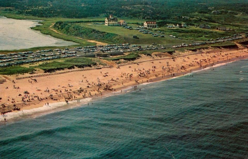
The earlier postcard image, from the 1960s, is part of the Eastham Historical Society collection. It shows a landscape that includes a large parking lot south of the former Coast Guard building and a sizable green lawn between the building and the sea.
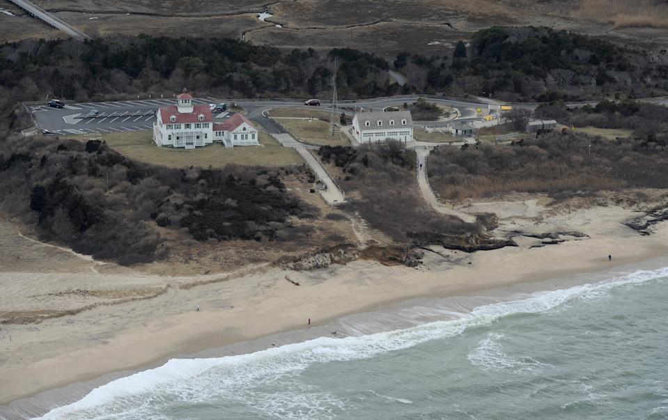
This is juxtaposed with an aerial National Park Service image from 2014, roughly 50 years after the first image. The parking lot is gone and the former Coast Guard building is much closer to the ocean.

Linzy French, visual information specialist at the Seashore, helped put the changes into perspective in an email to the Cape Cod Times.
"Coast Guard Beach and Nauset Light Beach specifically typically see a decent amount of erosion due to longshore sediment transport and the creation of parabolic dunes," wrote French. "It's part of the normal erosion cycle, but as storms grow more intense, more damage can occur."
How much of the bluff has been lost in Eastham?
According to French, "the bluffs lose about 3-5 feet a year, more so if we get a particularly bad storm. For example, in the recent January 14-15, 2024 storm, those bluffs saw several feet of loss in that one weather event alone."
Assuming that the postcard image dates from about 1965, French estimated "that shoreline has probably lost anywhere from 177-295 feet in the past 59 years, give or take."
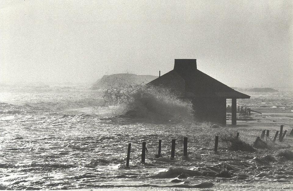
French also noted that the legendary storm known as the Blizzard of '78 "took out a much larger than average chunk of the landscape at Coast Guard Beach."
That larger than average chunk in 1978 included the parking lot seen in the image from the 1960s.
"Coast Guard Parking Lot Gone, Outermost House is Washed Away," was the headline on a Feb. 10, 1978 story in the Cape Codder newspaper, that reported "all parking spaces at Coast Guard Beach in Eastham had been permanently claimed by the Atlantic Ocean."
And it wasn't just the parking lot that was hit hard.
"To the south, beyond the remains of the parking lot, the sea engulfed structures on what remained of the Nauset spit," according to the Cape Codder article.
A Seashore history of Coast Guard Beach adds this description of the 1978 storm: "Waves repeatedly swept over most of Nauset Spit as well. In the process, four houses were destroyed, including The Outermost House, made famous by Henry Beston's book of the same name."
The dramatic changes that have occurred over a few decades may make you wonder about the geologic future of the Cape. It may be best not to look too far ahead and enjoy what we have now.
According to a geologic history of Cape Cod produced by the U.S. Department of the Interior and the U.S. Geological Survey, "at some distant time — not for many generations, however — Cape Cod will be nothing more than a few low sandy islands surrounded by shoals."
Eric Williams, when not solving Curious Cape Cod mysteries, writes about a variety of ways to enjoy the Cape, the weather, wildlife and other subjects. Contact him at ewilliams@capecodonline.com. Follow him on X: @capecast.
Thanks to our subscribers, who help make this coverage possible. If you are not a subscriber, please consider supporting quality local journalism with a Cape Cod Times subscription. Here are our subscription plans.
This article originally appeared on Cape Cod Times: Erosion on Cape Cod: Photos taken 50 years apart show massive change

