7 best snowy waterfall hikes and snowshoe trips in Oregon
The string of low-elevation snowstorms across northwest Oregon have meant plenty of trouble, from school delays to slower-traffic on roadways.
But it also means one positive thing — the arrival of peak winter waterfall hunting season. Traveling to snow-covered waterfalls is a glorious experience that's at its best following the type of low-elevation storms that have brought lots of fresh powder to elevations in the 3,000 to 4,000 foot range, the elevation where Oregon's best winter waterfalls reside.
Here are the best snowshoe trips to Oregon waterfalls covered in snow. All of the waterfalls can be found off mountain highways that are typically plowed and there is generally some parking open.
Even so, take every precaution before making the trip. Check conditions on TripCheck before leaving the house and make sure your car is equipped for winter travel.
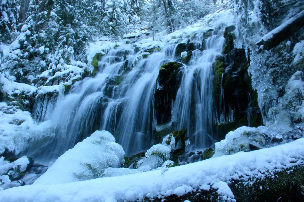
7. Proxy Falls (McKenzie Pass)
A snow gate on McKenzie Highway 242 blocks access to this famous pair of waterfalls from November to June, but by bringing snowshoes, skis or waterproof boots, Proxy Falls makes for a popular wintertime adventure east of Eugene.
After reaching the snow gate on Highway 242, park off to the side and hike, snowshoe or ski up the scenic highway for 2.5 miles to reach the Proxy Falls Trailhead on the right.
The 2-mile loop winds through lava fields and old-growth forest to a view of upper and lower Proxy Falls. All told, it's a journey of 7 miles.
More:Trip to ice-covered Proxy Falls brings winter adventure
Elevation: 2,100 feet at trailhead, 3,286 feet at waterfalls
Directions from Salem: The quickest route from Salem is following Highway 22 past Detroit to the Santiam Junction. Then follow Highway 20 and 126 south to Belknap Hot Springs and turn left on Highway 242. Drive up to the snow gate and park on the side of the road.
Directions from Eugene: Follow Highway 126 east for 55 miles, past McKenzie Bridge and Blue River, to Highway 242. Drive up to the snow gate and park on the side of the road.
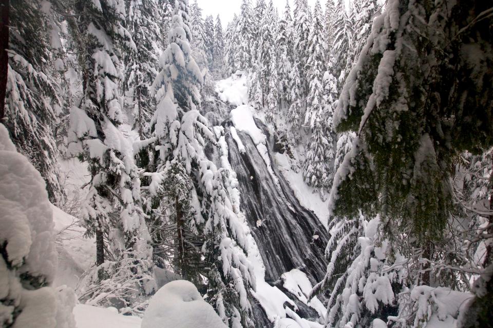
6. Watson Falls (North Umpqua)
The third-tallest waterfall in Oregon drops off sheer basalt cliffs like a thin string of silver rope, plummeting 272 feet into Southern Oregon's Umpqua National Forest.
The winter hike to Watson Falls is probably the most easy and scenic on this list, but with a lower elevation, good snow conditions don't happen that often.
Watson Falls has easy access off Highway 138 east of Roseburg (or west of Diamond Lake) and only requires a short one-mile loop hike.
After hitting Watson Falls, consider Toketee Falls just 2 miles away, or destinations like Crater and Diamond lakes, Umpqua Hot Springs and many of the beautiful waterfalls off Highway 138.
Elevation: 3,214 feet
Directions: From I-5 in Roseburg, take exit 124 for the North Umpqua River and OR 138. Follow signs for Diamond Lake through downtown Roseburg and continue east on OR 138 to milepost 61, then turn right (south) onto FR 37. The trailhead parking lot is just down FR 37.
5. Paulina Creek Falls (Newberry Monument)
A trip to Newberry Caldera and snowy Paulina Creek Falls offers a full-day adventure in winter via skis, snowshoes or a snowmobile.
Ten Mile Sno-Park, roughly 35 miles southeast of Bend, is the access point to reach this duo of 80-foot waterfalls.
A snowmobile trail leads to the falls following the entrance road.
Those on skis or snowshoes can follow a loop trail along both sides of the creek on a 6.8-mile journey.
The trip requires a long drive from the Willamette Valley, but the higher elevation also makes for more reliable snow conditions, and there's plenty to do in nearby Bend.
Elevation: 6,232 feet
Directions: From Bend, travel south on Highway 97 for roughly 24 miles, then turn left (east) and follow County Road 21 for 10 miles to Ten Mile Sno-Park.
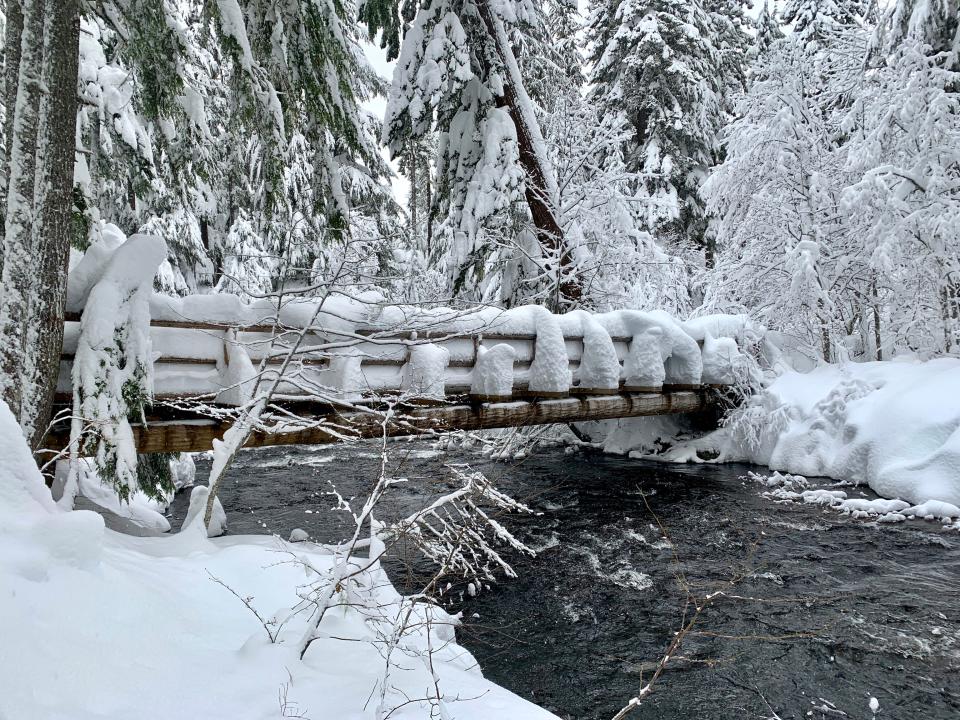
4. Sahalie-Koosah Falls (Santiam Pass)
The two most spectacular waterfalls on the McKenzie River are even grander when seen covered in snow.
This classic trek begins at one of three places off Highway 126 east of McKenzie Bridge. Carmen Reservoir Road is typically the best option for accessing the trails, but go to bit.ly/41DhGpg for a full breakdown of the details.
Wherever you start, snowshoeing is normally best. Follow the Waterfalls Trail and McKenzie River Trail on both sides of the river, using a bridge north of Sahalie Falls and Carmen Reservoir to connect the loop.
The full route is 3 miles, but you can easily visit just Sahalie or Koosah to shorten your day.
More:Snowshoe to ice-covered waterfalls on the McKenzie River
Elevation: 3,281 feet
Directions (from Salem): Follow Highway 22 east, past Detroit, to Santiam Junction. Then follow Highway 20 and 126 south to milepost 5. Signs alert you to the upcoming viewpoint/trailhead. If the snow is too deep, you can also begin the hike on Carmen Reservoir Road.
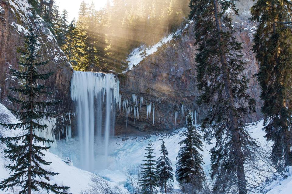
3. Tamanawas Falls (Mount Hood)
A beautiful hike in any season along Cold Springs Creek, through old-growth forest and over wooden footbridges, leads to this 100-foot waterfall.
In winter snow, the trek is nothing short of spectacular.
The hike is 4 miles round-trip, which is nice because it gets you out and away from the highway noise, and the waterfall payoff is stunning.
Follow East Fork Trail for half a mile, then be on the lookout for a junction with Cold Springs Trail, where you turn left and hike another 1.4 miles to the falls.
Elevation: 3,555 feet
Directions: From Hood River or Government Camp, follow Highway 35 to milepost 72 to a large parking area and trailhead, which usually stays plowed in winter.
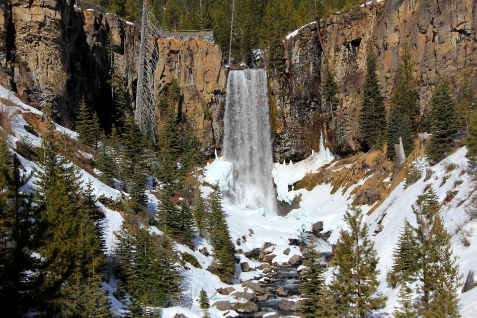
2. Tumalo Falls (Bend)
In summer, 89-foot Tumalo Falls can be reached with a short drive from Bend and is among the city's more popular hangouts.
By winter, however, the road is covered with snow, and the best way to reach this Central Oregon gem is with a scenic 5- or 7-mile trip on skis.
From Skyliners Sno-Park, Road 4603 Trail runs 5 miles out-and-back to the falls. A more challenging (and scenic) option is 7 miles out-and-back on Tumalo Creek Trail.
More:Trek to Central Oregon's Tumalo Falls on skis or showshoes
Elevation: 5,060 feet
Directions: From Bend, follow Skyliners Road 10 miles west to its end at a yellow gate. There is room for five cars in a small parking area and additional parking back down the road.
1. Salt Creek and Diamond Creek falls (Willamette Pass)
The chance to discover one of Oregon's tallest waterfalls covered in snow and ice is one of Oregon's great adventures and best easy snowshoeing trips.
The bonus is that once you reach 286-foot Salt Creek Falls, there are more winter waterfalls to be found on a loop that leads deeper into the forest.
More:Snowshoe to thundering Salt Creek Falls in winter
From Salt Creek Sno-Park off Highway 58 near Willamette Pass — a two-hour drive from Salem — the easy trail follows a summer access road 1.2 miles round-trip to Salt Creek Falls overlook.
Not enough? From the overlook, the Diamond Creek Falls Loop dives into deep and silent forest, crossing snowy bridges and high ridges to an overlook of 120-foot Diamond Creek Falls. The full route to both waterfalls is 4.5 miles to 5 miles, following an official route marked by blue diamonds attached to the trees.
This route could also be explored on cross country skis for those with moderate to high skill.
More:Winter waterfalls: Snowy trek to Salt Creek and Diamond falls features stunning views
Elevation: 3,902 feet
Directions: From I-5 in Eugene, take exit 188 onto Highway 58 east. Follow Highway 58 east for 57 miles, past Oakridge. At milepost 57, turn right at a sign for Salt Creek Falls/sno park. Park at a pullout on the right pretty quick after entering.
Zach Urness has been an outdoors reporter in Oregon for 15 years and is host of the Explore Oregon Podcast. Urness is the author of “Best Hikes with Kids: Oregon” and “Hiking Southern Oregon.” He can be reached at zurness@StatesmanJournal.com or 503-399-6801. Find him on Twitter at @ZachsORoutdoors.
This article originally appeared on Salem Statesman Journal: 7 best snowy waterfall hikes and snowshoe trips in Oregon

