Ferry cancellations, snow on highways could impede weekend travel
Travellers in B.C. are being warned to plan ahead due to a combination of ferry cancellations and snowfall warnings for major highways.
B.C. Ferries is advising travellers between the Lower Mainland and Vancouver Island to consider travelling as foot passengers or carpooling to terminals this weekend, due to a vessel being out of service for repairs.
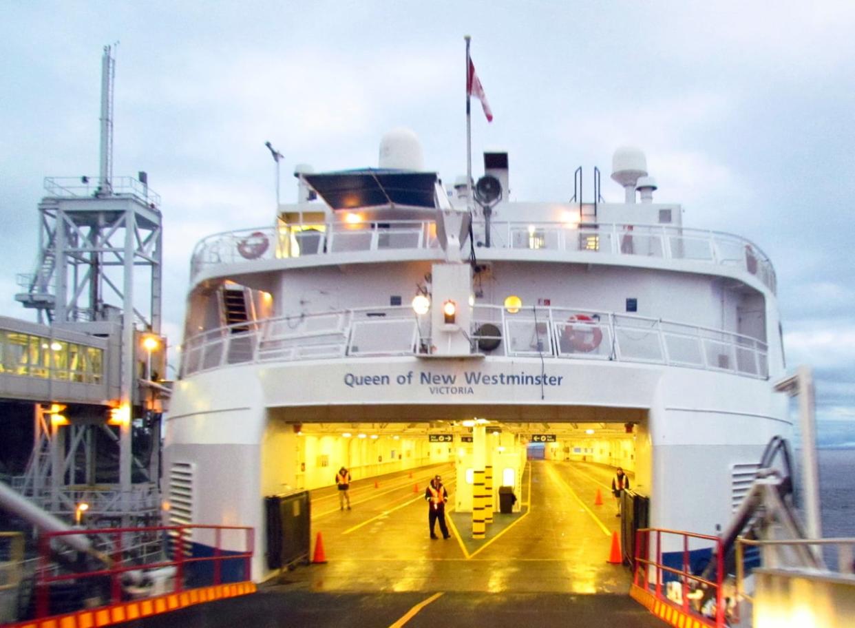
The ferry operator has cancelled eight sailings on the busy Tsawwassen-Swartz Bay route between Metro Vancouver and Vancouver Island for Friday and Sunday because the Queen of New Westminster vessel needs its rudder fixed.
"We've got divers in the water today ... they're doing dismantling of the rudder, we've ordered parts for it, we're expecting them to arrive soon," said Jeff Groot with B.C. Ferries.
"We're hopeful that the Queen of New Westminster is going to be back in service by next weekend, but we should know more this week."
'We know what customers expect'
Two sailings were also cancelled on Thursday. B.C. Ferries says passengers with reservations on the affected sailings have been accommodated elsewhere or offered a refund.
Groot says he understand travellers' frustrations over vessels needing repair, especially as the corporation's fleet ages. The Queen of New Westminster was built in 1964 and can carry 254 vehicles.
"We know what our customers expect. They expect to be able to get where they need to go, to travel between communities, to be able to visit their family and friends, and they expect to have some certainty in how they can do that — and the best way we can do that is by adding more capacity to the system," said Groot.
B.C. Ferries is in the process of having four new vessels built for its smaller routes, and there is a plan to add seven new major vessels as well. However, those vessels won't come online until 2027 and 2029, said Groot.
He said the corporation is working hard to make sure the vessels it has now are maintained and repaired promptly to keep service levels as high as possible.
Between July and September 2023, there were 1,172 sailing cancellations, up 16 per cent from the previous year. One-third of them were due to mechanical issues.
Snowy mountain highways
Meanwhile, it could be a dicey weekend on some of B.C.'s mountain highways with a forecast of significant snowfall.
Environment Canada says mountain passes will see blowing snow and rapidly changing conditions as a cold front arrives.
The snow is expected to start Saturday, intensify on Sunday and then ease off by Monday.
The weather office warns that drivers need to be cautious on the Coquihalla Highway, Highway 3, the Trans Canada through to Rogers Pass and the Yellowhead Highway to the Alberta boundary.
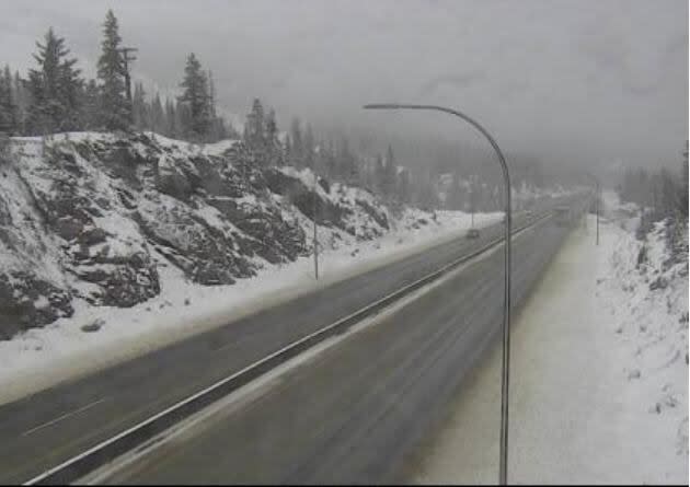
A webcam 61 km north of Merritt, B.C., shows a snowy Saturday afternoon on the Coquihalla Highway (Highway 5). More snow is in the cards for many Interior highways, according to Environment Canada. (DriveBC)
Environment Canada says snow will build in the valley bottoms in the wake of the cold front.
Further north, snow is forecast for the entire South Peace region with snow starting in some areas Saturday night and temperatures dropping to –20 C.
Shelly Fulmes of Argo Road Maintenance, which manages highways in the region, says while there is currently no snow warning in place, crews are preparing for that to change and are asking drivers to check the weather forecast as the weekend progresses.
Further south, the weather system bringing snow to much of B.C. could result in cooler temperatures in the Lower Mainland.
"By the time we get to Monday and Tuesday, our daytime highs are only going to reach into the mid-single digits, so quite a bit cooler than what we've been recently experiencing," said Lisa Erven, an Environment Canada meteorologist.
"Our overnight temperatures will drop to, or perhaps even below, zero [degrees] for Monday night and Tuesday."
Erven said there could be flurries early next week in the Lower Mainland as a result of the cold front, which arrives Saturday night.

