'Abundant lightning': Heat gives way to extreme wildfire danger in south, central Oregon
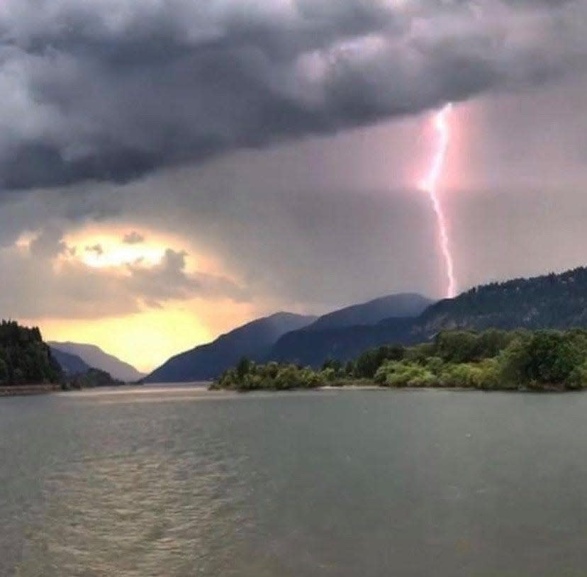
Oregon is swinging from one extreme danger to another this weekend, as multiple thunderstorms with “abundant lightning” roll into the southern and central parts of the state and bring the likelihood of numerous wildfire ignitions.
Red flag warnings have been issued across the length of southern Oregon, all the way from the California border to the Diamond Lake area, although lightning is also expected as far north as Bend and the Three Sisters, according to meteorologists, especially later in the weekend.
The danger is expected to last over the course of three days beginning Saturday afternoon and lasting into Monday.
“It’s fair to say we’re likely to see a significant number of fire starts,” said Brett Lutz, a meteorologist with the National Weather Service in Medford. “It’s hard to predict and there’s a lot of factors at play, but when you have a historic duration heatwave followed by this many lightning strikes, we could see upward of 100 new fire starts.”
Numerous fire crews and firefighting resources are being staged across southern Oregon in anticipation of the new fire starts, including on the Rogue River-Siskiyou National Forest and land protected by the Oregon Department of Forestry.
The overarching concern is that lightning will bring lots of small fires that get whipped up by winds projected for Sunday and Monday, as the heatwave breaks down and brings cooler temperatures.
One major question is how smoke from the recently ignited McKinney Fire in extreme northern California impacts the thunderstorms, Lutz said. The blaze, located northwest of Yreka, Calif., is 18,000 acres and growing rapidly, bringing evacuations south of the border and spewing heavy smoke into Oregon.
“Generally when we have a massive amount of smoke like this, it creates a shadow over the ground so that it doesn’t heat up as much and can cause us not to get thunderstorms where that shield is,” Lutz said. “Instead we may see storms on the edges of the fire or from a pyrocumulus cloud. It will undoubtedly have some kind of impact, but exactly what that is remains to be seen.”
Another question is how much rain falls with the thunderstorm.
“There is more moisture expected,” Lutz said. “And it will help wash out some of the fires started. The issue is that some areas won’t get rain that still get lightning, and later in the storm it also tends to get breezy, which can really get an active fire going.”
Overall, Lutz said, this type of danger is something that has happened commonly in southwest Oregon and it’s never exactly clear how it will play out. But with the wet spring bringing rapid growth of fire fuels, such as grasses and smaller brush, and the heatwave baking them to a crisp, the forecast is a "significant concern."
“It’s not really unusual for this area,” he said. “All you can do is hope it comes with more rain than not.”
Zach Urness has been an outdoors reporter in Oregon for 15 years and is host of the Explore Oregon Podcast. To support his work, subscribe to the Statesman Journal. Urness is the author of “Best Hikes with Kids: Oregon” and “Hiking Southern Oregon.” He can be reached at zurness@StatesmanJournal.com or (503) 399-6801. Find him on Twitter at @ZachsORoutdoors.
This article originally appeared on Salem Statesman Journal: Extreme wildfire danger forecast as lightning storms roll into Oregon

