AccuWeather forecasters watching Gulf of Mexico for potential tropical, subtropical development
Will conditions be right for the development of a tropical or subtropical storm to form in the Gulf of Mexico next week?
AccuWeather meteorologists plan to closely monitor conditions, saying there is a potential for tropical development of a system before it moves into the southern U.S. next week, bringing with it much-needed rain to some portions of Florida.
While rare, tropical depressions or storms have formed in April. The most recent was Tropical Storm Arlene in 2017 in the Atlantic.
There have been no documented April storms in the Gulf, according to AccuWeather.
Ironically, the first named storm of 2023 is Arlene.
As of Friday morning, AccuWeather meteorologists said a storm could from anywhere near the coast of Florida and the Keys to along the Louisiana coast.
Florida may not catch a break: AccuWeather issues 2023 hurricane season forecast, predicting 11-15 named storms
WeatherTiger: Florida hurricane season has a 70% shot at normalcy, but it only takes one
Whether a tropical or subtropical system develops, a broad area of moisture is forecast to head toward Florida and the upper Gulf Coast.
The track and forward speed of that storm will determine which areas end up receiving the most rain.
"At the very least, it appears that portions of Florida will receive some much-needed rain from the ordeal," AccuWeather Meteorologist Alex DaSilva said.
Development of the system in the Gulf of Mexico depend on several factors, including water temperatures and enough time over the Gulf before moving inland.
“The closed low must sit over the Gulf of Mexico for 48-72 hours in order to gain tropical characteristics, and it appears that it may only get into the northern Gulf of Mexico for about 24 hours before moving inland,” Accuweather Chief On-Air Meteorologist Bernie Rayo explained.
“If this is correct, the storm will not have enough time to develop.”
For a true tropical system to develop, water temperatures generally need to be in the mid- to upper 70s F. Because water temperatures are barely high enough this early in the year, a subtropical storm or hybrid storm may develop — or perhaps not form at all, AccuWeather said.
Here's the forecast across Florida for the Easter weekend and into next week.
Weather radar and forecast for Pensacola

Saturday: Showers and possibly a thunderstorm. High near 75. Southeast wind 5 to 10 mph. Chance of precipitation is 80%. New rainfall amounts between a half and three quarters of an inch possible.
Easter: Mostly cloudy, with a high near 66. Northeast wind 10 to 15 mph, with gusts as high as 20 mph.
Monday: A 20 percent chance of showers after 1 p.m. Mostly cloudy, with a high near 65. Northeast wind around 15 mph, with gusts as high as 25 mph.
Tuesday: A 30 percent chance of showers and thunderstorms. Partly sunny, with a high near 70. Breezy, with an east wind 15 to 20 mph, with gusts as high as 30 mph.
Wednesday: A 40 percent chance of showers and thunderstorms. Partly sunny, with a high near 72. Breezy.
Thursday: A 30 percent chance of showers and thunderstorms. Partly sunny, with a high near 74.
Follow National Weather Service Mobile on Twitter
Weather radar and forecast for Tallahassee

Saturday: A chance of showers and thunderstorms between 8 a.m. and 2 p.m., then showers likely and possibly a thunderstorm after 2 p.m. Mostly cloudy, with a high near 77. East northeast wind around 5 mph becoming calm in the afternoon. Chance of precipitation is 70%. New rainfall amounts between a quarter and half of an inch possible.
Easter: A 30 percent chance of showers. Mostly cloudy, with a high near 64. Northeast wind around 10 mph.
Monday: A 20 percent chance of showers and thunderstorms after 2 p.m. Mostly cloudy, with a high near 68. Breezy.
Monday Night: A 20 percent chance of showers and thunderstorms. Mostly cloudy, with a low around 56.
Tuesday: A 20 percent chance of showers and thunderstorms. Partly sunny, with a high near 74.
Wednesday: A 40 percent chance of showers and thunderstorms. Partly sunny, with a high near 75.
Thursday: A 50 percent chance of showers and thunderstorms. Partly sunny, with a high near 79.
Follow the National Weather Service Tallahassee on Twitter
Weather radar and forecast for Jacksonville

Saturday: A slight chance of showers, then a chance of showers and thunderstorms after 11 a.m. Mostly cloudy, with a high near 83. Southeast wind 5 to 10 mph. Chance of precipitation is 50%. New rainfall amounts between a quarter and half of an inch possible.
Easter: A 40 percent chance of showers. Cloudy, with a high near 66. Windy, with a north wind 14 to 22 mph, with gusts as high as 33 mph.
Monday: A chance of showers, with thunderstorms also possible after 9 a.m. Mostly cloudy, with a high near 70. Breezy. Chance of precipitation is 40%.
Tuesday: A 40 percent chance of showers and thunderstorms. Partly sunny, with a high near 73. Breezy.
Wednesday: A 50 percent chance of showers and thunderstorms. Partly sunny, with a high near 77. Breezy.
Thursday: Showers and thunderstorms likely. Partly sunny, with a high near 80. Chance of precipitation is 60%.
Follow the National Weather Service Jacksonville on Twitter
Weather radar and forecast for Daytona Beach

Saturday: A 30 percent chance of showers and thunderstorms after 2 p.m. Partly sunny, with a high near 83. Southeast wind 5 to 10 mph.
Easter: Showers likely and possibly a thunderstorm. Mostly cloudy, with a high near 74. North wind 10 to 15 mph, with gusts as high as 25 mph. Chance of precipitation is 60%.
Monday: Showers likely and possibly a thunderstorm. Partly sunny, with a high near 73. Windy, with an east northeast wind 15 to 20 mph, with gusts as high as 30 mph. Chance of precipitation is 60%.
Tuesday: A 40 percent chance of showers and thunderstorms. Partly sunny, with a high near 74. Windy, with an east northeast wind 15 to 20 mph, with gusts as high as 25 mph.
Wednesday: A 50 percent chance of showers and thunderstorms. Partly sunny, with a high near 76. Windy, with an east wind 15 to 20 mph, with gusts as high as 25 mph.
Thursday: A 50 percent chance of showers and thunderstorms. Mostly sunny, with a high near 79. Southeast wind around 15 mph, with gusts as high as 25 mph.
Follow the National Weather Service Melbourne on Twitter
Weather radar and forecast for Melbourne
Saturday: A slight chance of showers, then a chance of showers and thunderstorms after 2 p.m. Mostly sunny, with a high near 84. East wind 5 to 10 mph. Chance of precipitation is 30%.
Easter: Showers likely and possibly a thunderstorm. Partly sunny, with a high near 81. North wind 5 to 15 mph. Chance of precipitation is 60%.
Monday: Showers likely, with thunderstorms also possible after 8 a.m. Partly sunny, with a high near 77. Windy, with an east northeast wind 15 to 20 mph, with gusts as high as 25 mph. Chance of precipitation is 60%.
Tuesday: A 50 percent chance of showers and thunderstorms. Partly sunny, with a high near 76. Windy, with an east northeast wind 15 to 20 mph, with gusts as high as 25 mph.
Wednesday: Showers likely and possibly a thunderstorm. Partly sunny, with a high near 78. Windy, with an east wind 15 to 20 mph, with gusts as high as 25 mph. Chance of precipitation is 60%.
Thursday: A 50 percent chance of showers and thunderstorms. Mostly sunny, with a high near 82. Southeast wind around 15 mph, with gusts as high as 25 mph.
Follow the National Weather Service Melbourne on Twitter
Weather radar and forecast for Port St. Lucie
Saturday: A slight chance of showers between 9 a.m. and 3 p.m., then a chance of showers and thunderstorms after 3 p.m. Mostly sunny, with a high near 85. East wind 5 to 10 mph. Chance of precipitation is 30%.
Easter: A chance of showers and thunderstorms, then showers likely and possibly a thunderstorm after 9 a.m. Partly sunny, with a high near 84. West wind 5 to 10 mph becoming north in the afternoon. Chance of precipitation is 60%.
Monday: A chance of showers, then showers likely and possibly a thunderstorm after 9 a.m. Partly sunny, with a high near 78. Windy, with a northeast wind 15 to 20 mph, with gusts as high as 25 mph. Chance of precipitation is 60%.
Tuesday: A chance of showers and thunderstorms, then showers likely and possibly a thunderstorm after 9 a.m. Mostly cloudy, with a high near 76. East northeast wind around 15 mph, with gusts as high as 25 mph. Chance of precipitation is 60%.
Wednesday: Showers and thunderstorms likely. Mostly cloudy, with a high near 78. East wind around 15 mph, with gusts as high as 25 mph. Chance of precipitation is 60%.
Thursday: A 50 percent chance of showers and thunderstorms. Mostly sunny, with a high near 83. Southeast wind around 15 mph, with gusts as high as 20 mph.
Follow the National Weather Service Melbourne on Twitter
Weather radar and forecast for West Palm Beach
Saturday: A chance of showers, with thunderstorms also possible after 2 p.m. Mostly sunny, with a high near 80. Southeast wind 9 to 13 mph. Chance of precipitation is 30%.
Easter: A 50 percent chance of showers and thunderstorms, mainly after 2 p.m. Mostly sunny, with a high near 81. West wind 6 to 11 mph becoming north in the afternoon.
Monday: A chance of showers and thunderstorms, then showers likely and possibly a thunderstorm after 2pm. Partly sunny, with a high near 76. Breezy, with a northeast wind 15 to 17 mph, with gusts as high as 25 mph. Chance of precipitation is 60%.
Tuesday: A chance of showers and thunderstorms, then showers likely and possibly a thunderstorm after 2pm. Mostly cloudy, with a high near 74. Breezy, with an east wind around 17 mph, with gusts as high as 26 mph. Chance of precipitation is 60%.
Wednesday: Showers likely and possibly a thunderstorm. Mostly cloudy, with a high near 75. Breezy. Chance of precipitation is 70%.
Thursday: A 50 percent chance of showers and thunderstorms. Mostly sunny, with a high near 79. Breezy.
Follow the National Weather Service Miami on Twitter
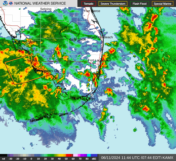
Weather radar, forecast for Naples
Saturday: A 20 percent chance of showers after 3 p.m. Sunny, with a high near 84. East wind 5 to 9 mph becoming west in the afternoon.
Easter: A 30 percent chance of showers and thunderstorms after 3 p.m. Sunny, with a high near 85. North wind 5 to 10 mph becoming west in the afternoon.
Monday: A 50 percent chance of showers and thunderstorms, mainly after 3pm. Partly sunny, with a high near 83. Northeast wind 10 to 13 mph, with gusts as high as 18 mph.
Tuesday: A chance of showers and thunderstorms, then showers likely and possibly a thunderstorm after 3pm. Partly sunny, with a high near 82. Breezy, with a northeast wind around 16 mph, with gusts as high as 25 mph. Chance of precipitation is 60%.
Wednesday: Showers and thunderstorms likely. Partly sunny, with a high near 81. Breezy. Chance of precipitation is 70%.
Thursday: A 40 percent chance of showers and thunderstorms. Mostly sunny, with a high near 82. Breezy.
Follow the National Weather Service Miami on Twitter
Weather radar and forecast for Fort Myers
Saturday: A 20 percent chance of showers and thunderstorms after 2 p.m. Sunny, with a high near 87. East wind 5 to 7 mph becoming southwest in the afternoon.
Easter: A 40 percent chance of showers and thunderstorms after 2 p.m. Mostly sunny, with a high near 86. West northwest wind 6 to 9 mph.
Monday: A 50 percent chance of showers and thunderstorms, mainly after 2 p.m. Partly sunny, with a high near 82. East northeast wind 10 to 14 mph, with gusts as high as 21 mph.
Tuesday: A chance of showers and thunderstorms, then showers likely and possibly a thunderstorm after 2 p.m. Partly sunny, with a high near 79. Breezy, with an east wind 14 to 16 mph, with gusts as high as 25 mph. Chance of precipitation is 60%.
Wednesday: Showers and thunderstorms likely. Partly sunny, with a high near 80. Breezy. Chance of precipitation is 60%.
Thursday: A 40 percent chance of showers and thunderstorms. Mostly sunny, with a high near 82. Breezy.
Follow the National Weather Service Tampa Bay on Twitter
Weather radar, forecast for Sarasota
Saturday: Mostly sunny, with a high near 86. Southeast wind 7 to 10 mph becoming west southwest in the afternoon.
Easter: A 30 percent chance of showers and thunderstorms, mainly after 2 p.m. Mostly sunny, with a high near 85. Northwest wind 6 to 11 mph.
Monday: A 40 percent chance of showers and thunderstorms, mainly after 2 p.m. Partly sunny, with a high near 84. Breezy, with an east northeast wind around 15 mph, with gusts as high as 23 mph.
Tuesday: A 50 percent chance of showers and thunderstorms, mainly after 8 a.m. Partly sunny, with a high near 82. Breezy, with an east wind around 17 mph, with gusts as high as 26 mph.
Wednesday: Showers and thunderstorms likely. Partly sunny, with a high near 82. Breezy. Chance of precipitation is 60%.
Thursday: A 40 percent chance of showers and thunderstorms. Mostly sunny, with a high near 83. Breezy.
Follow the National Weather Service Tampa Bay on Twitter
Weather watches and warnings issued for your area
If you can't see any local weather warnings here, you'll need to open this story in a web browser.
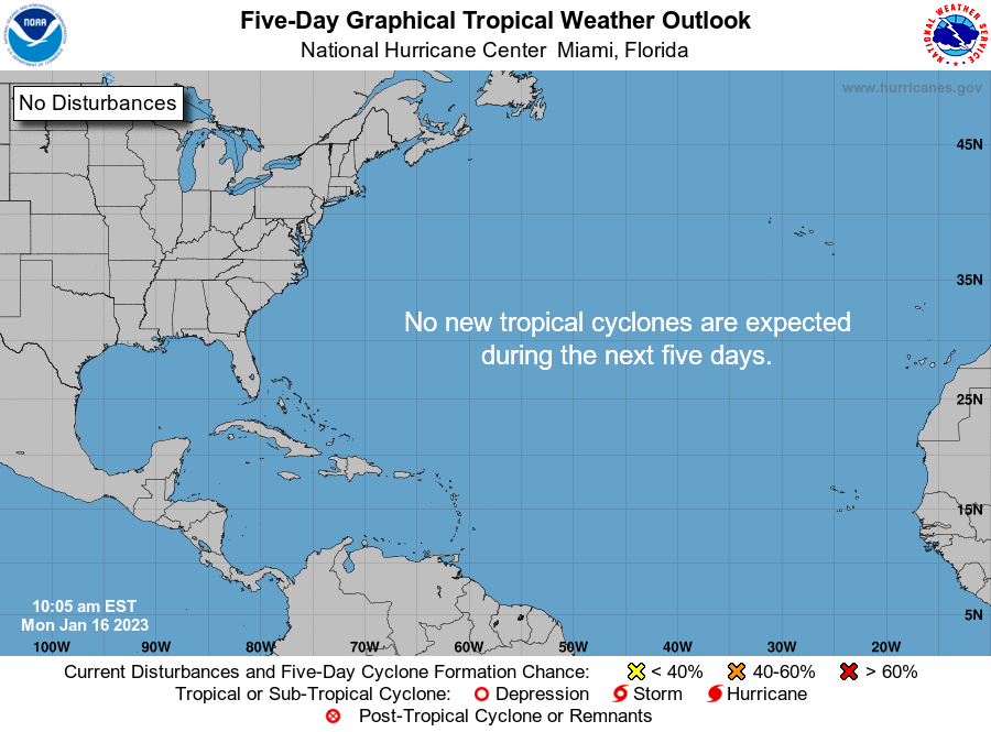
Tropical forecast over the next five days
What's out there?
Systems currently being monitored by the National Hurricane Center.
This article originally appeared on Treasure Coast Newspapers: Tropics watch: Potential for tropical, subtropical system in Gulf

