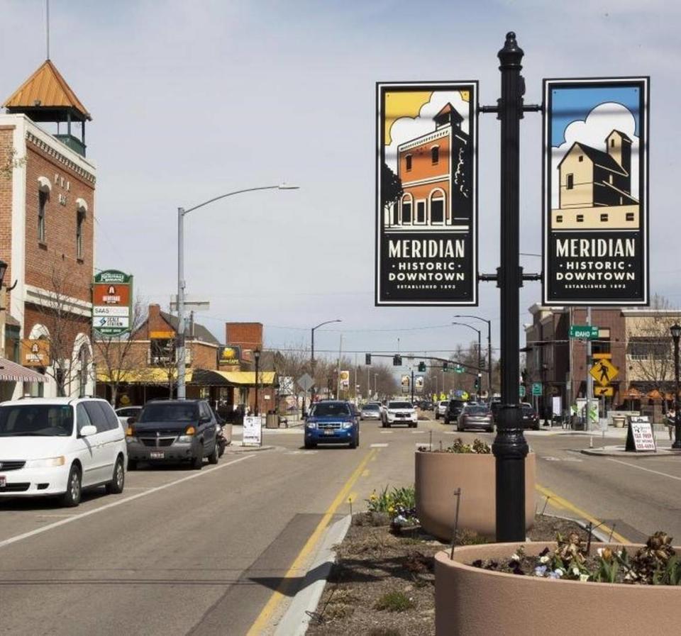
ACHD plans road, sidewalk improvements for West Bench, Meridian. What’s in the works
As Ada County approaches the end of a deadly year for pedestrians and bicyclists, the Ada County Highway District released new plans and recommendations for transportation improvements in the West Bench and downtown Meridian.
The recommendations update ACHD’s original neighborhood transportation plans for the areas that were first completed in 2013 and 2012. The five-person board of commissioners is expected to vote on adopting the plans at a Jan. 10 meeting.
The updates outline a massive number of improvements for nearly 87,000 residents in these areas, including addressing sidewalk gaps, increasing the number of crosswalks, adding bike lanes and implementing tactics that can slow traffic.
ACHD has identified over 1,300 projects throughout their 16 neighborhood districts since 2012, said Aaron Williams, senior transportation planner for ACHD, during a Dec. 13 commission meeting. Of those, the district has completed 301.
“The main goal of the neighborhood transportation plan is to engage and work with the community to identify their needs and wants for the neighborhood,” Williams said.
Public outreach earlier this year found several issues in the downtown Meridian area and Boise’s West Bench with congested areas and problems with walkability and bikeability, Williams said.
The West Bench area saw 2,287 crashes that resulted in a fatality or injury from 2017 to 2022, according to the plan. The downtown Meridian area saw 977 crashes that resulted in a fatality or injury during the same time frame.
West Bench: Slow the traffic, make walking & biking easier
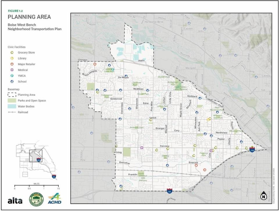
ACHD organized the West Bench area as an oddly shaped wedge with Interstate 84 and I-184 as its southern edge, a squiggly line following Settlers Canal for its northeastern edge and the West Boise Water Renewal Facility and Chinden Boulevard marking the boundary in the north. The western edge follows the border between Boise and Meridian.
Some common themes it found in the West Bench included a need to make it easier to walk and bike places, improve congested intersections and add traffic and speed-calming measures such as speed bumps.
Some of the high-priority projects ACHD recommended include completing a sidewalk along Franklin Road between Five Mile Road and Bethel Street, replacing a signal and widening certain parts of the Fairview Avenue and Cloverdale Road intersection, and addressing a crossing at Records Way and Fairview Avenue that leaves cyclists exposed to traffic.
“There’s an enormous amount of substandard bike lanes (in the West Bench),” said Alexis Pickering, president of the ACHD Board of Commissioners, during the meeting. “I’m really pleased with a lot of the upcoming investments in the plan.”
Many of the investments in the West Bench, Pickering said, are sorely needed.
According to the plan, cars travel too fast in the area and a significant portion is devoted to commercial and industrial uses surrounding the Union Pacific Railroad and Fairview Avenue corridors.
Barriers include high-stress roadways, lack of network connectivity, areas with a history of crashes and natural barriers such as the topography of the Bench, according to the plan. The area is also constricted by several cul-de-sacs, meandering and offset streets, long block lengths and canals.
Pickering, whose district covers the West Bench, said she loves the centrality of the area and the ease to reach the Greenbelt, fairgrounds, Meridian and downtown Boise, but that it is difficult to do so unless you have a car.
“It is nearly impossible to get there safely by another mode of transportation besides car,” Pickering said.
Downtown Meridian: Drivers don’t yield to pedestrians
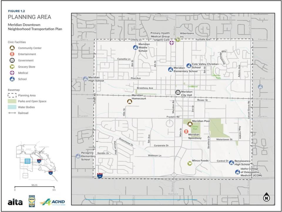
ACHD defined the downtown Meridian area as a square with I-84 as the southern border and the northern border formed by Cherry Lane and Fairview Avenue. Linder Road forms the area’s western border, while Locust Grove Road forms the eastern side.
In the downtown Meridian area, Williams said the public highlighted the need to improve safety and walkability to and from schools and noted that drivers do not always yield to pedestrians at intersections.
“Projects identified in this plan promote safe, effective and convenient walking and biking facilities for residents and visitors,” according to the plan.
ACHD highlighted several roadways for improvement, including segments on Cherry Lane and Fairview Avenue, Linder Road, Pine Avenue, Franklin Road, Meridian Road, Main Street and Locust Grove Road. ACHD highlighted many of these roadways for pedestrian improvements as well.
“High-stress roadways … include most of the arterials in the planning area including Cherry Lane, Fairview Avenue, Franklin Road, Meridian Road, Linder Road and Locust Grove Road,” according to the plan.
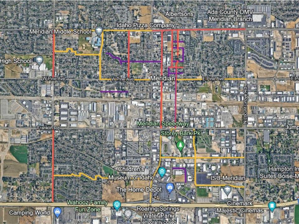
The plan’s high-priority projects include adding sidewalk connections for Gruber Avenue and exploring options for “enhanced bicycle facilities” such as protected or raised bike lanes along Main Street between Franklin Road and Broadway Avenue.
Other considerations included allowing traffic circles in some residential areas, improved pedestrian signals, fixing the surface of some roads and upgrading railroad crossings.
Pedestrian deaths draw highway planners’ attention
Rachel Bjornestad, spokesperson for ACHD, said the district is taking the recent spate of pedestrian deaths in the Boise area into consideration for the plans and worked with local cities and advisory groups to build the plan.
“That’s something we’re really focusing on,” Bjornestad said by phone.
ACHD’s neighborhood plans are project identification tools and do not commit the organization to funding specific projects or adopting specific projects, according to plan documents. Some projects listed are under construction, some are slated for construction in the near future and others still need approval.
The plans help build the organization’s five-year work plan and act as a planning tool, Bjornestad said.
“They’re all living documents — it’s not like once we finish the plan that’s just what we’re going to be doing for the next 10 years,” Bjornestad said. “It’s definitely not set in stone.”
ACHD is accepting public comment on the plans from Dec. 13 through Jan. 10 before they head to the board of commissioners for adoption. Feedback can be submitted for the West Bench and downtown Meridian plans through engage.achdidaho.org.
“This is the point where we go out to the community to identify projects for these neighborhoods,” Bjornestad said. “With each iteration of the integrated five-year work plan, we also identify projects”
Some busy Boise streets will change. What it means for drivers, bikers, walkers
Boise’s contentious new zoning code went live. Here’s what that could mean for you
New park, improved bike and walking path are coming to downtown Boise’s Grove Street
Stretches of an iconic Boise street will be changed. Pedestrians, bicyclists take note

