Across the SouthCoast, storm prep underway for potential impacts from Hurricane Lee
NEW BEDFORD — In New Bedford storm-prep ramps up when nasty weather's projected to be about a week away.
In this case, that would be Hurricane Lee.
New Bedford Department of Public Infrastructure Commissioner Jamie Ponte said Monday DPI has a standard operating procedure that kicks in a week out of a potential storm.
"That's about where we are right now," he said Monday.
Ponte said they delved into Lee's potential during a storm meeting last week.
At this point, he said, they're inventorying equipment, including pumps, portable generators and chainsaws.
Any maintenance chores are also attended to, and vehicles are fueled up. He added, "We start staging sandbags citywide."
Essential workers will also start getting notices that they may be needed, he said.
Three days before an anticipated major storm event, like a hurricane, equipment will be issued to personnel who will have assigned routes to make sure low-lying areas are dealt with throughout the city.
Catch basins will also be attended to, a process that's already started.
He added Monday, "Right now it's looking like Friday night we could start seeing some effects from it, or into Saturday."
Live updates: How New Bedford and Fall River areas are preparing for Hurricane Lee's impacts
Mayor Jon Mitchell said early Monday afternoon, “The city is closely monitoring Hurricane Lee. While it is too soon to determine whether the storm will affect our area, city departments have already begun planning and preparing for possible impacts out of an abundance of caution. I encourage residents to monitor local media over the next several days as the path and intensity of the storm becomes more clear.”
Dartmouth firefighters ready for flood events
Over in Dartmouth, District 1 Fire Chief Peter Andrade said Tuesday that his department — which covers the southeast region of town, including Padanaram — has been busy preparing for the worst, whether it comes or not.
"We're pretty much going to double up our staff on Saturday during the day and into the night if required," Andrade said, noting normal Saturday staffing levels would be three personnel, including the deputy chief. "I may come in myself and we'll maybe increase by three or four more.
"Other than that, we're going through the routine of sharpening the chains on our saws, making sure they all start, gas is fresh, oil is in them," he said. "We're on the ready."
Hurricane Lee: Canceled events, postponements in the New Bedford area
Andrade said in the event of heavy rain, one major area of concern within District 1 would be Padanaram down by the harbor.
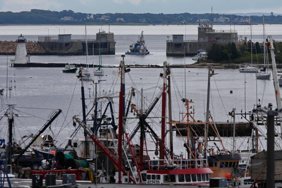
"We'll keep our fingers crossed. Nobody wants to see a storm down here in Padanaram with the amount of boats that are in the harbor," he said. "This would be the worst time, I think, as opposed to a month from now when mostly all the boats would be out."
Plans in place for Padanaram Bridge
Andrade said flooding in the area of the Padanaram Bridge is nothing new for his department, and as such, plans are already in place for events that may prevent firefighters from crossing over to the other side.
"We relocate a couple pieces of apparatus over to the Smith Neck Road side so we're covered there in case the bridge goes out or the causeway gets flooded," he said.
Other areas that are known to be flood-prone include the end of Williams Street, Apponagansett Village, the old police station on Russells Mills Road, Cushman Lane and the area of Russells Mills Road near the mouth of Slocums River, Andrade said.
According to Dartmouth Communications Coordinator Magnolia McComish, as of Tuesday the Padanaram Bridge schedule was expected to remain the same. She advised residents to contact the Department of Public Works for "any storm or power outage interruptions."
Live view: See Hurricane Lee impacts as they happen in the Fall River and New Bedford area
In flooding events, geography favors North Dartmouth
In North Dartmouth, District 3 Deputy Fire Chief Theodore Borges said his department's jurisdiction — encompassing the town's commercial center, including the mall — isn't as prone to flooding as its southern counterparts.
"If a storm is coming through and we feel that it's going to affect us, the EMA (emergency management agency) and us will gather and work up a plan but we haven't done that as of yet," he said.
In Fairhaven, 'hurricane permits' may come into play
In Fairhaven, Fire Chief Todd Correia said that his department expected to activate hurricane watch procedures as early as Wednesday. This would entail:
Considerations for opening shelters and an EOC (emergency operations center);
Checking equipment to ensure vehicles are fueled, emergency generators are full at all public buildings and wastewater pumping stations, and addressing any out-of-service equipment issues;
Coordinating with shipyards on fuel shutdown;
Coordinating with the town harbormaster on use of public boat ramps;
Meeting with MEMA on statewide plans and storm forecasts;
And opening lines of communication with nursing homes/elderly housing.
Correia said residents would also be urged to obtain town hurricane passes in case of an evacuation.
"These are needed in order to return to your property after an evacuation, and are intended to protect your property from non-residents," the town website reads. "Based on past history, Fairhaven takes yearly hurricane planning extremely seriously. This includes a possible evacuation order for West Island, Sconticut Neck, and other low lying areas of the Town."
Remember this: What are the biggest hurricanes to hit Massachusetts? A look back at 8 storms
For further instructions on how to obtain a hurricane permit, visit fairhaven-ma.gov.
Acushnet Fire & EMS may consider extra staff
In Acushnet, Fire Chief Thomas Farland said his department will be keeping a close eye on Hurricane Lee's track and planning accordingly. As of now, basic preparatory measures are being taken.
"We're just making sure our equipment is up and ready, fueled and good to go," Farland said. "We’ll be watching the weather forecast throughout the week to see just exactly how close it’s going to get to us and see if we need to bring in extra staffing."
As far as any significant areas of attention, Farland said a number of scattered spots throughout town have been known to flood, but a major focus will be the Acushnet River.
"For a major rain event like that we'd be watching the Acushnet River basin from where it hits the harbor all the way up to Lake Street," he said. "The ponds at Lake Street are actually part of the Acushnet River."
Eversource ever-ready to take on 'storm roles'
Chris McKinnon, a spokesperson for utility company Eversource, said the company is always ready to switch gears from the typical day at work, to storm mode.
"Everybody at Eversource has what we call our 'blue sky days' where we do our typical jobs, and then we have our 'storm roles,'" McKinnon said Tuesday. "Everyone has a specific storm role where you're supporting restoration efforts in some way."
Other means to address major system-impacting events such as hurricanes include shifting resources from less-affected areas to bolster the efforts where needed.
"That's a benefit of having a regional company like us," he said. "We have service territories in Connecticut, parts of Massachusetts and New Hampshire, so we're able to quickly move resources around."
Like others, McKinnon said Eversource is currently monitoring Lee's track to get a sense of what storm preparations should look like and will adjust accordingly in the days to come.
Eversource customers may want to download the Eversource mobile app ahead of any potential brush with Lee, McKinnon noted, as they'll be able to communicate with the company via text, see status updates and more.
Storm safety tips: How can you stay safe during a hurricane, flood or tornado?
How to stay safe in a hurricane
The following tips come from the personnel interviewed for this article:
Assume any downed wires are live and stay clear. Report them to 9-1-1 immediately.
If operating a power generator, do so as far away from the home as possible, and not inside of any enclosed space such as a garage.
Make sure outdoor items in yards and around properties are tied down or stored safely, e.g. patio furniture, basketball hoops, etc.
Have bottled water and other essential items on-hand.
Keep phones and devices charged.
Do not attempt to drive through flooded roads.
Minimize travel during, and in the aftermath of the storm. If driving, slow down and move over if passing by any utility or work crews.
Impact of Lee on Massachusetts and New England
Lee is a category 3 hurricane on the Saffir-Simpson Hurricane Wind Scale. Maximum sustained winds are near 115 mph, with higher gusts.
As of Wednesday morning, AccuWeather meteorologists expected a high risk to lives and property from damaging winds and flooding on much of Nova Scotia, Down East Maine, and southwestern New Brunswick from Saturday to Sunday.
However, some risk from direct impacts from Hurricane Lee extends as far to the west as Rhode Island and includes all of eastern Massachusetts, southeastern New Hampshire, and central and coastal Maine.
The storm may pass close enough to bring strong winds and heavy rain to Southern New England as early as Friday night into Saturday, according to the National Weather Service.
The saga continues: Montigny mentions possible lawsuit over Star Store: Impasse continues
"There is an increasing risk of wind, coastal flooding, and rain impacts from Lee in portions of New England and Atlantic Canada beginning on Friday," the National Hurricane Center wrote in a tweet this morning.
The severity of wind, rain, and coastal problems in New England will depend on the track and strength of Lee late this week and this weekend.
With reporting from USA Today and The Enterprise
This article originally appeared on Standard-Times: SouthCoast first responders, workers prepare for Hurricane Lee

