Before-and-after aerial images show California reservoirs' dramatic rebound after years of drought
California's two biggest reservoirs are all but full after reaching perilously low levels late last year.
Lake Shasta, at 96% full, and Lake Oroville, at 100%, had fallen to around 25% to 30% of their capacity before the state's historically wet winter rejuvenated them.
Statewide, reservoirs are at 85% of total capacity, well above their 30-year average of 73% for the month of June. With the Sierra Nevada snowpack still above three times its normal level for mid-June, they are expected to fill up even more as the snow melts.
The before-and-after images below from NASA show Lake Shasta on Nov. 18, 2022, when the lake stood at just 31% of capacity, and again on May 29, 2023, when it was 98% full.
California's biggest reservoir had not been so full in more than four years, according to California Department of Water Resources data. A “bathtub ring" around the lake showing how far the water line had fallen was clearly visible in November, but it had vanished by May.
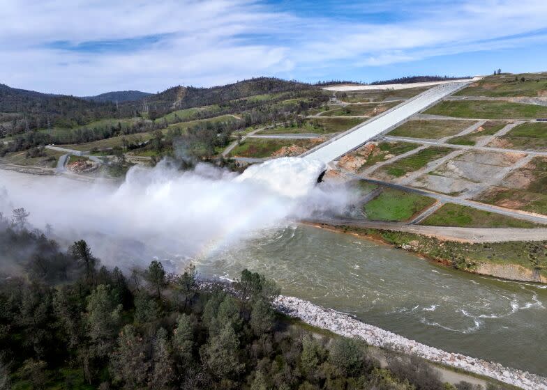
Lake Oroville, in Butte County, has also undergone a spectacular transformation.
Read more: Striking satellite photos from space show California's transformation from dry to lush
Since Dec. 1, the lake’s water level has risen more than 240 feet thanks to more than 2.5 million additional acre-feet of water brought on by a series of powerful winter storms and the melting of a historically deep snowpack. That puts the reservoir at 127% of its historical average for the date, state data show.
The image below shows the lake near Enterprise Bridge on Dec. 21, when levels were at 29% of capacity. A narrow band of water winds through the bottom of the gully, far below the bridge's span.
Less than six months later, the landscape had undergone a noticeable shift. In the image below, taken June 12, water levels are dramatically higher at the same part of Lake Oroville, filling up nearly to the top of the piles supporting the bridge.
In the second photo, the reservoir is at 100% capacity, submerging the barren hillsides that were previously exposed by low water levels.
A study of satellite data from NASA's Jet Propulsion Laboratory found that the winter brought the greatest net gain of water in California's lakes in the 22 years that the metric had been tracked.
Between October 2022 and March 2023, the Central Valley's "lakes, rivers, soil, snowpack, and underground aquifers" saw their levels increased by the equivalent of 20 inches, or around twice the average gain in the last 22 years.
Read more: The great California snowmelt has begun: See striking before and after satellite photos
However, groundwater levels remain depleted, experts say, and may remain so into the future.
“One good winter of rain and snow won’t make up for years of extreme drought and extensive groundwater use,” said Felix Landerer, a scientist at JPL.
Times staff writer Nathan Solis contributed to this report.
Sign up for Essential California, your daily guide to news, views and life in the Golden State.
This story originally appeared in Los Angeles Times.

