Aftermath of Hawaii's deadly wildfire inferno revealed in gut-wrenching satellite images
An out-of-control wildfire erupted on the drought-stricken island of Maui earlier this week, wreaking havoc on the Hawaiian town of Lahaina. Satellites are providing a sobering view of the scope of destruction.
The blaze, which scorched the historic town on Hawaii's second largest island, erupted on Tuesday for reasons still unknown. The wildfire quickly grew into enormous proportions shortly thereafter, fanned by powerful winds spurred by the passing Hurricane Dora. At least 55 people have lost their lives and thousands have lost their homes, officials have said.
Meteorologists explained that although Dora passed more than 700 miles (1,200 kilometers) south of the Pacific archipelago, its interaction with an area of high pressure in the northern Pacific Ocean produced powerful winds, which rapidly spread the fire across Maui's dry landscape.
Related: Wildfire smoke is warming the planet more than previously thought
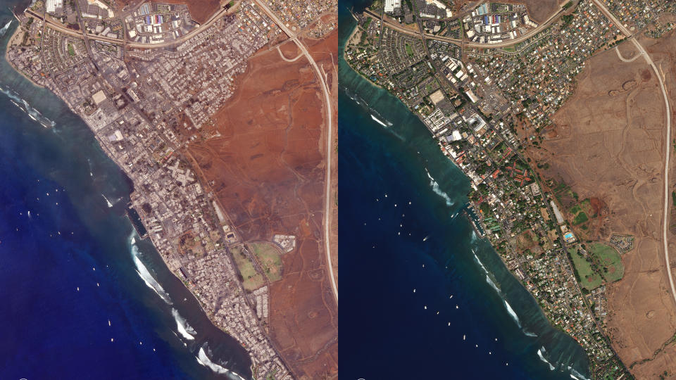
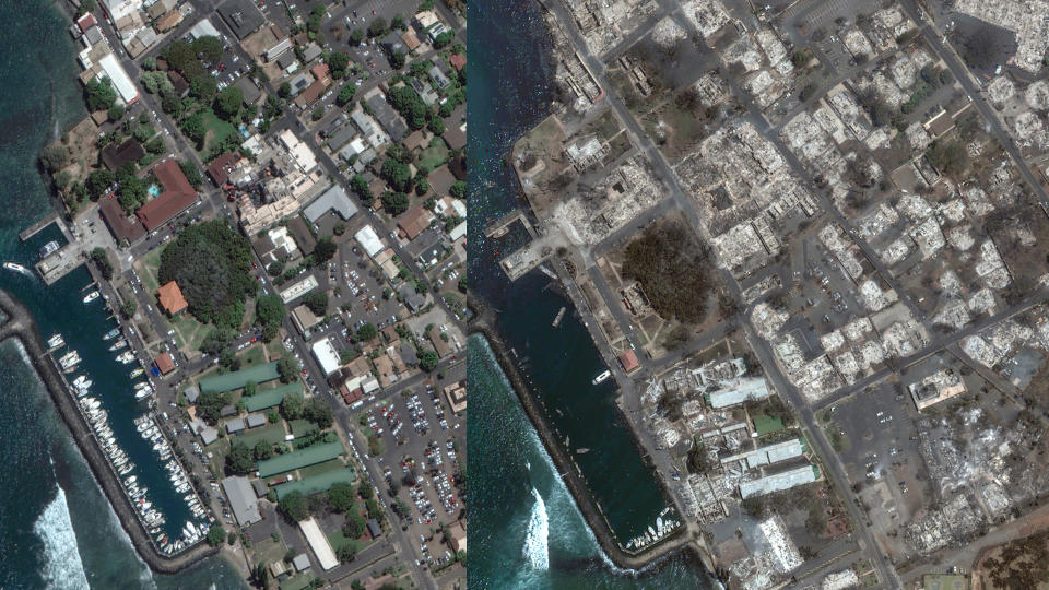
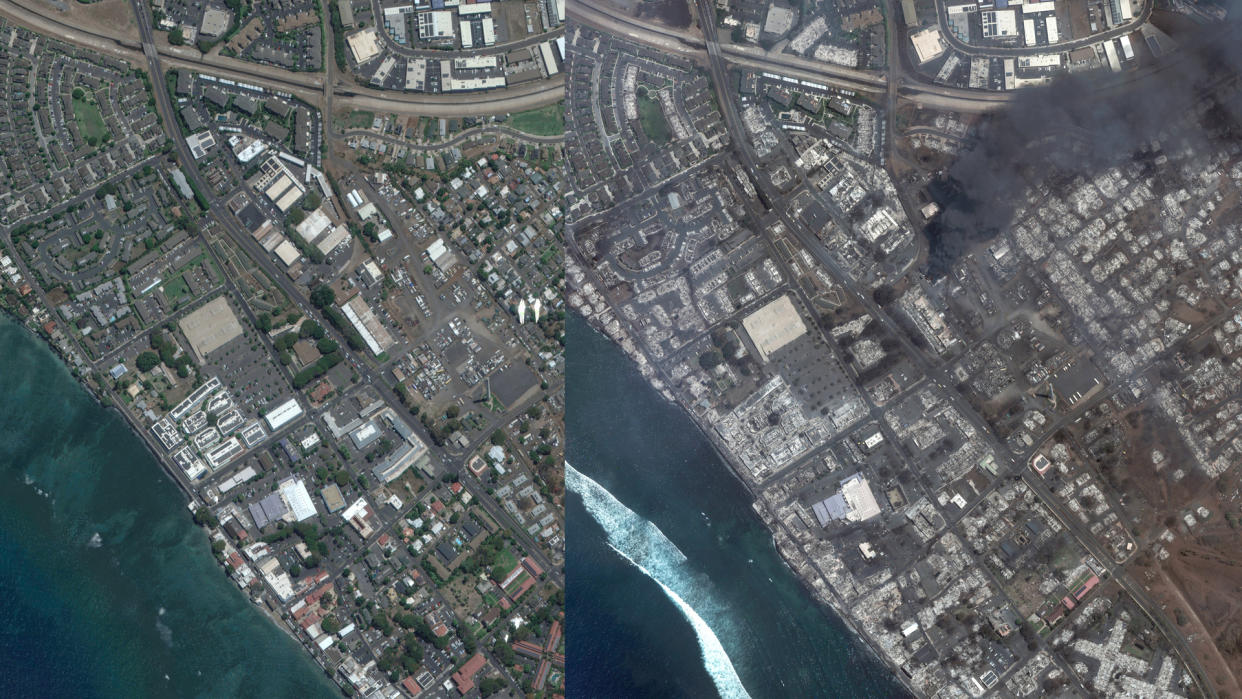
Images shared by U.S. Earth-observation companies, Maxar Technologies and Planet, provide side by side comparisons of Lahaina and its surroundings before and after the blaze. While images taken by Maxar in June show a neat neighborhood abundantly sprinkled with greenery, views from Wednesday (Aug. 9) reveal a bleak, ash-covered scene in grays and browns with thick plumes of dark smoke billowing above.
Planet's images taken a day later provide similar views to those of Maxar after the smoke cleared.
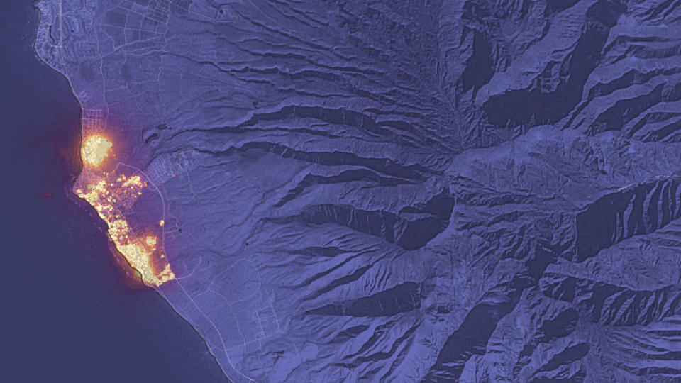
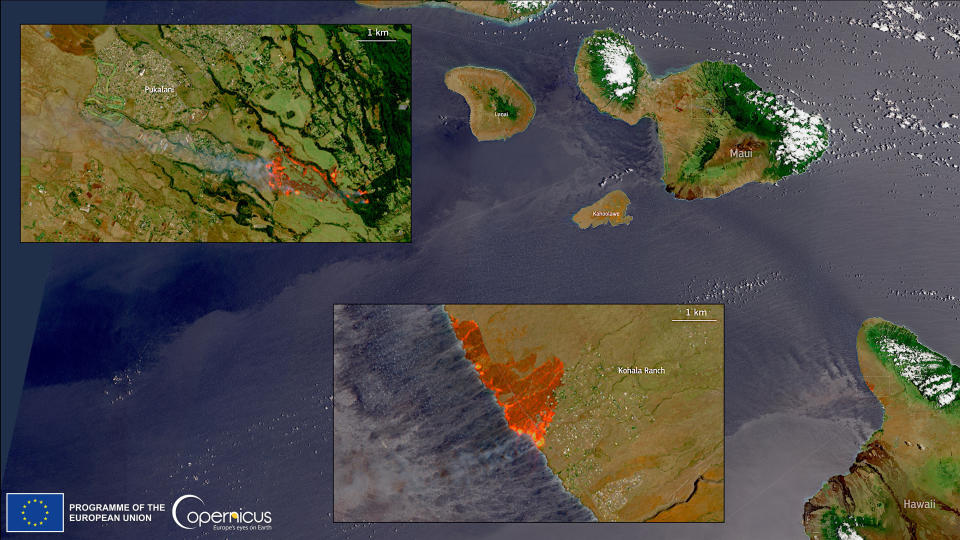
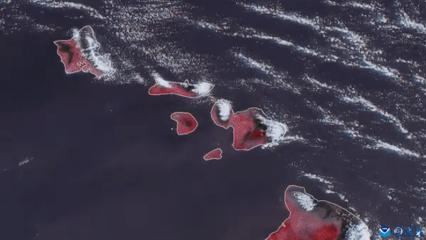
NASA's Landsat 8 satellite also captured a gut-wrenching image of the town ablaze on Tuesday (Aug. 8), shortly after the fire was first reported. In that image, nearly all of the town, which prior to the disaster had a population of about 12,000, glows bright orange with flames. Europe's Sentinel-2 Earth-observing spacecraft spotted the region on fire as well, during its pass on Aug. 8. These Hawaiian fires were so intense that they could clearly be observed in images taken by weather satellites in the geostationary orbit, some 22,000 miles (36,000 km) above Earth.
According to media reports, the fires have still been raging on the remote island as of the morning of Friday (Aug. 11). Hawaii's governor, Josh Green, called the fire the "largest natural disaster in Hawaii state history," adding that 80% of Lahaina was "gone," according to the BBC.
Related stories:
— Canadian wildfire smoke dims the vision of Earth-observing satellites (photos)
— Satellites watch as wildfires rage across Greece (photos)
— Siberian wildfires double greenhouse gas emission record: This is how they look from space.
According to the U.S. National Weather Service, the winds that fanned the flames are now receding and will remain at moderate levels throughout the weekend and early next week. That should put an end to the lethal mix of conditions which, in addition to fueling the flames, also complicated fire-fighting and rescue efforts.
According to CBS News, National Guard helicopters called to help fight the fires had to be grounded as wind gusts reaching speeds over 60 mph (97 kph) lashed the island. In fact, the winds alone caused destruction in the region, knocking out power lines and damaging homes, CBS reported.
Rescue operations and humanitarian aid efforts are further complicated by the remote nature of Maui and the limited resources the island has at its disposal to handle disasters of such a massive scale.

