Wind Advisory issued for entire region tonight; Snow, colder tomorrow
The National Weather Service has issued a Wind Advisory for the entire region starting tonight at 7 p.m. until noon tomorrow. This includes Butler, Champaign, Clark, Clinton, Darke, Greene, Logan, Mercer, Miami, Montgomery, Preble, Shelby, and Warren counties in Ohio. It is also in effect for Union and Wayne counties in Indiana.
QUICK-LOOK FORECAST:
Back to snow showers tonight
Staying windy through Wednesday
More rain/snow chances starting Friday
>> TRACK THE LATEST CONDITIONS: Live Doppler 7 Radar
DETAILED FORECAST:
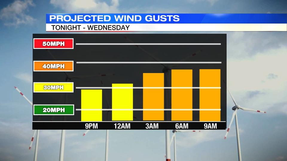
TUESDAY: Tonight, there will be cloudy skies with rain showers transitioning back to snow showers overnight, Storm Center 7 Chief Meteorologist Austin Chaney reports. Accumulation should be very light where it does occur. A dusting to a half inch is possible. Warm ground temperatures should limit roadway issues. Windy tonight. Frequent gusts between 30-40MPH are possible. Isolated higher gusts can’t be ruled out. Lows tonight are around freezing.
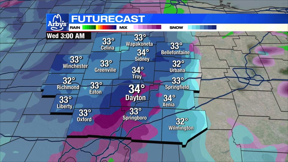
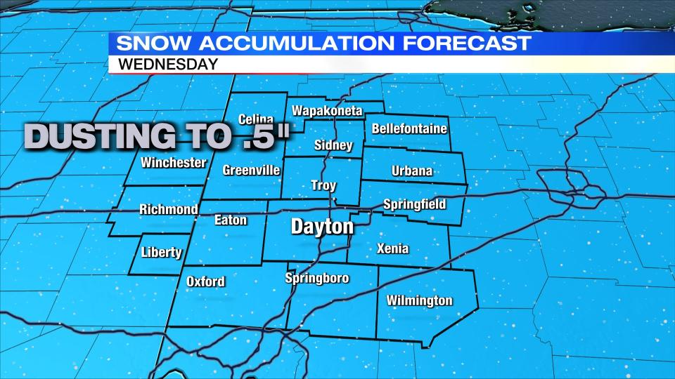
WEDNESDAY: Colder with snow showers early. Accumulations will be light, around .5″ or less by daybreak.
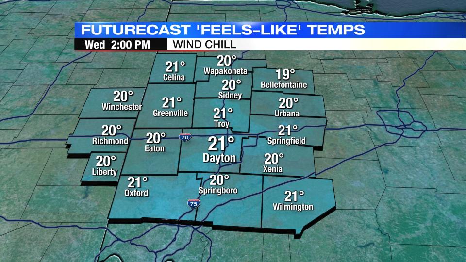
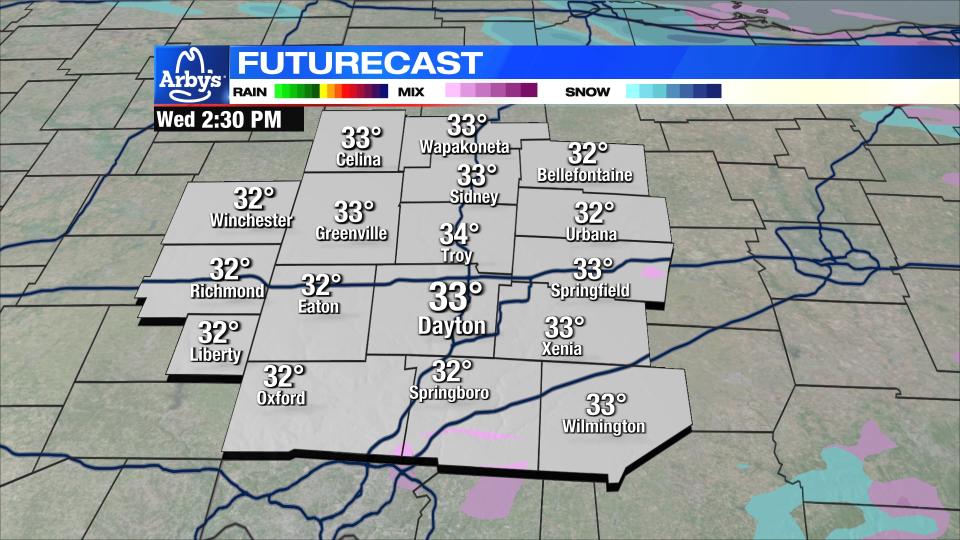
Mainly dry and cloudy into the afternoon. Temperatures struggle to warm - only getting back to the low 30s. Windy. Gusts to 30-40MPH are possible early in the day.
THURSDAY: Mostly cloudy. Chilly with highs near 40. A few rain or snow showers may miss the northern Miami Valley.
FRIDAY: Cloudy with precipitation arriving late day. Snow is possible early before we go to all rain for the afternoon. Snow is possible again by Friday night. High temperatures in the low 40s.
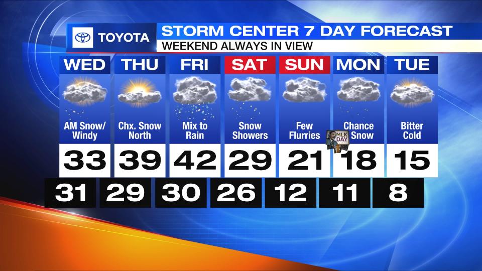
SATURDAY: A chance for snow showers and much colder. Highs in the upper 20s.
SUNDAY: A few lingering snow showers are possible. Very cold. Highs in the lower 20s.
MONDAY: Cloudy with a chance for snow. Cold with highs in the teens. Lows in the upper single digits to low teens.
TUESDAY: Bitter cold. Single-digit lows with highs in the teens. Dangerous wind chills, especially in the morning. Mostly cloudy skies are expected.

