Overnight severe storm threat targets parts of Ontario, Quebec
It’s another stormy weekend for parts of Ontario and Quebec, especially for areas still rattled by the powerful storms that swept through the region last Thursday.
Multiple rounds of rough conditions are likely through Sunday, including a risk for potent storms in eastern Ontario and southern Quebec overnight Saturday into the pre-dawn hours on Sunday.
DON'T MISS: Clean-up underway after severe storms spawn tornado near Ottawa
The warm, muggy airmass will provide plenty of instability that could push some of the storms beyond severe limits.
Pay close attention to warnings in your area and prepare to seek shelter immediately if hazardous weather threatens.
Saturday afternoon and evening
Areas: Southern, northern and eastern Ontario
Weather: Two different systems are responsible for the storm risk across northern and southern Ontario on Saturday.
Up north, a cold front will trigger scattered thunderstorms in northeastern Ontario through Timmins and Moosonee.
A weak low-pressure system will serve as the spark for scattered thunderstorms down across southern Ontario.
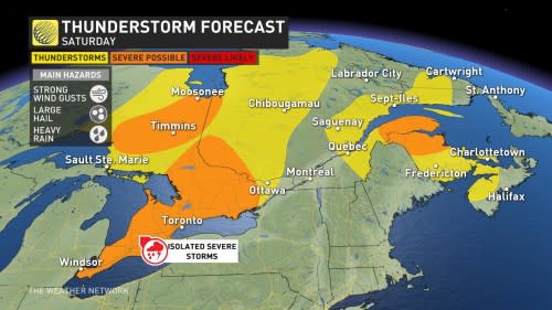
Not all of the storms will turn severe, but those that take advantage of the energy in place could produce strong wind gusts, large hail, and heavy rainfall.
As with any thunderstorm on a humid summer day, beware the risk for localized flooding and standing water on roadways beneath any slow-moving storms.
Conditions on Saturday won’t be anywhere near as bad as what folks in eastern Ontario and southern Quebec saw on Thursday, but even the severe hazards and lightning of one thunderstorm is dangerous to any community in its path.
Temperatures across southern Ontario are seasonal, hovering around the mid-to-high 20s. However, with the humidity, it is going to feel like the low- to mid-30s across the region.
Saturday night
Areas: Eastern Ontario and southern Quebec
Timing: Overnight Saturday into the pre-dawn hours on Sunday
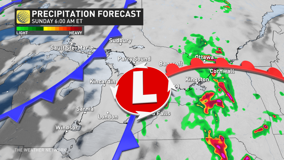
Weather: The centre of low pressure that moved over southern Ontario on Saturday will scoot toward eastern Ontario and southern Quebec overnight Saturday into the wee morning hours on Sunday.
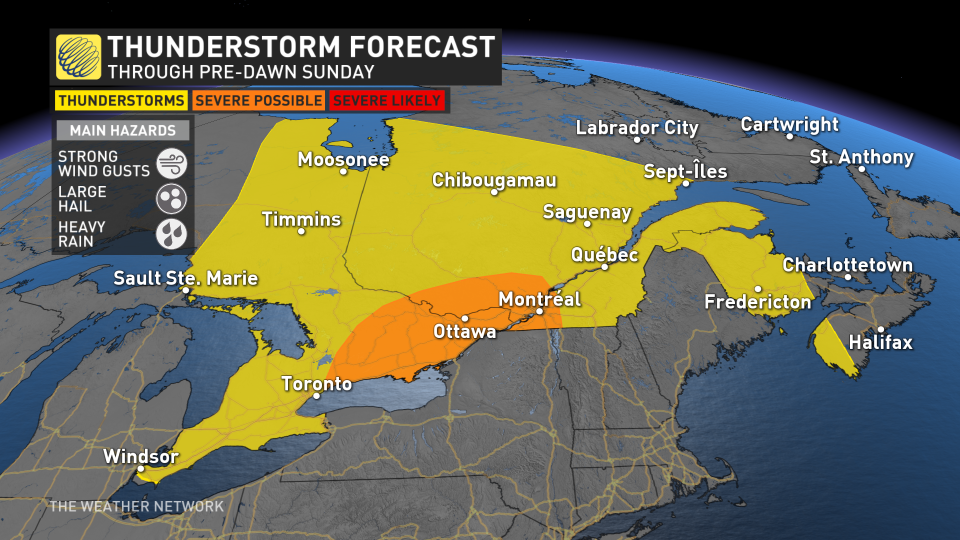
We’ll still see plenty of instability across the region through the overnight hours. Widespread thunderstorms are likely to form as the low plows into that unstable air, setting the stage for quite the spectacle for night owls and early risers alike.
MUST SEE: Staying safe during a power outage
Dynamics are in place for thunderstorms to organize into clusters or lines as they move through the region, potentially reaching severe limits with strong wind gusts and heavy rainfall the predominant threats. This could exacerbate any lingering damage from Thursday’s storms, and it could push down any trees or power lines weakened by the recent severe weather.
A risk for severe weather at night is especially dangerous because it’s easy to sleep through any warnings that may be issued. Make sure you’ve got a way to receive severe weather warnings on your phone, smart devices, or weather radio while you’re asleep. It would be a good idea to keep a flashlight by your bedside in case the power goes out overnight.
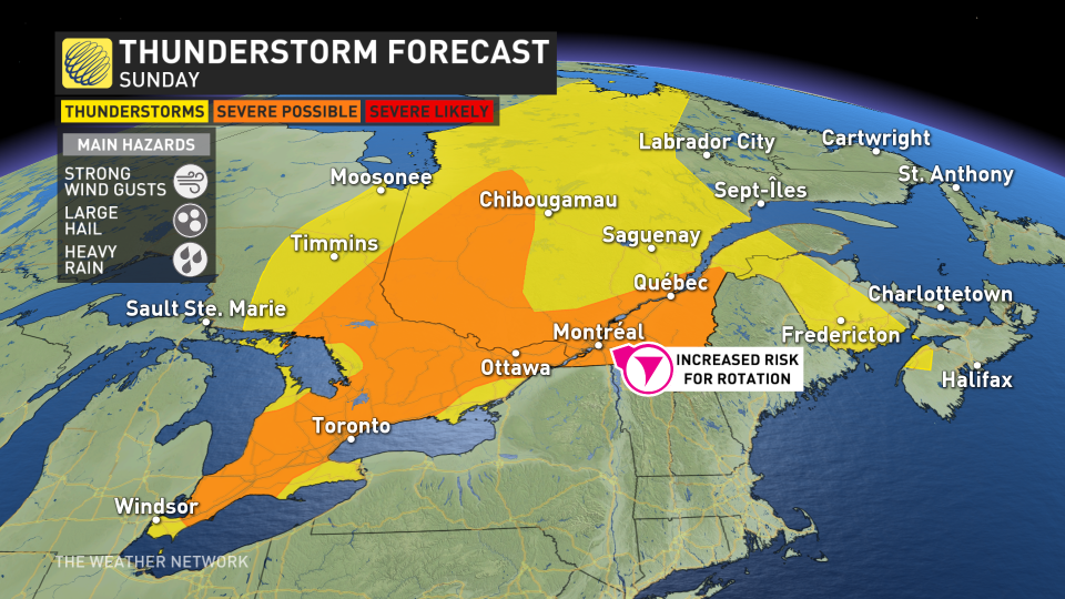
Sunday
Areas: Portions of southern, northern Ontario, and southern Quebec
Timing: Through the afternoon and evening hours
Weather: A renewed risk for thunderstorms will pop up again on Sunday in Ontario and Quebec as our warm, soupy air remains locked in place.
Scattered thunderstorms are likely to develop through the afternoon and evening hours as we reach the peak of daytime heating. Some of the storms could turn severe, bringing the risk for strong wind gusts, large hail, and heavy rain. It’s worth noting that there is a risk for some rotation in southern Quebec.
MUST SEE: Don’t fall victim to these seven dangerous tornado myths
However, as is the nature with pop-up summertime storms, confidence is a little lower in exactly where the strongest storms will pop up.
Prepare
Keep The Weather Network’s app handy on your phone to peek at the radar and keep up with watches and warnings as the day progresses.
Stay close to a safe shelter in case storms threaten your location. And remember, the greatest danger in any thunderstorm is lightning. If you can hear thunder, you’re close enough to be struck by lightning.
Thumbnail image courtesy of Lacey Davey.
Stay tuned to The Weather Network for the latest updates on conditions across Ontario and Quebec.

