Another cold front expected to move through Florida. Heavy rain could impact Daytona 500
Get ready for a wet, cool weekend across Florida.
Yes, a cold front is moving through the state this weekend. And no, you're not mistaken; it is still Florida, in February, the time of year when air conditioners are usually coming out of their brief — think days — hibernation.
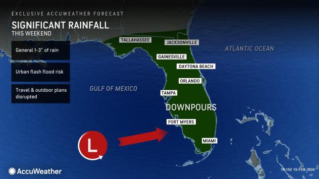
Rain in the forecast for the weekend could even impact the Daytona 500 since downpours will be focused primarily on the Florida Peninsula, sparing most of the Panhandle, according to AccuWeather.
Two to three inches of rain is expected over the weekend in a swath across Central Florida that includes Daytona Beach, according to the National Weather Service, Tampa Bay.
Here's what we can expect this weekend.
Florida weather forecast: Cooler temperatures, rain
A cold front is expected to impact the state over the weekend with a "notable drop in temperatures and soaking rains," according to the Florida Public Radio Emergency Network.
Showers are possible starting Friday in some locations, before the front sweeps through the Florida Peninsula over the weekend.
Expect rain to continue throughout the weekend as the system moves from west to east.
Downpours are expected to focus primarily on the Florida Peninsula Saturday night through Sunday, and could bring 1 to 3 inches of rain, according to AccuWeather and the National Weather Service.
Isolated amounts up to 4 inches also are possible, according to the National Weather Service, Melbourne.
If there's any good news to the expected rain, conditions are unfavorable for the development of widespread severe thunderstorms, according to AccuWeather forecasters.
How low will weekend temperatures drop across Florida?
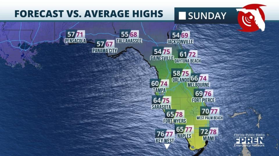
The coolest temperatures are expected Sunday afternoon, according to the Florida Public Radio Emergency Network. High temperatures Sunday are forecast to be lower than average highs, with the greatest departures expected to be across North and Central Florida.
The forecast high Sunday in Orlando is only 58 degrees, 17 degrees below the average high in Orlando of 75. Tampa will also be much cooler than average, with afternoon temperatures that may not climb out of the 50s.
Temperatures will be lower than the historical average by about 10 to 15 degrees across Central Florida, AccuWeather said.
Those temperatures are much lower than residents saw just a week ago, on Feb. 11. Orlando’s high Feb. 11 was 87, a difference of almost 30 degrees. Jacksonville hit 85 degrees Feb. 11. On Feb. 18, the expected high is 54.
Winds out of the north could bring gusts up to 30 mph, making it feel even colder.
Will it rain during the Daytona 500?
The weather forecast Daytona Beach isn't looking good when it comes to all the races scheduled for Saturday and Sunday.
Saturday races include a Cup Series final practice (10:30-11:20 a.m.); Xfinity Series qualifying (11:30 a.m.); ARCA Menards Series, Daytona ARCA 200 (1:30 p.m.); and the Xfinity Series, United Rentals 300, at 5 p.m.
The Daytona 500 starts at 2:30 p.m. Sunday. The race usually lasts between three and four hours, depending on crashes, track conditions and rain.
AccuWeather forecasters said fans should prepare for rain and weather delays for many of the activities planned for the weekend. If the storm moves through quickly on Sunday, it is possible the track may dry out for a delayed start on Sunday, AccuWeather said.
What happens if there is rain during the Daytona 500?
Everything stops. Cars pull over to the side and are covered.
Once the rain stops, or sometimes even as light rain is falling, a fleet of Air Titans use compressed air to blow water off the track and suck it up.
Once the track is deemed safe, the race continues.
If the rain won't stop, the driver in the lead after at least 100 laps or the end of Stage 2, whichever comes first, will be declared the winner.
In prior years, the race has even been delayed and restarted well into the night, or even the next morning, to get a winner. It's also been postponed to later on Monday.
"If the race ends up being postponed until Monday, a few lingering showers may still threaten," said AccuWeather Senior Meteorologist Dan Pydynowski.
"Even if Monday turns out mainly dry, it will be a breezy and cool day with afternoon highs only in the middle to upper 60s, 5-8 degrees below the historical average."
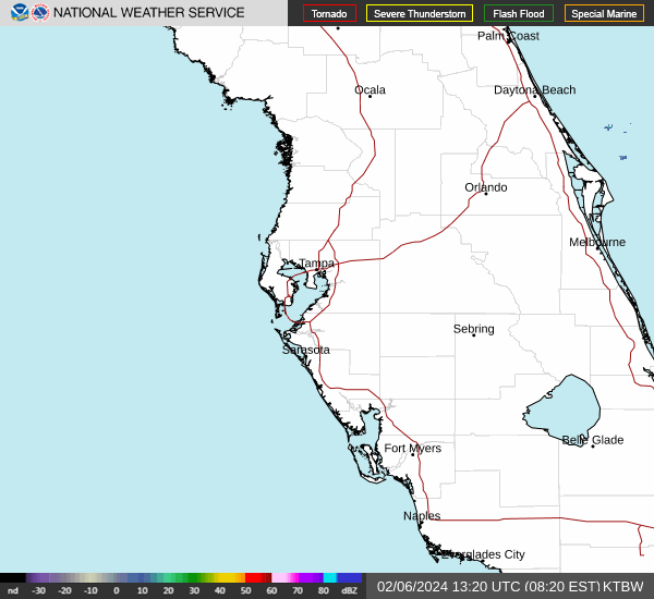
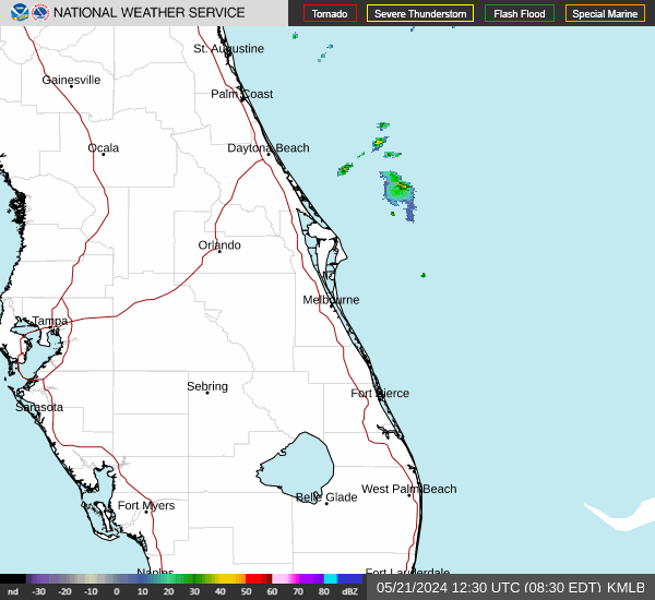
Weather radar out of Tampa Bay and Melbourne. Watch storms as they move through
What about next week? What's the forecast?
Central Florida's forecast includes northerly winds, with gusts of 25 to 30 mph expected to continue into Monday, although temperatures are expected to increase across Central Florida into the low to mid 60s. Lows are forecast to be in the upper 50s Monday night, according to the National Weather Service, Melbourne.
In North Florida, the potential for any showers during the start of the week will be confined offshore, according to the National Weather Service, Jacksonville. High temperatures for Presidents Day are expected to be in the low 60s, with lows dipping into the low 40s.
South Florida can expect cool temperatures to linger, with highs in the upper 60s Monday and lows in the upper 50s.
Along the West Coast, temperatures are forecast to inch up, with highs in the mid 60s and lows around 50.
In the Panhandle, temperatures will start off cold, with lows around freezing through early next week before gradually increasing throughout the week. Temperatures are forecast to climb into the low 60s, with lows around 40 Monday.
This article originally appeared on Treasure Coast Newspapers: Florida weather forecast, radar: Cold front could bring heavy rain

