April snowstorm could bring up to 6 inches to Wausau, Shawano, Oconto and southern Door County
This story has been updated.
As temperatures are warming up, winter is making another stop in northeastern Wisconsin.
April opened with dropping more than a foot of snow in some parts of Wisconsin, especially in the Northwoods. Even though snow from that storm is rapidly melting, another burst of snowfall is on the way for parts of northeast Wisconsin, the National Weather Service said.
Right now, the snow is expected to fall across east-central Wisconsin ― but that could still change by the end of Friday with an unpredictable storm track.
Here's what we know so far and what could still change until the snow starts flying.
Where and when will the snow fall?
While the storm could start off as some rain, the snow is expected to start flying late Friday evening, said Roy Eckberg, meterologist with the National Weather Service.
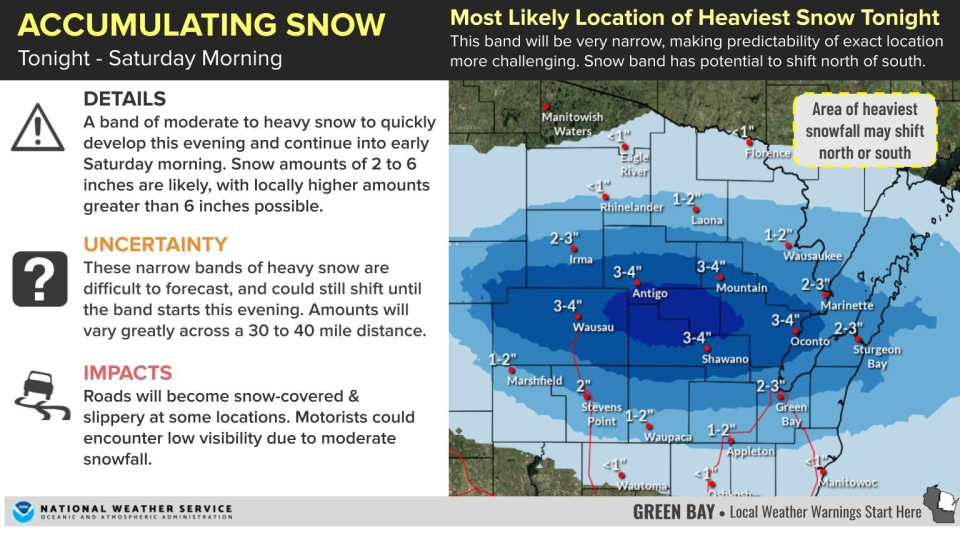
The heaviest snow is expected to fall in near Wausau, Antigo, Mountain, Shawano and Oconto. These regions are expected to get at least 3 inches of snow and could see up to 6.
The areas surrounding those regions ― Green Bay, Sturgeon Bay, the Fox Cities, Stevens Point, Marshfield and Waupaca — are forecast to see 1 to 3 inches of snowfall.
Both sides of the storm will see a sharp cutoff if the existing track holds: south of Marshfield, Appleton and Two Rivers, and north of Irma and Wausaukee aren't likely to see more than a few flurries.
The snow will taper off and change back to rain before 9 a.m. Saturday. However, it could still end "as a little freezing drizzle," Eckberg said.
What impacts will the weather have?
Driving during the storm will likely be difficult, with slippery, snow-covered roads and low visibility.
The possibility for flooding along already-rising rivers will increase. A Flood Warning has been issued for the Oconto and Wolf rivers, especially near the communities of Shiocton, New London and Oconto.
Both rivers at these locations are already above flood stage. As snowmelt continues with warmer temperatures next week, the water could remain high for several days.
The National Weather Service predicts the Oconto River will remain in flood stage until Saturday. The Wolf River near Shiocton and New London is expected to remain at or near flood stage through all of next week.
What's causing this, and is it normal?
A warm front in southern Wisconsin combined with "upper-level disturbance" is what's causing the storm to come in, Eckberg said.
Wisconsin, of course, is no stranger to such storms this late in the year. One of the most notable was a blizzard on April 13-15, 2018 that dropped nearly 2 feet of heavy snow on Green Bay.
Eckberg said the latest snowfall on record for Green Bay was on May 28, 1947. Some parts of the Northwoods have even had flurries in early June.
What could change?
There's still a lot of uncertainty about where the final storm track would end up. The band of heaviest snow could still shift north or south by as much as a hundred miles, Eckberg said.
What's next?
The snow won't stick around for long. Easter is forecast to reach a high of the low 60s, with some cloud cover and a chance of rain.
A high-pressure system across the central US, along with southerly winds will warm up Wisconsin even more, with "the first 60s and 70s of the year," Eckberg said.
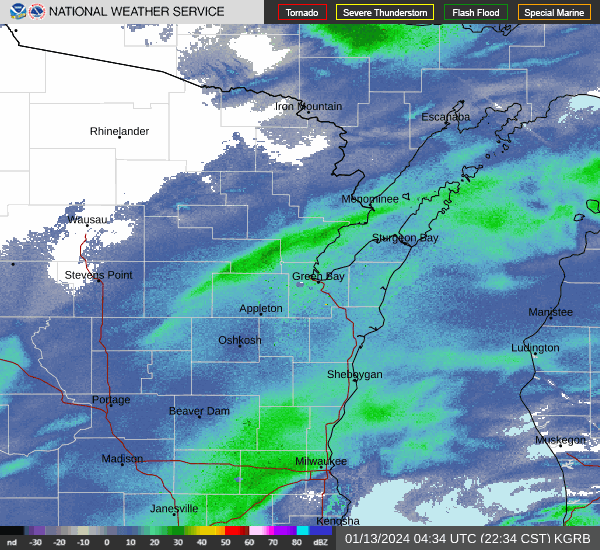
Wisconsin weather radar
Can't see the image? Click here.
Rebecca Loroff is a breaking and trending news reporter for USA TODAY NETWORK-Wisconsin. Contact her at rloroff@gannett.com.
This article originally appeared on Green Bay Press-Gazette: April snowstorm to bring up to 6 inches to Wausau, Shawano, and Oconto

