Arctic air spilling into B.C. will complicate wind damage cleanup
Get ready for a big cooldown, British Columbia.
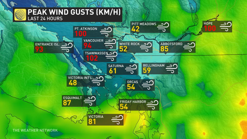
It’s been a hectic couple of days across the South Coast after a series of atmospheric rivers wrapped up with a period of damaging winds Friday into Saturday. Hundreds of thousands of homes and businesses started Saturday in the dark after winds of 100+ km/h raked the region.
FALL BACK TONIGHT: These great tips can help you adjust to tonight’s time change
While things calmed down through the day Saturday, the blustery conditions aren’t over just yet.
Gusty winds will continue heading into our Sunday, with 40-70 km/h wind gusts possible across the Strait of Georgia during the early morning hours. The winds will complicate efforts to restore power to those who are still in the dark.
We’ll also see some off-and-on precipitation across the Lower Mainland throughout the day on Sunday. Most lower elevations should remain all rain, with possibly a few snowflakes mixed in for some spots. Localized snowfall accumulations are possible under heavier precipitation for areas above 150 m, and spotty accumulations are possible for higher terrain on Vancouver Island.
STAY SAFE: Slippery as ice: Brightly-coloured leaves mask dangerous threat
The big story for B.C. heading into next week will be the unseasonable chill descending on the region. A classic Arctic outflow setup will allow cold air to spill south and keep much of southwestern B.C. much cooler than normal for early November.
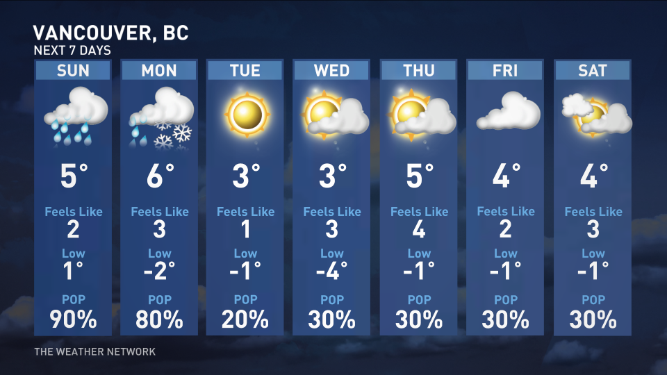
Temperatures will come in 5-7 degrees below seasonal by the beginning of the workweek, and the chill will persist straight into next weekend. Vancouver will struggle to climb out of the lower single digits by the middle of the week, and nighttime lows should dip below freezing every night through at least Saturday.
Stay with The Weather Network for the latest on conditions across British Columbia.

