Bomb cyclone, blizzard-like conditions and flooding could hammer parts of the U.S.
A storm system strengthening Thursday across the Plains will be so intense that it will reach the official criteria of a bomb cyclone and bring blizzard-like conditions and flooding to the eastern half of the country through Saturday.
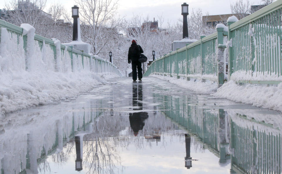
Millions are under flood watches and wind and winter alerts as the country’s central region braces for an Arctic blast that is set to bring “dangerously cold” subzero temperatures there this weekend and as the eastern half of the country prepares for more snow, sleet and rain from relentless winter storms.
The National Weather Service said in an advisory Thursday that in the wake of this week’s storms, a “much colder Arctic airmass” will arrive across the Plains and the Midwest and into the Ohio Valley, lasting well beyond the end of this week.
The bitterly cold temperatures in the northern Plains will continue into the central Plains on Friday, with highs below zero for the northern Plains.
By Saturday morning, temperatures in the minus-20s, minus-30s and as low as minus-40 are forecast for the northern Plains. The central Plains will get temperatures in the single digits.
“Gusty winds” will add to the cold, with wind chills as low as minus-35 to minus-50 for parts of the northern Plains and minus-15 to minus-30 for the central Plains.
The coldest air of the season is expected to blow into the Rockies and the Plains on Thursday, dumping snow in parts of Nebraska and Kansas.
Meanwhile, severe storms in Waco, Texas, and Shreveport, Louisiana, on Thursday night could produce large hail and the potential for an isolated strong tornado.
On Friday, blizzard-like conditions are possible in the Plains, the Midwest and the Great Lakes. Des Moines, Iowa; St. Louis; Chicago; Detroit; and Milwaukee could all be affected.
People in Mississippi to North Carolina may not have to worry about a blizzard Friday, but they could experience strong tornadoes and wind gusts that exceed 75 mph. Heavy rain and wind are forecast to move into the mid-Atlantic and the Northeast on Friday night.
The mercury will drop to minus figures across much of Montana and North Dakota on Friday afternoon, with highs in the single digits and the 10s across Iowa and Minnesota.
“Temperatures will be brutal compared to the relatively mild conditions that have been experienced for much of the winter season up to this point in time,” the weather service said.
Following heavy snow and treacherous driving conditions all week, the agency said, another major winter storm was due to hit eastern Nebraska to central Michigan on Saturday, with widespread snow of 6 to 12 inches across that part of the Midwest and more than a foot possible in lower Michigan.
Iowa's first-in-the-nation caucuses Monday are expected to be the coldest in history, with zero degrees Fahrenheit forecast for Des Moines, amid fears that the cold could affect turnout.
And sports are not immune to the Midwest freeze, either: Saturday's AFC playoff game between the Kansas City Chiefs and the Miami Dolphins is set to be played in minus-6 conditions — dropping to about minus-20 with wind chill — which would make it the coldest home playoff game in the Chiefs' history.
The South is also expected to get yet more extreme weather this weekend, with a repeated chance of high winds and tornadoes. Parts of Florida are still repairing damage from tornadoes this week.

At least seven people were injured by a tornado that reached wind speeds of 125 mph in Jackson County, Florida, on Tuesday, the weather service in Tallahassee said in a report issued Wednesday night.
So far, five people are known to have died as a result of winter weather in the last week.
While more rain is expected along the East Coast beginning Friday, it is expected to be less than that during last week's storm systems — although 1 to 2 inches of rain is still possible in the mid-Atlantic and Northeast regions, bringing the chance of flooding.
The number of properties without power had dropped from more than a half-million Wednesday morning to just over 51,000 across the country as of Thursday afternoon, according to the outage tracking website PowerOutage.us.
In western regions and the Rockies, more heavy snow is expected, with the heaviest due for the northwestern coast of California and the Oregon Cascades, where “a few feet of snow” are likely Saturday, the weather service said, as yet another storm makes its way inland.
In locations with lower elevations out west, like Portland, Oregon, and Boise, Idaho, "several inches" of snow are expected throughout Friday.
Warnings for high morning tides and high surf were in effect in Southern California, the weather service in Los Angeles said.
"Add in the gusty winds & cold weather, the beach & ocean won't make for a fun place to be. Be safe & consider staying away," the weather service said Wednesday night on X.
It also urged people to "check on your family, friends, neighbors, pets, and plants" as temperatures drop.
A state of emergency was declared in Ventura, California, where high surf has caused $1.75 million in damage to the city's historic pier, which remains closed.
This article was originally published on NBCNews.com

