Record cold, flooding and tornadoes: 2023 was a wild weather year in Southern New England
The year 2023 brought a brief period of record cold, flooding, a soggy summer and tornadoes to Southern New England.
The National Weather Service captures the weather highlights (or maybe they should be called lowlights) in a website presentation that includes photographs of storm damage, radar images, graphics and explanatory text.
"Join us for a look back on some of the memorable weather events to impact Southern New England in 2023," the weather service says about its Weather Year in Review.
Below are a few highlights from the weather service's highlights. The full presentation can be found on the weather service's website: tinyurl.com/NWSNewEngland.

More: Rhode Island rivers kept rising after Monday's storm, leaving roads and businesses flooded
An arctic blast disrupts a mild winter
The winter of 2022-2023 was warmer than normal, but the region was hit with a brief arctic blast in early February that set two daily records.
On Friday, Feb. 3, the temperature dropped to 4 below zero, breaking the record of 3 below set in 1955. It got even colder the next day, with the temperature dropping to 9 below on Feb. 4, breaking the record of 2 below set in 1918.
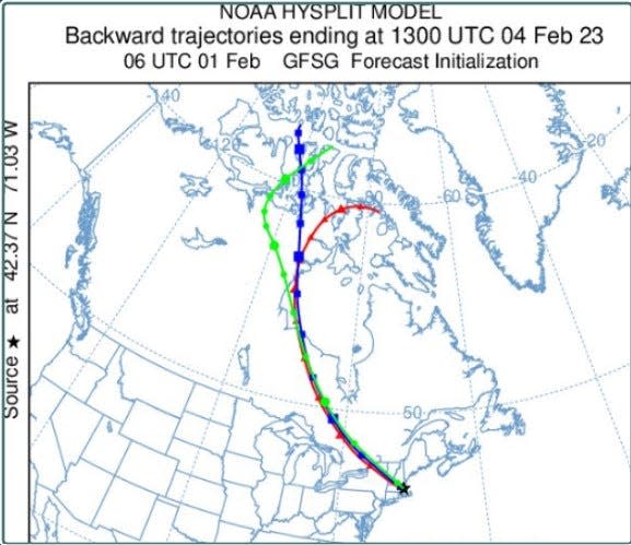
"Arctic sea smoke was visible on many bodies of water, including Vineyard Haven Harbor and Boston Harbor," the weather service said, with photographs showing the phenomenon. "It forms due to the temperature difference between the Arctic airmass and milder water."
The weather presentation includes an image from computer models that helped meteorologists "determine that the airmass originated near the Arctic Circle."
Summer bummer for beach lovers
The summer wasn't kind to beach lovers, especially during July, which was the second-rainiest July on record for the Providence area.
"An active weather pattern in mid to late July resulted in several flash flood and severe weather events in Southern New England," the weather service said.
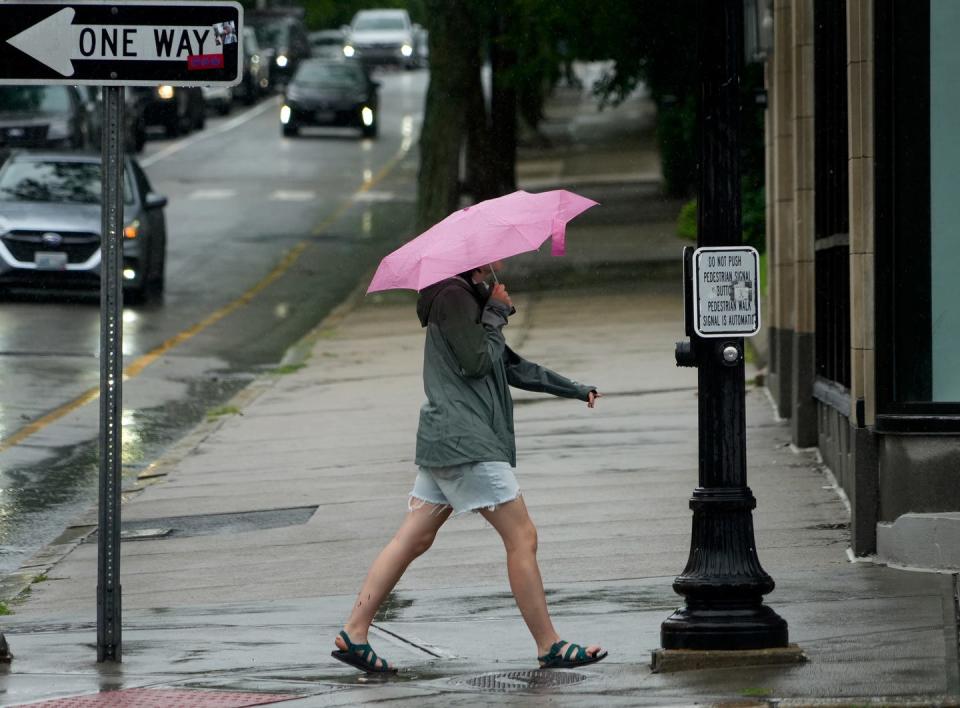
The Providence area had 8.37 inches of rain in July, second only to July 2009, which had 10.52 inches. For Hartford, it was the rainiest July on record, 13.93 inches, while Worcester and Boston had their second-rainiest Julys.
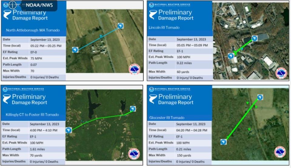
Tornadoes hit Southern New England
Some of the July storms produced tornadoes, as did storms in August. On Aug. 18, five tornadoes touched down in Southern New England, including an EF-2 tornado with wind speeds of 115 mph. It had a "discontinuous" track of more than 9 miles, touching down in Scituate and crossing into Johnston and North Providence, according to the weather service. One person was injured.
On Sept. 13, three more tornadoes hit Rhode Island, in Foster, Glocester and Lincoln.
Hurricane Lee bypasses region
For a while in September, it also looked like Hurricane Lee might hit Southern New England, but it passed well offshore, mostly kicking up waves for surfers.
Still, Southern New England had strong winds and some damage.
The review was published on Dec. 11, before the storm that brought heavy rain and flooding to much of Rhode Island this month.
This article originally appeared on The Providence Journal: 2023 wild weather in Southern New England: NWS captures highlights

