Army Corps of Engineers seeking input on Intracoastal Waterway dredging
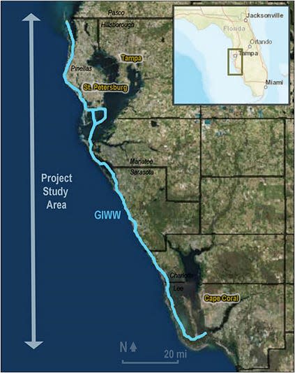
The U.S. Army Corps of Engineers Jacksonville District is planning to dredge parts of the 160-mile Intracoastal Waterway, including priority areas in Charlotte, Manatee and Sarasota counties.
Those priorities include from Venice Inlet south to Alligator Creek east of the island of Venice; Anna Maria Island south to the middle of Longboat Key; two sections east of Siesta Key, and off of Don Pedro Island between Stump Pass and Gasparilla Pass in Charlotte County.
The federal agency launched a public comment period Wednesday on its planned maintenance dredging, which encompasses the area between the Anclote River near Tarpon Springs and the Caloosahatchee River in Fort Myers.
Except for the Venice Inlet, dredging of the passes that connect the bays to the Gulf of Mexico is not part of the project.
The Army Corps hosted virtual open house sessions from 10 a.m. to noon and 6 to 8 p.m. Wednesday as a prelude to receiving open comment on the plan, which must ultimately comply with the National Environmental Policy Act.
The document is based on a NEPA draft written and released for public comment in 2018 but not finalized because of funding cuts.
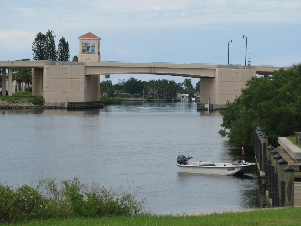
The channel is 100 feet wide and designed to be 9 feet deep.
Locally the Intracoastal Waterway resulted in the creation of the island of Venice, when a channel was dug from the Hatchett Creek to Alligator Creek and links the Sarasota Bay watershed with the Lemon Bay watershed.
A start date for the work will be established once the plan is approved, while the overall project timetable depends on the availability of funding. There is a 10-year window for the task to be completed.
Here’s what you need to know about the dredging plan in the bays off of Charlotte, Sarasota and Manatee counties.
Venice Inlet south to Alligator Creek
The plan is to remove 30,000 cubic yards of material from the channel between Snake Island and mainland Sarasota and south of the Venice Municipal Airport near Alligator Creek.
Project manager Eduardo Marin said that if the material meets federal environmental beach compatibility requirements, it could be placed on Venice Beach. Otherwise it would be placed at an upland site likely maintained by the West Coast Inland Navigation District, which, along with Pinellas County are two non-federal sponsors of the project.
Marin stressed that should any material be placed on nearby beaches, the impact would not the same as a a beach renourishment project.
“I do want to make this one point,” Marin said: “Understand that in any and all of these alternatives that we’re discussing for disposal, the profile and length of beach placement is limited to the amount of volume we’re taking out.”
Anna Maria Island south to the middle of Longboat Key
The plan here to remove 44,000 cubic yards of material from north of the Anna Maria City Pier, with the northern section carrying the highest priority, along with the channel in Sarasota Bay from just north of Longboat Pass to the middle of Longboat Key.
Materials could be placed offshore, on the beach near Longboat Pass, or on an upland site.
East of Siesta Key south of Skiers’ Island and north of the Stickney Point Bridge
The plan here is to remove 17,000 cubic yards of material from Roberts Bay just south of Skiers’ Island, near the Field Club and from an area north of the Stickney Point Road Bridge.
The material could be placed offshore, on the beach near Lido Key, or on an upland site.
East of Don Pedro Island between Stump Pass and Gasparilla Pass
The plan is to remove 21,000 cubic yards of material off of Don Pedro Island. It could be placed offshore, on the beaches at Stump Pass, Knight Island and Manasota Key Beach or on an upland site.
What’s next?
The public comment will help produce a draft of a National Environmental Policy Act compliant plan. Once that draft is complete, it will be made available for public comment.
Since all the analysis used in the current plan was made prior to Hurricane Ian, subsequent surveys could alter that plan, too.
The Corps will work with state and local agencies to determine how the plan would impact water quality, sea grasses and marine life habitat.
Once that second round of public comment is factored in, the plan will either include an assessment of its environmental impact or a determination that there is no significant impact.
Public comments may be submitted through April 21 via email to CESAJ-GIWW-Navigation@usace.army.mil or by mail to the U.S. Army Corps of Engineers, Jacksonville District; ATTN: Kathryn Lebow; 701 San Marco Blvd., Jacksonville, FL 32207
Comments must be received by close of business April 21, 2023, for consideration. A copy of the NEPA scoping presentation will be posted for review to the project webpage: http://www.saj.usace.army.mil/GIWWCRtoAR/.
This article originally appeared on Sarasota Herald-Tribune: Army Corps plans Intracoastal Waterway dredging off Sarasota, Manatee

