Asheville wind advisory in effect until midnight; 50 mph gusts possible
ASHEVILLE - A wind advisory is in effect for the Asheville area until midnight Dec. 18, with northwest winds of 20 to 30 mph and gusts up to 50 mph possible, according to a 3 p.m. update from the National Weather Service. An area meteorologist cautioned possible power outages as "gusty winds" could bring down trees, tree limbs and blow around unsecured objects.
In the higher elevations, areas in Yancey, Mitchell and Avery counties topping 5,500 feet, wind gusts could get up to 55 mph, said Doug Outlaw, a meteorologist with the National Weather Service, based in the Greenville-Spartanburg office.
The wind advisory for the northern Western North Carolina mountains was extended through noon Dec. 19.
The low temperature Dec. 18 in Asheville is 20 degrees, but the wind chills are expected to be about 5 degrees, down "in the single digits," said Ashley Rehnberg, also a meteorologist based in the NWS Spartanburg office.
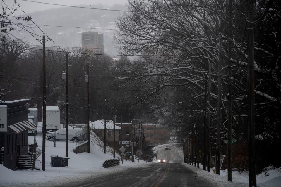
Winds were ushered in by a cold front tracking across the area, a high pressure system building in behind it, creating a "tight pressure gradient across the mountains," Rehnberg said.
In Asheville, winds are expected to remain elevated through the morning of Dec. 19, and slowly taper off throughout the day.
Outlaw told the Citizen Times at around 2 p.m. that wind gusts were measuring consistently at around 30 mph that morning, but were down to 20-25 mph during the afternoon.
Though the area's rain is gone, said Duke Energy spokesperson Bill Norton, with very saturated ground and high winds, "customers should be prepared for more outages this evening due to damage from falling trees and branches."
He advised people to keep their phones and battery backups charged.
More: Answer Woman: Will Asheville have a white Christmas this year?
A Dec. 15 news release from Duke warned of a "severe weather system" expected to move through the area Dec. 17, with tips like keeping a storm emergency kit handy, having a plan to move family members and keeping a portable radio or TV on hand. People should stay away from power lines that have fallen or are sagging. Consider all lines energized, as well as trees, limbs or anything in contact with lines.
Crews responded quickly to outages over the weekend, Norton said. As of 1:30 p.m., there were about 2,500 customers without power in Duke Energy Carolinas' coverage area, only 30 of which were in Buncombe county.
"Crews remain active in working these outages this afternoon and are in place and ready should the outages increase this evening due to high winds," Norton said.
Duke Energy customers who experience an outage can report it in the following ways:
Visit duke-energy.com on a desktop computer or mobile device.
Use the Duke Energy mobile app — Download the Duke Energy App from a smartphone via Apple Store or Google Play.
Text OUT to 57801 (standard text and data charges may apply).
Call the automated outage-reporting system, at: 800.POWERON (800.769.3766).
Visit Duke Energy’s interactive outage map to find up-to-date information on power outages, including the total number of outages systemwide and estimated times of restoration.
More: Downtown Asheville Grove Street Community Center closed for up to 4 weeks
Chances of snow?
While temperatures will be chilling, Outlaw said no snow is expected in the Asheville the night of Dec. 18. The days that follow are also expected to be dry.
Some snowfall is expected in areas close to the Tennessee/North Carolina border counties the evening of Dec. 18 until midnight, Outlaw said, with up to 2 inches forecast for the highest elevations, like Iron, Beech and Sugar mountains. Snow will likely taper off, ending before sunrise, he said.
There's been no snow accumulation yet this winter in Asheville, Outlaw said. A typical December for the area sees 2.5 inches of snow.
“There’s still plenty of winter left," Outlaw said. "Eventually, it will probably happen. But not tonight.”
Update, 6 p.m.:
Flurries could be seen in the sky over Asheville at around 6 p.m. Dec. 18, but NWS meteorologist Jake Wimberely said no accumulation is expected for the city, and the spiraling flakes would diminish over the next hour or two. Some areas of Buncombe County could see up to a quarter- or half-inch of accumulation in some of the higher elevation areas, like Barnardsville or north of Weaverville.
Sarah Honosky is the city government reporter for the Asheville Citizen Times, part of the USA TODAY Network. News Tips? Email shonosky@citizentimes.com or message on Twitter at @slhonosky. Please support local, daily journalism with a subscription to the Citizen Times.
This article originally appeared on Asheville Citizen Times: Asheville wind advisory in effect until midnight; Outages possible

