Deepest low near Pacific Northwest bombards B.C. with winds, soaking rains
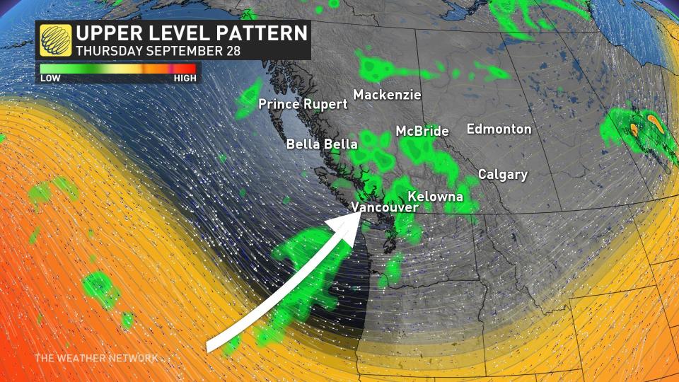
A large dip in the jet stream is sending an active storm track over the West Coast as we end September, allowing several moisture-laden systems to sweep through the region.
DON'T MISS: Canada's summer defined by record wildfires, damaging floods and storms
The first of the lows was considered to be a "bomb cyclone," stemming from the term bombogenesis, or the rapid intensification of a low-pressure system in a short period of time. Meteorologists use different metrics to measure bombogenesis, but the most widely used criteria is when a low’s minimum pressure falls 24 millibars in 24 hours.
The winds have peaked and will continue to ease into Tuesday, with rainfall also lingering as the system continues to make its way farther inland.
Significant storm persists on the West Coast
Areas: South Coast
Timing: Through Tuesday
Weather: A bomb cyclone that developed through Sunday spread gusty winds across Vancouver Island and exposed coastal sections, leading to thousands of customers losing power. While winds peaked Monday afternoon, and are set to ease through Tuesday, heavy rainfall at times will remain.
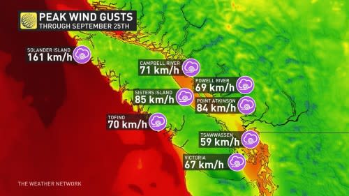
Northern Vancouver Island saw the most intense wind gusts on Monday, with Solander Island Lightstation recording a peak of 161 km/h and Sartine Island Lightstation observing a peak of 142 km/h.
CHECK IT OUT: Explore our gorgeous planet in these stunning satellite images
WATCH: Flash flooding and strong wind warnings for British Columbia's South Coast
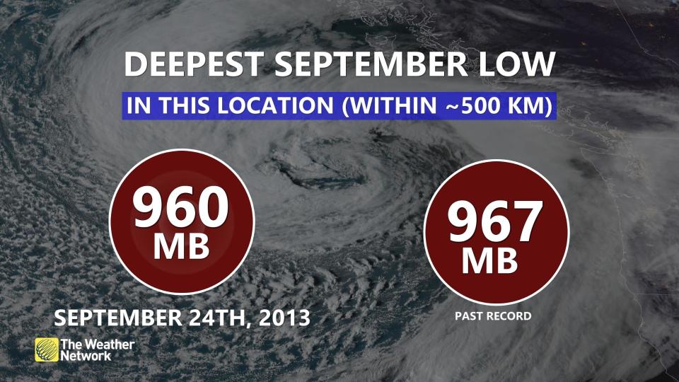
According to reanalysis data for extratropical cyclones, this particular low-pressure system is the deepest on record for this location in the Pacific Ocean for the month of September. Most recently, October 2021 recorded deep pressure offshore from British Columbia, reaching a pressure of 942.5 mb, a new monthly record.
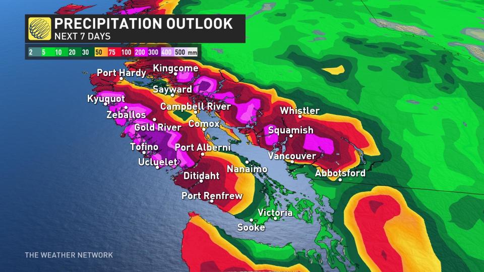
Tuesday morning will see rain soak northern Vancouver Island and head south, also reaching into the Lower Mainland through the day. The rain will not stop there as consistent systems and an onshore flow could raise rainfall totals this week.
There’s even a risk of thunderstorms due to the unstable air moving off the Pacific Ocean. These thunderstorms could produce gusty winds and brief downpours in the impacted regions.
Tapping into some higher Pacific moisture, seven-day rainfall totals could bring 40-75 mm to parts of the Lower Mainland, even up to 200 mm to higher elevations across the Sunshine Coast and the North Shore of Vancouver.
The swing and a miss is felt as we head east into the Interior. These Pacific systems rain-out over the coast, and will not offer much rainfall benefit to the Okanagan Valley and areas east.
Atmospheric river ranked as Category 3
An atmospheric river streaming in from the Pacific will give these systems plenty of moisture to work with.
The impending slug of moisture will rank as a Category 3 on the University of California San Diego’s atmospheric river scale, which ranks the duration and magnitude of these plumes of moisture as they stream into the West Coast.
RELATED: Why we see floods following fires: A tale of two extremes
Category 3 atmospheric rivers are both beneficial and hazardous, bringing quenching rains that could also lead to localized flooding if it falls too quickly.
Thumbnail courtesy of NOAA.
Stay with The Weather Network for all the latest on conditions across B.C.

