21-mile 'grand loop' of Jefferson Wilderness offers old-growth, alpine lakes, waterfalls
When you see it on the map, it’s almost hard to believe the grand loop of the Mount Jefferson Wilderness fits together so perfectly for a three-day backpacking trip.
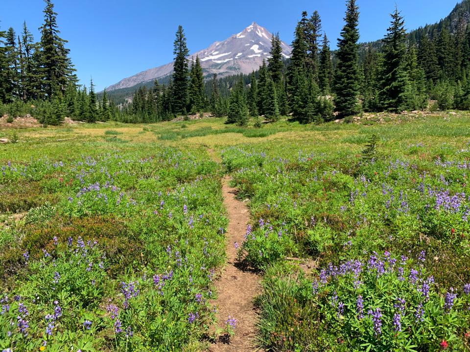
The 21-mile lollipop route, centered around Pamelia Lake, Hunts Cove and the Pacific Crest Trail to Shale Lake, offers some of the most breathtaking scenery around Oregon’s second tallest mountain.
The campsites are well spaced and feature beautiful alpine lakes, while each day brings a surprise — a waterfall set in old-growth forest or a wildflower meadow cut by a crystal stream.
And always, big Jeffy looms overhead.
The best part is the route is entirely unburned, avoiding the massive wildfire scars that mark much of this 111,177 acre wilderness. That allows backpackers to climb a challenging 4,000 feet of elevation gain largely in the shade.
While there are plenty of moments of solitude, this is a popular route where you'll meet other backpackers, even midweek and particularly on the PCT. A Central Cascades Wilderness permit is required and they can be difficult to score for Pamelia Lake Trailhead on Fridays and Saturdays, though other times they can usually be had.
The hordes of mosquitoes were just beginning to thin out on my early August trek, making this route a great option from now until early October as they start die out in greater numbers.
I backpacked this route with my giant dog Comet. And for me, having access to a backpacking trip of this quality just 90 minutes from my home is the reason to live in Oregon.
Here’s how to make the trip happen.
Who should backpack the grand loop?
This is not a beginners backpacking trip. The route is composed of multiple trails and can be confusing. It climbs a calf-burning 4,000 feet, the equivalent of hiking a major Cascade peak like Diamond Peak or Mount McLoughlin, except with a pack on.
For those with backpacking experience, it’s probably moderate to strenuous difficulty.
Permits and maps
The first thing you’ll need to backpack the grand loop is the right permit — in this case an overnight permit for Pamelia Lake Trailhead. You get those on Recreation.gov, under the Central Cascades Wilderness permit overnight permit page.
Up next, I’d get a good map. My favorite map is the “Mount Jefferson, Bull of the Woods and Opal Creek Trail Map” from Adventure Maps of Salem. You can also create your own map using the platform Cal-Topo.
A handheld GPS system is always recommended as well.
Jefferson backpacking loop: Pamelia-Hunts Cove-Shale Lake-PCT by Zach Urness on Scribd
Day 1: Hunts Cove, 7 miles, 2,600 feet of climb
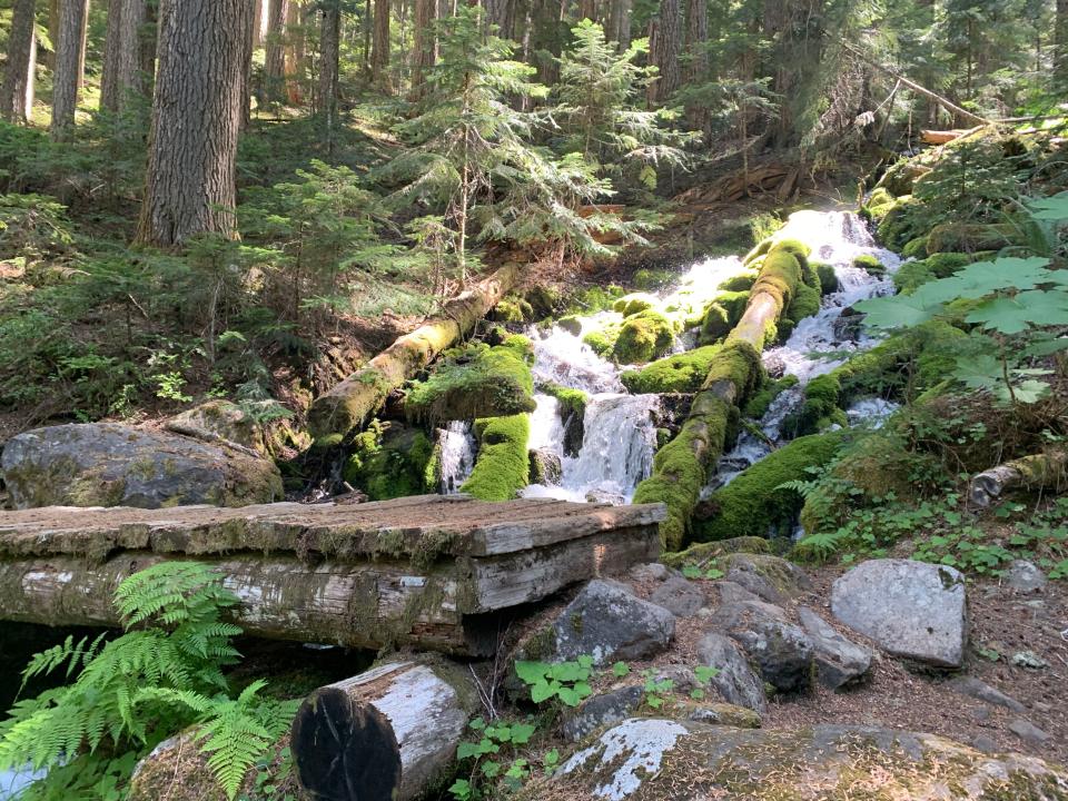
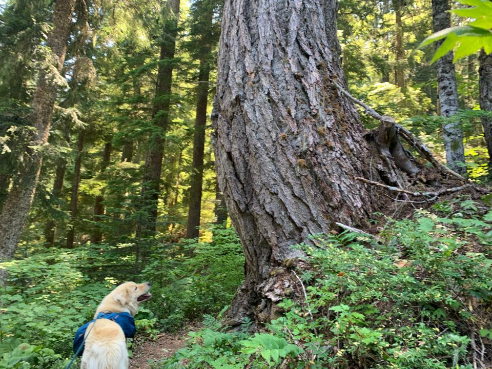
The hike begins at Pamelia Lake Trailhead and climbs through shady old-growth forest as Pamelia Creek tumbles down small waterfalls, entering the Mount Jefferson Wilderness.
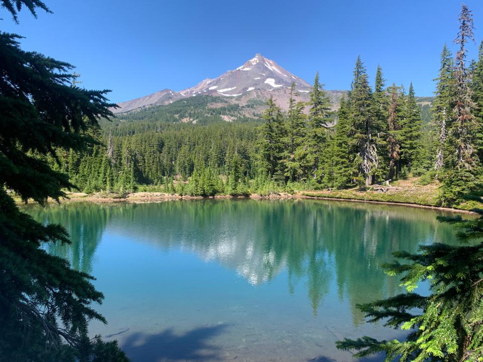
You’ll reach Pamelia in 2.2 miles and if you want, you can take a moment to swim in the lake and get your first view of Mount Jefferson. The lake is shallow and marshy in places, and warnings about blue-green algae do apply here if you’re hiking with a dog.
This might be the most challenging day of hiking so don't stay long. Follow the trail up and around the lake to the left and soon you’ll reach the official start of the loop, at a sign pointing to the PCT. This is the spot you'll return to in a few days.
Continue forward on Hunts Creek Trail and into the upper reaches of the forested valley.
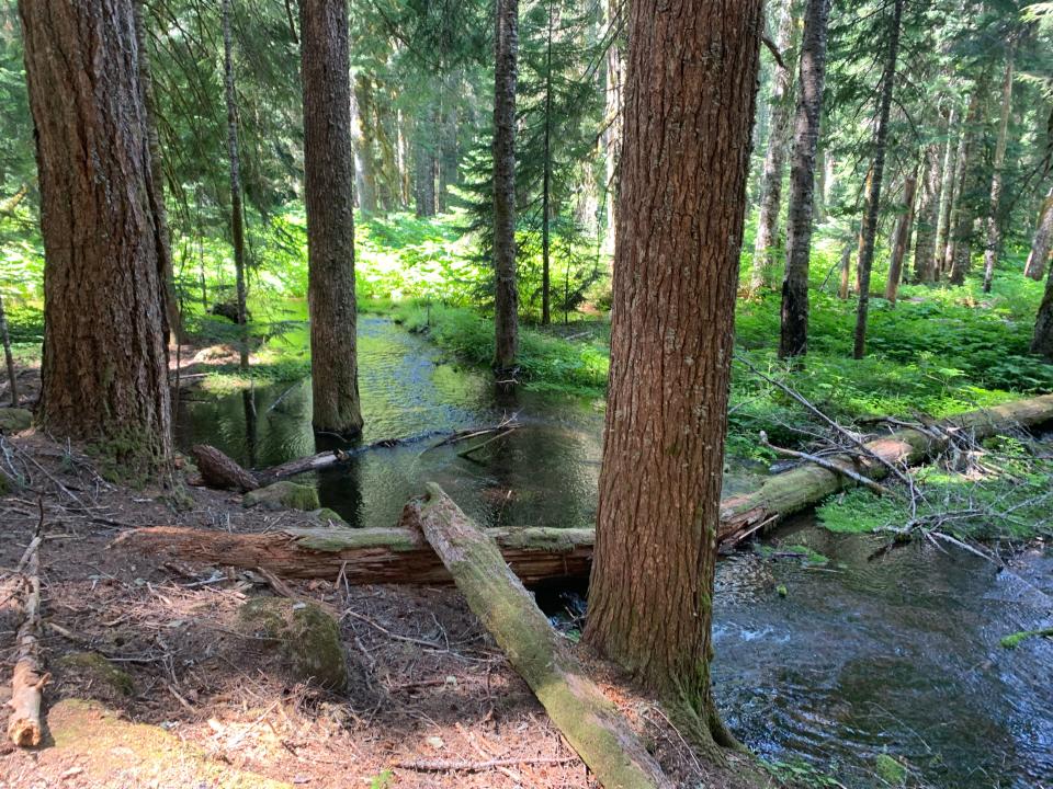
The creek pools among old-growth trees and a pair of waterfalls roar down mossy boulders on the side of the trail, keeping you cool even as the trail climbs steadily upward. There’s one major creek crossing, where you have to balance across downed logs to cross. After 6 miles, you’ll reach the trail junction for Hunts Cove, a side-pocket valley home to Hanks and Hunts lakes.
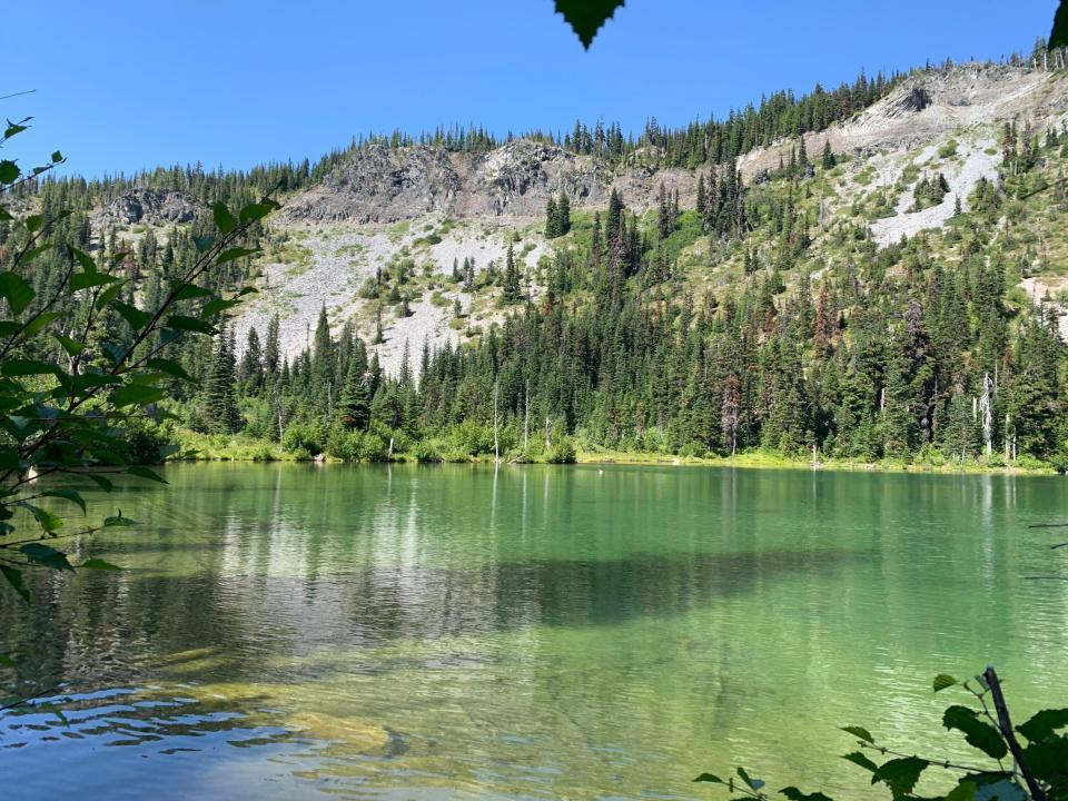
The water at Hanks was a bit marshy and the campsites felt a bit more exposed. So I continued back, following an increasingly rough trail with many downed trees to Hunts Lake. It was the nicer option, with clear turquoise water below silver cliffs.
I found four or five campsites around the lake and picked one with easy access to water and a nice place to string my hammock before taking a swim (chilly). At peak mosquito season in June and July, I suspect this area is pretty thick but it wasn’t too bad for us, especially as it cooled off in the evening.
I set up camp as Comet took a nice long afternoon snooze in the afternoon sunshine.
Backpacking with a dog
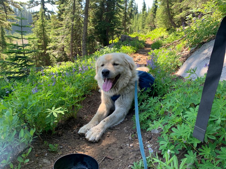
I started bringing my dog Comet on backpacking trips last year. He’s an anatolian shepherd — a very large livestock guardian dog bred for fighting off predators but with a sweet disposition. I got him a Ruffwear pack, the largest I could find, but it still looks comically small on him. Anatolians are notoriously stubborn dogs — and he hated the pack at first. But he now jumps up on his hind legs (a sight to behold) when I bring out the pack.
The general rule is dogs can carry about 10 to 25% of their body weight. So, he was easily able to carry a liter of water, a full bag of his food, bowls for food and water, and even a few beers for me. The trick was keeping the weight balanced between the two sides of the pack.
We get along well on the trail, although I sometimes get annoyed by his need to stop, smell and pee, while he gets annoyed with my need to stop and take pictures. I did pack out all his poop, so he gets to carry that as well. I pick up the poop in plastic bags and then put it into a special poop holding bag.
I always keep him on a leash and he loves to meet new dogs on the trail. I’ve got no issues with people who have their dogs off-leash if they’re mostly under control. But occasionally a dog will come bounding up to Comet and get aggressive — big dogs seem to bring out aggression in smaller ones. This is not ideal since holding back an angry Comet is a bit like trying to wrangle a polar bear. Luckily, it's pretty rare.
Day 2: Shale Lake and the PCT, 6.1 miles, 1,419 feet of climb
The upside to having a strong dog is he’ll actually help pull me up the mountain. My kids call it “Comet power.” That extra boost came in handy the second day, which begins with climb up Lizard Ridge and atop cliffs that surround Hunts Cove. It’s a climb of just under 1,000 feet in 2 miles — whew.
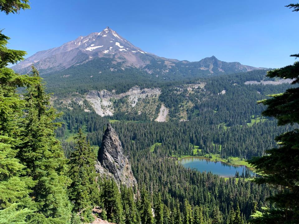
After that, however, things get good. The second day is the highlight of the trip, as the trail weaves tightropes above Hunts Cove, past spectacular views of Mount Jefferson above wildflower meadows.
There are a few critical trail junctions. After the 1.2 mile climb, turn left to stay on Hunts Creek Trail 3440. The next 1.7 miles were my favorite of the trip, with big Jefferson views nonstop, but it ends at a treacherous spot.
Confusing spot or day-hike loop
You’ll have hiked the right distance, along Hunts Creek Trail, to be looking for a left turn onto the PCT. However, just before reaching the PCT there is a trail junction that, at present, is marked by a post with no sign. A well-established trail dives downhill and it’s easy to think it’s the PCT. However, it’s not — it’s an old and unofficial trail that drops back down to Hunts Cove. It doesn’t show up on official U.S. Forest Service maps.
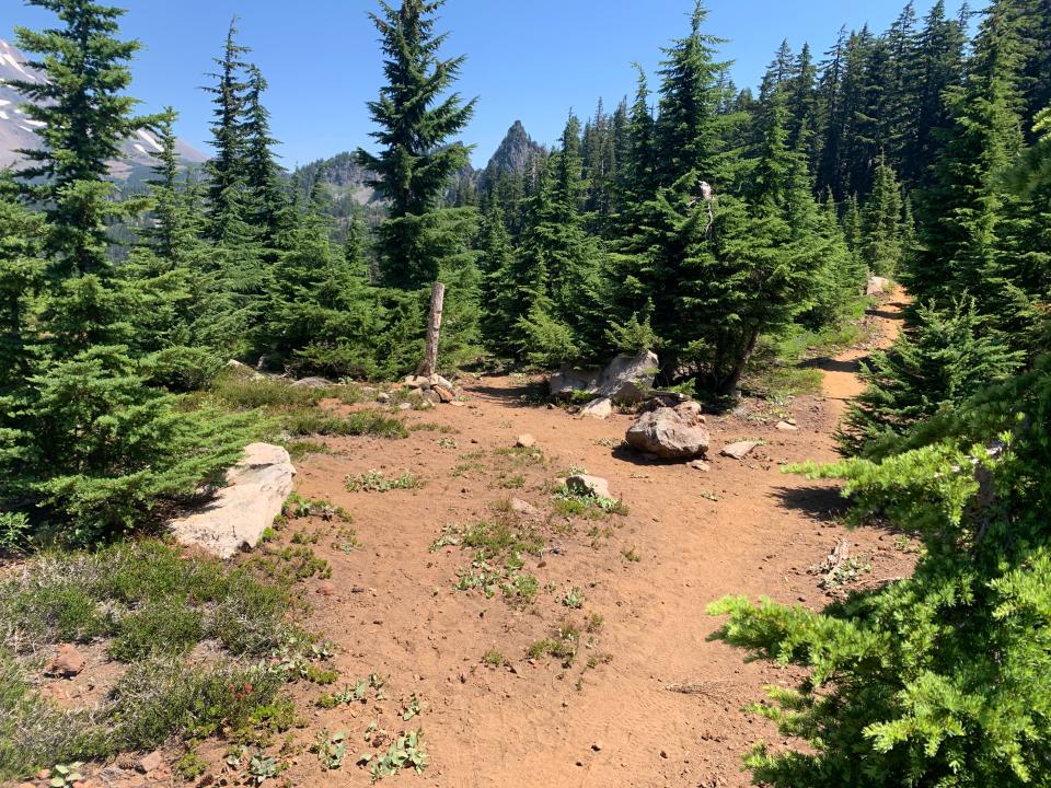
To stay on the backpacking loop, continue on the uphill side a short ways to the real PCT junction. The actual PCT is marked as such.
This “Old Hunts Cove Trail” could be used as a nice day-hike option that begins and ends at Hunts Cove, but I was also told the trail is in rough shape. I actually made the mistake of hiking down it a ways before realizing that I shouldn’t be losing so much elevation and turned around. It’s does have some beautiful meadows.
Shale and Coyote lakes
Camp the second night comes after another 2 miles on the PCT, where you reach Shale and Coyote lakes.
Both are beautiful but Shale is the real gem. The small clear pool, named for the rocks that surround it, has Jefferson rising right overhead. The water is clear and good for filtering water but also an ideal temperature for swimming. I scored the only campsite near the lake.
Coyote Lake is bigger and has more campsites, but had also dried up in part and doesn't match Shale for scenery.
Both lakes are major stopping points for PCT long-distance hikers. A handful of them stopped to chat and pet Comet. A few were from California, another from Las Vegas and another from Missoula, Montana.
It was late afternoon and most of the PCT hikers I met still planned to hike another 10 miles. I was pretty happy to set up my hammock, get into my book and laze away in the sunshine. For big views and a glorious campsite, day two was about as good as it gets.
Day 3: Long downhill ramp homeward, 8.2 miles, 2,900 feet of elevation loss
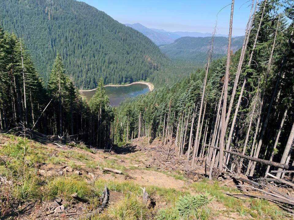
The final day is one long downhill ramp homeward. There are nice views from the ridgeline above Pamelia Lake. And it was fun to explore the spot where, it appears, a landslide took out a bunch of trees above Pamelia. But overall, the final day was a gradual stroll downhill without the dramatic views of the first two days.
Which was fine.
Comet and I got into a nice hiking rhythm, stopped for a swim and lunch at Pamelia Lake, and then reached my car by early afternoon.
This grand loop of the Mount Jefferson Wilderness offers just about everything you could ask for in three days of backpacking — alpine lakes and big mountain views, all in the shade of an unburned forest.
'Grand loop' of the Mount Jefferson Wilderness
In a nutshell: A fairly challenging backpacking loop in the Mount Jefferson Wilderness east of Salem and Eugene
Camps: Hunts Cove and Shale Lake
Distance: 21.3 miles
Climb: 4,000 feet
Begins and ends: Pamelia Lake Trailhead
Permit required: Yes, from the Central Cascades Wilderness system on Recreation.gov.
Zach Urness has been an outdoors reporter in Oregon for 15 years and is host of the Explore Oregon Podcast. Urness is the author of “Best Hikes with Kids: Oregon” and “Hiking Southern Oregon.” He can be reached at zurness@StatesmanJournal.com or 503-399-6801. Find him on Twitter at @ZachsORoutdoors.
This article originally appeared on Salem Statesman Journal: 'Grand loop' of Mount Jefferson Wilderness offers backpacking paradise

