How bad are this year's Mississippi River floods?
The mighty Mississippi River, the longest waterway in North America and the fourth-largest in the world, is set to unleash floods in Iowa and Illinois this week after swift snow melting left water levels dangerously high.
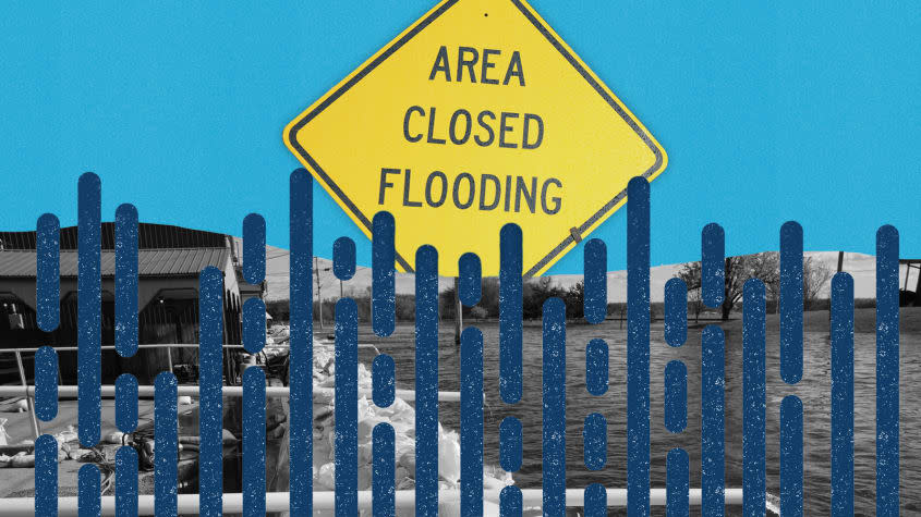
Why is the river flooding?
There is one primary culprit for what is expected to be a serious flooding season on the Upper Mississippi (the part of the system between Minneapolis and Cairo, Illinois): rapid snow melt from Minnesota and Wisconsin. The region saw very heavy snowfall this winter followed by a cold March that locked a significant snowpack in place. The Upper Mississippi Valley then experienced a series of unseasonably warm days in April, which led to sudden and catastrophic melting. Another round of snowfall that melted quickly on April 16 and 17 didn't help.
Areas in Wisconsin and Minnesota have already seen significant flooding, and as the water moves south along the swollen river, it hit places like Davenport, Iowa, which is seeing the third serious flooding in a decade. Iowa Gov. Kim Reynolds (R) issued a disaster declaration for a number of counties on April 24. Water levels on the river in Davenport peaked just below expectations, falling short of records and likely sparing the city widespread devastation. As National Weather Service meteorologist Steven Wilson told The Associated Press: "Everybody's plan along the river has been put to the test and everybody is passing right now." Still, the National Weather Service is reporting close to record water levels along the river in Iowa and Illinois, with "major" flooding, defined as "extensive inundation of structures and roads." Many towns in both states will see their forecast water level peaking ("cresting" in flood lingo) this week. The Lower Mississippi is not expected to experience major flooding this year due to lower-than-usual winter and spring precipitation.
Several factors combined to limit the potential damage from this flooding season. Above-average temperatures in April ensured that the ground wasn't frozen, allowing some water to be absorbed rather than sent downstream to wreak havoc. The region also got lucky with the weather — no major rain or snow storms are predicted to hit the affected areas during the most vulnerable periods. Had that happened, the flooding may have overwhelmed defenses along the river and caused a much more grave crisis.
What preparations have been made?
States and municipalities have reacted to the threat of flooding in different ways. Some have reinforced levees and existing flood control infrastructure. Davenport, Iowa, for example, uses "temporary sand-filled barriers and allows the river to flood in riverfront parks" to control flooding. Dubuque, Iowa, built a flood wall in 1973 designed to prevent flooding with river levels up to 28 feet. Others have permanently located some residents away from flood plains to more secure locations, using what are known as "levee setbacks."
So far these adjustments seem to have helped Upper Mississippi communities avert greater calamity. But levee systems have costs too, and some argue that they increase flood risk downstream by raising water levels and speeds, and that they too will eventually be overwhelmed. As University of California, Davis, geologist Nicholas Pinter told NPR in 2018, "There are two types of levees: those that have failed and those that will fail." As climate change brings more rain and unpredictability to the region, the only long-term solution guaranteed to reduce property losses and deaths is to avoid intensive development on flood plains.
More than anything else, climate change brings unpredictability. While flooding is the more serious risk on the Upper Mississippi, flash droughts threaten the Lower Mississippi with lower water levels, a menace to the river's shipping industry and to that region's drinking water supplies and recreation. The different needs of communities along different parts of the Mississippi will require creative cooperation between state authorities seeking to manage disruption.
How do these floods compare to past incidents?
One of the worst floods ever to hit the Upper Mississippi region was the Great Flood of 1993, which caused $15 billion in property damage and killed 50 people. Some of the harder-hit areas experienced 200 days of flooding. Evacuations numbered in the tens of thousands, 10,000 homes were lost, and some towns never regained their pre-flood population levels. Grafton, Illinois, which had 195 consecutive days of flooding, lost almost half of its residents forever. The flooding paralyzed nearly the entire Mississippi River region for months. In the Upper Mississippi region, many water level records date to floods in the spring of 1965, which drove 40,000 people from their homes north of St. Louis, killed 19, and caused $200 billion in property losses.
Current flooding is not expected to approach these catastrophic numbers, either in terms of damage or loss of life. Mississippi River flooding hasn't yet caused any deaths, in part due to preventive road closures and other precautions that authorities have taken. So far, it looks more like the 2019 flooding season. Still, flood prevention preparations have brought life to a standstill in many cities like Davenport, and it is not yet clear what will happen as the surge makes its way south to Missouri.

