Balancing growth: Union Township to welcome development, preserve rural charm ahead of Intel
Licking County continues to grow, and Union Township is being proactive to ensure a balance between future development and the area's rural character.
Since Intel Corp. announced its $20 billion computer chip factory in January 2022, Licking County communities have been planning for future development that will follow the tech giant to central Ohio.
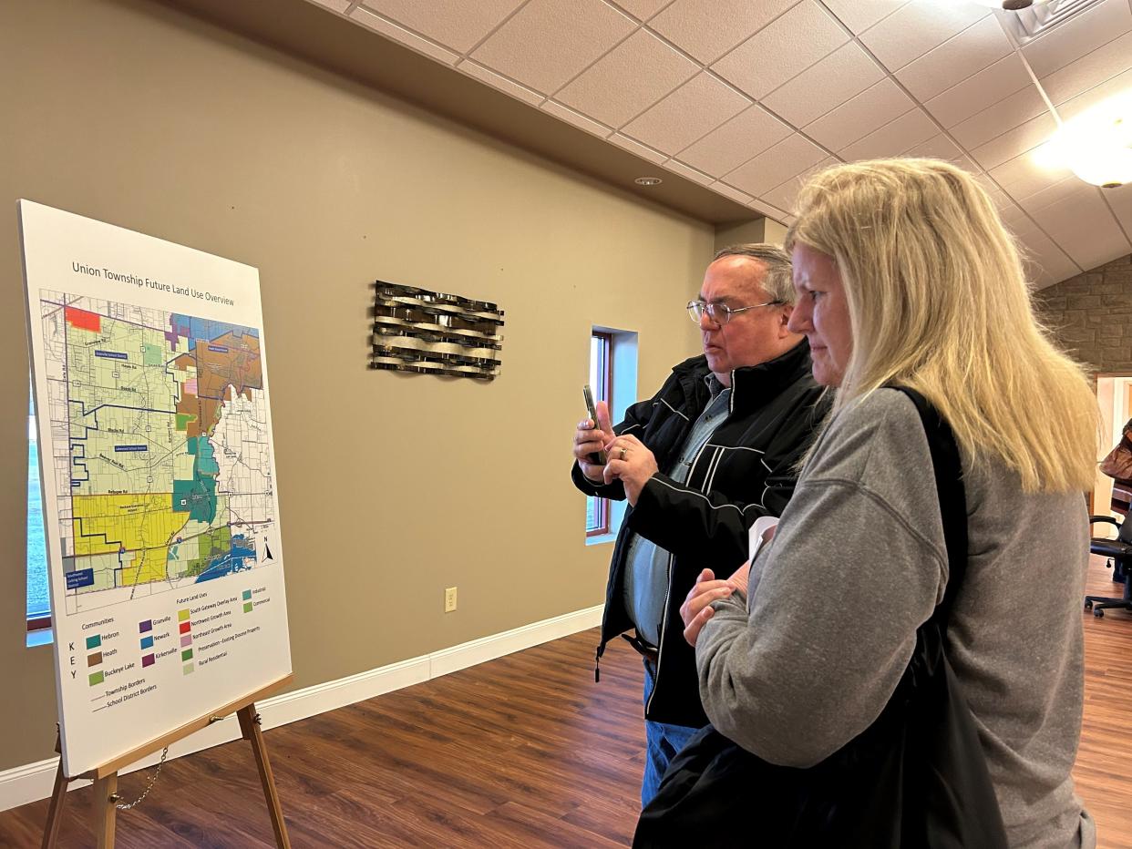
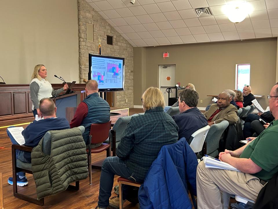
The township has worked since March to update it's comprehensive plan for the first time since the early 2000s and is now sharing the draft plan with the community. First, in an open house with more than 120 people in November and most recently in two information sessions Thursday.
Holly Mattei, president of Crossroads Community Planning, who led the planning process, presented residents with a draft plan that outlines where and how the township can welcome housing and business development but in a way that maintains the rural character and quality of life residents love.
Union Township Trustee Roger Start said since he took office in January 2022, the township has been proactive about planning for the kind of development residents want. And so far residents have been receptive.
"We've taken the strategy that we've got to get out ahead of this," he said.
The draft plan has four key themes:
Balancing growth and preservation to protect and enhance the quality of life
Fostering partnerships to enhance community services
Supporting sustainable infrastructure
Promoting economic prosperity
Each theme has at least four goals that outline how to achieve each theme. For example, the first theme includes goals for outlining growth in areas with existing or planned infrastructure, protecting farmland outside of designated growth areas, creating attainable housing and preserving open space.
Draft materials, including the goals, can be viewed on the township's website, under the "Comp Plan Information" tab.
The draft plan includes an updated land use map, which shows the types of uses for township land in the future.
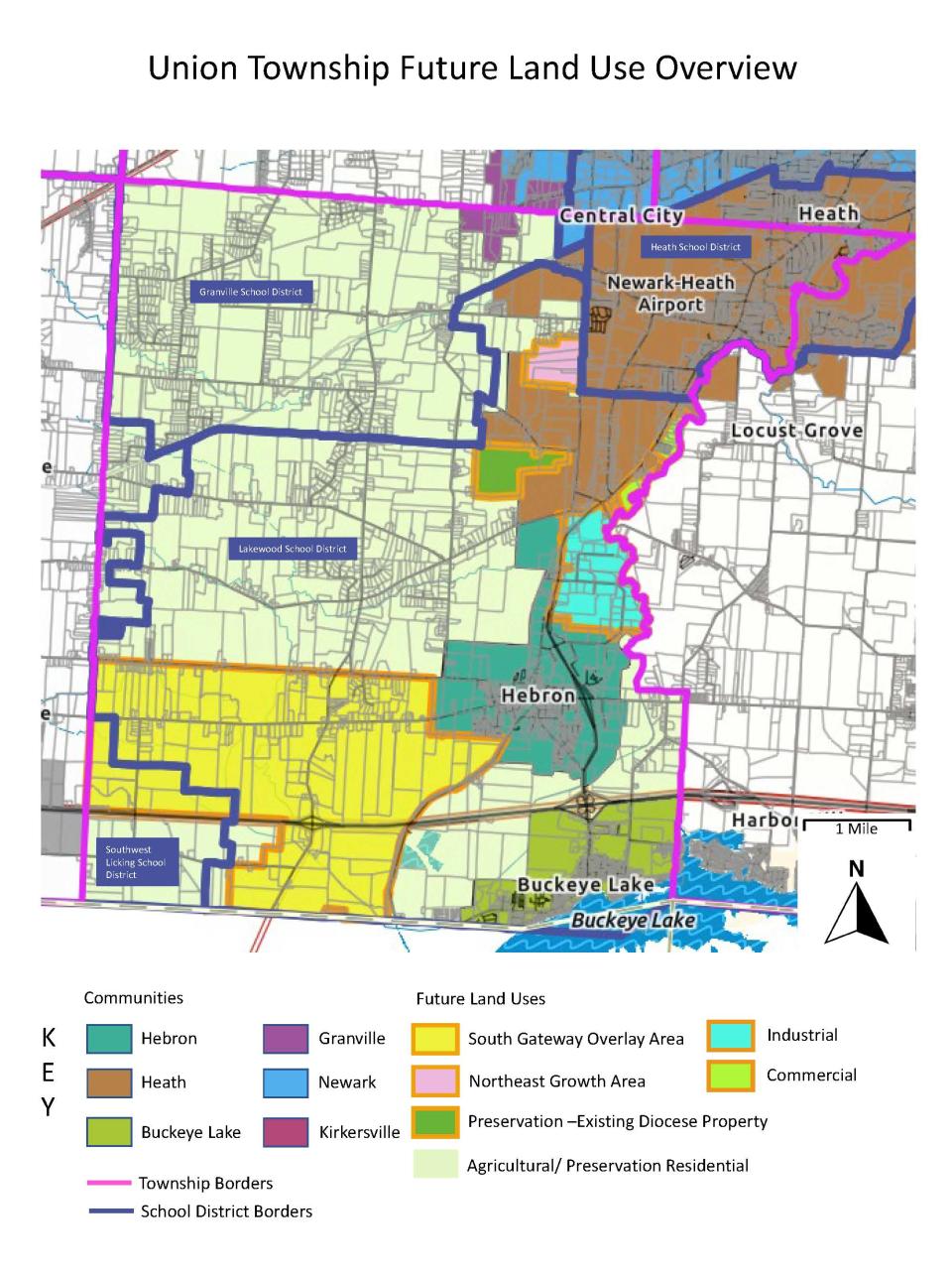
Mattei said about three-fourths of the map isn't changing, and the northwest portion of the township will remain agricultural and rural residential. The plan is to keep Union Township rural, which residents said they want during the November open house and through a survey.
The biggest change to future land use is along Ohio 37, from Refugee Road to the north and the township line to the south. Within that area are U.S. 40 and Interstate 70.
"If we're going to dictate where we want development, that's the best place for it," Start said after the presentation.
In that area, the comprehensive plan recommends the township adopt an overlay zoning district, which does not replace a property's existing zoning but instead gives landowners another option if they choose to develop their land.
If adopted, the overlay district would include standards for road improvements, setbacks, aesthetics, architecture, landscaping and design elements to protect the rural quality of life while also allowing some development, Mattei said.
Through the overlay district, Mattei said the township can limit the number of housing units and warehouses within the area, and caps are included as part of the draft language.
The overlay district would include the specific types of housing and businesses allowed within the defined area. It matches the properties that agreed to join a joint economic development district, or JEDD, that the township approved last year. A JEDD is an economic development tool that allows townships to collect income tax on commercial properties within a defined area.
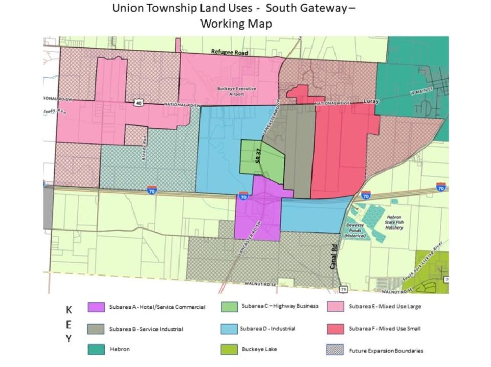
The overlay district would be separated into subsections:
Subarea A: Surrounding the I-70 and Ohio 37 interchange. Allowed uses would include hotels, restaurants, assisted living facilities, banks and other uses to service Union Township and those traveling along I-70.
Subarea B: Southeast of the Ohio 37 and U.S. 40. Allowed uses are research and development, manufacturing, lumberyards, contractor's offices, commercial recreation and more that are compatible with the existing commercial uses in the area. Structures would be limited to 45 feet tall.
Subarea C: Along Ohio 37, between I-70 and U.S. 40. Allowed uses are truck service centers, logistics, makers spaces, retail and more.
Subarea D: Southwest of Ohio 37 and U.S. 40, as well as west of Canal Road south of I-70. Allowed uses are advanced manufacturing, biotechnology, data processing centers, wholesale businesses and more. Structures would be limited to 60 feet tall.
Subarea E: Generally southwest of Refugee Road and Ohio 37 and south of U.S. 40 near the township's west boundary. Allowed uses are mixed-use buildings, schools, nursing homes, restaurants, daycares, multifamily dwellings and more. Structures would be limited to 45 feet tall.
Subarea F: Generally south of U.S. 40 to Canal Road. Allowed uses are mixed-use buildings, duplexes, single family housing, schools, restaurants, nursing homes, parks and more. Structures would be limited to 35 feet tall.
Brenda Weaver, a township resident who attended Thursday's session, said it's been scary to watch industrial warehouses coming closer to the area. But as a real estate agent, she knew it was expected with Intel coming less than 20 miles from Union Township. She appreciates that the township is acting now to preserve the rural environment people want.
"It's better to be proactive rather than just letting it happen," she said.
Start said the township is continuing to gather resident feedback about the draft comprehensive plan and then will share the final draft in a public presentation in the coming months. The final step in the process is adoption by the township trustees, which Start and Mattei said they expect to happen this spring.
mdevito@gannett.com
740-607-2175
Twitter: @MariaDeVito13
This article originally appeared on Newark Advocate: Union Township to balance future growth, rural charm ahead of Intel

